… If you imagine a line drawn from “Kraljevo towards Trstenik” the other line drawn from Trstenif towards Jankova Klisura, the third drawn from here towards Jarinje or the place where the river Ibar for the first time meets our country, and if you draw the fourth line from Jarinje down the Ibar to the place where it empties into Morava, you’ll get an irregular quadrilateral, which surrounds the places which I’d like you to learn more about – Kopaonik and its foothill”.
NATURAL CHARACTERISTICS
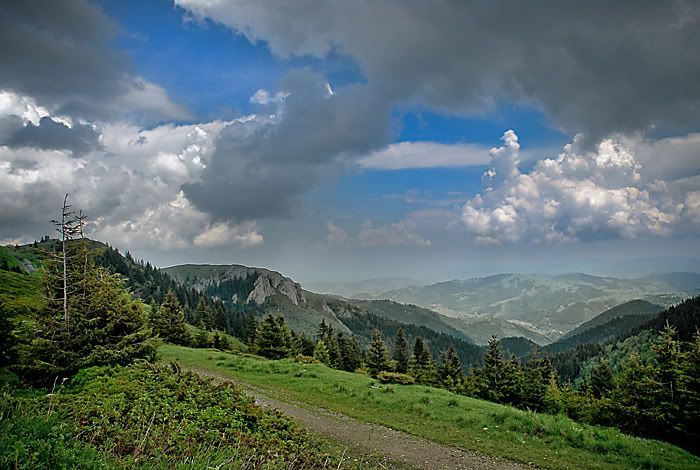
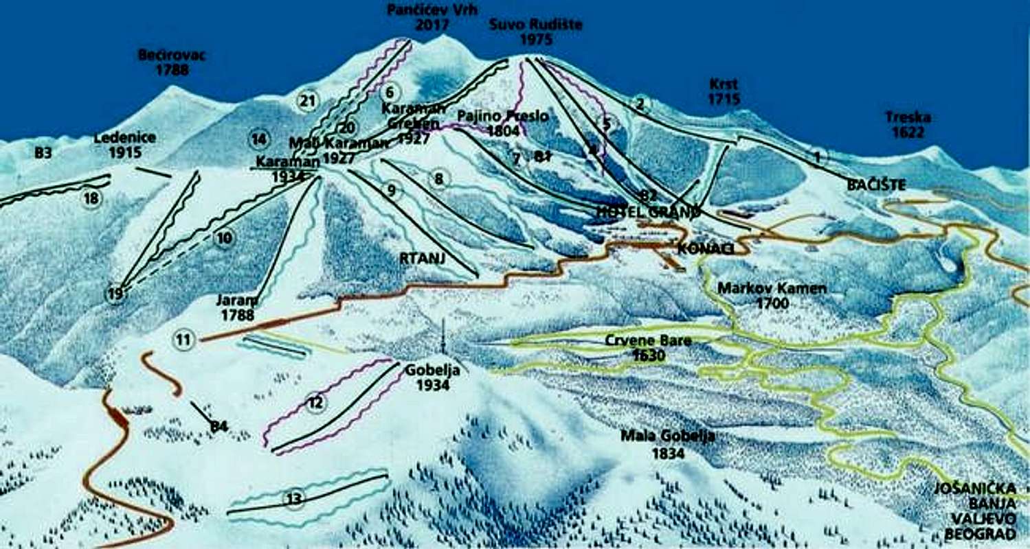
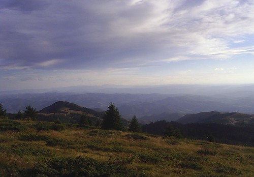
Kopaonik, the biggest mountain of the central Serbia, spreads its wide mountain – ridge 83 km. long, in the direction from the mountainous region over Mitrovica, to the north – west over the series of peaks higer than 1600 m., to the highest part of the massif called Ravni Kopaonik (Flat Kopaonik) with the peaks: Gobelja (1934 m), Karman Vucak (1936 m), Suvo Rudiste (1976 m) and Pancicev Vrh (Pancic Peak) (2017 m).
The northern border of the massif is separated from the massif of the mountain Zeljina by the rivers Josanicka reka and Koznicka reka.
At the western side, along the whole Kopaonik mountain – ridge, the Ibar gorge is placed.
The eastern side is bounded by the rivers Rasina and Toplica valleys.
The region’s geology dates back 70 million years ago when the older sedimentary rocks were exposed to the strong tectonic movements and to the volcano activity which caused dent and issue of the magmatic cliffs.
This is why Kopaonik distinguishes itself by its geological structure of rocks of different inception and age (granites, serpentinites, slates, marbles, andesites, lime-stones).
The later processes of erosion during past millenniums created present-day outlines of the relief of Kopaonik.
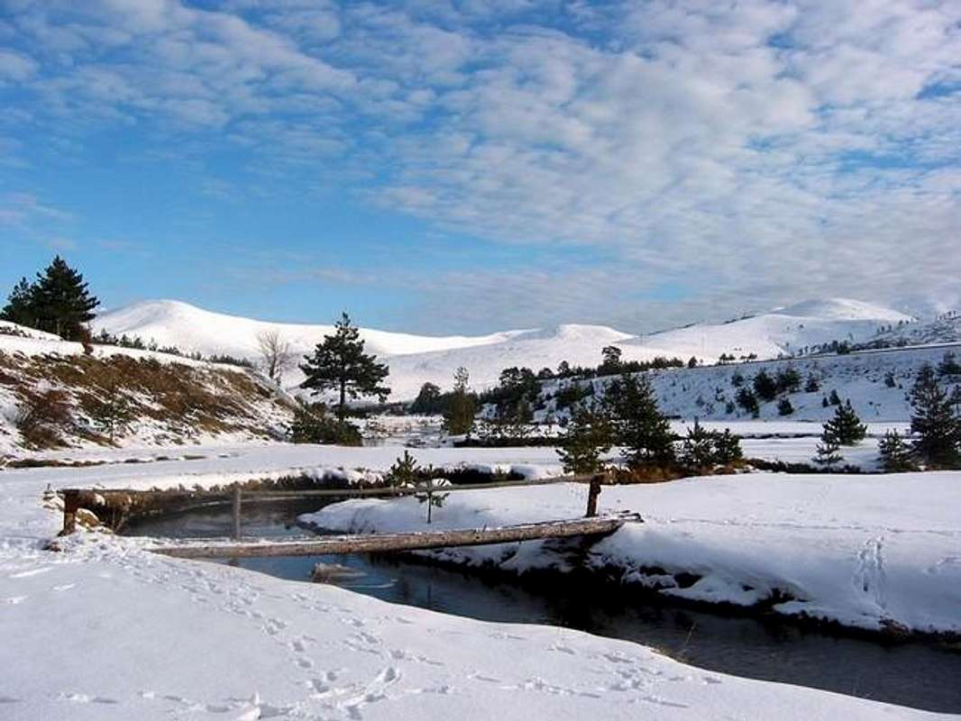
Climate of Kopaonik, with almost 200 sunny days annually, deserves credit for Kopaonik’s other name – “mountain of the Sun”. The southern position of the massif, level and openness of the terrain prevent continual detaining of cloudiness over the mountain. Colder and heavier air moves through the nearby valleys and ravines so that winter temperatures are not too low. Kopaonik has sub-alpine climate. Average annual temperature of the Flat Kopaonik is 3,7°C.
It starts snowing at the end of November and it snows unti May, 159 days a year in average. On average, precipitation are higher than 1000 mm a year.
Kopaonik, where people used to work mines from old times, was named after its ore resources (kopati – to dig).
The volcano activity and discharge of hot mineral solutions caused changes on the nearby old rocks because of high temperatures and heavy pressures. That is how “mining region of Kopaonik” came to be, with a large number of mines from old times.
In the Kopaonik region, besides the usual ores: metals iron, lead and zinc, there are rare metals silver and gold and rare minerals: volastonite,fluor-spar, asbestos and others.
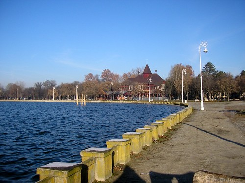
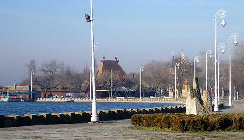
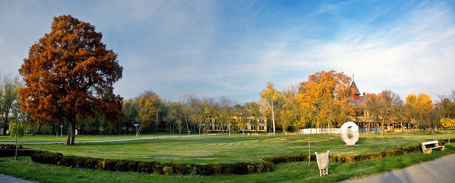
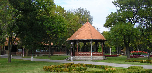
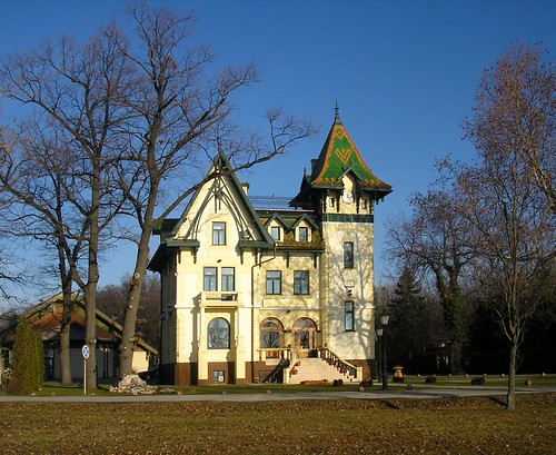
Thermal – mineral springs – spas are situated at the foothill of Kopaonik. Besides famous spas such as Vrnjacka Banja, Mataruska Banja, Sijarinska Banja, in the Kopaonik region there are springs of Josanicka Banja (t° 78°C), Lukovska Banja (t° 36°-56°C) and Kursumlijska Banja (38°-57″C).
Besides thermal waters, there are also slightly mineralized waters on Kopaonik. In the first place, these are slightly radioactive springs Krcmar vode and Marine vode at the heights of 1700 – 1950m.
LIVING WORLD – FLORA AND FAUNA
Kopaonik is situated at the border of two significant Balkans provinces, Illyrian (western and more humid) and Moesian (eastern and drier) with considerable influence of southern, mediterranean and sub-mediterranean regions and northern Pannonian regions.
Favorable hill and mountain climate with considerable quantities of the water sediment and snow cover guarantees a long period of vegetation and a creation of a large volume of biomass.
Heterogeneous geological foundation (granite, metamorphic, limestone and serpentinite) enables detainment of humidity and water reserves which are sufficient enough for life of plants and other organisms.
During severe winters, thick snow cover protects permanent and delicate parts of plants, animals and other organisms from low temperatures and frosts.
Geomorphological and orographic characteristics enable formation of the most various habitats of the plant and animal world in proportion to the height above sea – level, exposure, ground slopes and other.
Plant world – Flora
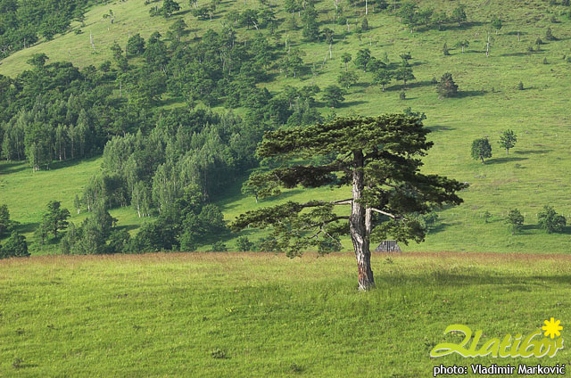
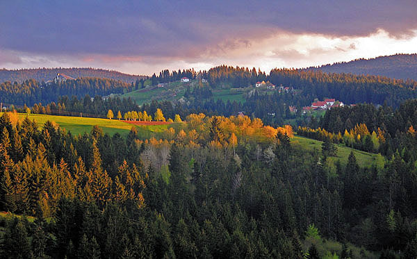
Favorable natural conditions of this high mountain massif enable development of almost all the forest mountainous belts with prime and autochthonous forest vegetation wich used to spread to the very mountain tops, where at those times had two smaller areas covered with mountainous bushy and grassy vegetation of the Alpine – Nordic character.
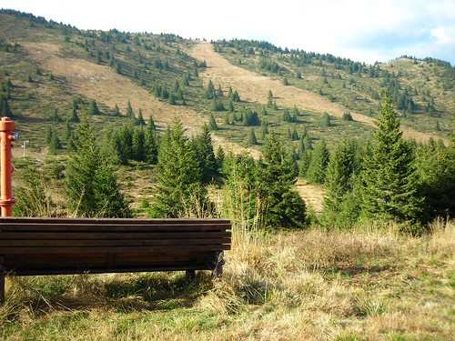
That’s why the plant world (flora) of the Kopaonik massif is so rich and various. It contains numerous and various species of trees, bushes, herbaceous plants, seed plants, fern, moss, lichen, mushrooms etc. A lot of them have healing properties and they are known as herb teas (Klamath weed, wild thyme, milfoil etc.). Above the forests in the lower regions (Turkey oak, hornbeam, oak – tree, common pear tree), there is a belt of beech tree forest (Fagus moesiaca) in which there are maple (greater maple) and sugar maple (Acer pseudoplatanus, Acer platanoides), ash – tree (Fraxinus excelsior), common maple, lime – tree and at the higher regions fir trees (Albies Alba).
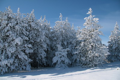
The highest forest belt on Kopaonik placed on the altitude of 1500 m is covered with thick spruce forests (Pieceetum excelsae). At the highest altitudes (1750 -1900 m) the spruce forests become less thick and they are replaced with low bushes where the most prevailing plants are juniper – bush (juniperus nana) and blueberry (vaccinium myrtillus) as well as the other species of the ground floor among which we should single out Gentiana Lutea, great mullein and edelweiss.
Endemic species, like Leontopodium alpinum, ought to be particularly pointed out. The higest regions are covered with grassy vegetation of pasture – grounds.
Distinct characteristic of the plant world of the high Kopaonik is represented by peat-bogs. Peat-bogs are not very thick with specific plant species of peat. Peat-bogs of Kopaonik are over 1000 years old. Here, they are called Bare. The most famous ones are: Jankova bara, Crvene bare, Barska reka.
Animal world – Fauna
The animal world of the present Kopaonik is various despite it being reduced in number, especially of the big game. Several decades ago, bear, lynx, deer, wildcat, marten, otter and falcon and horned owl used to live here.
Today, the only species left are wolf and other game such as doe, fox, hare, and also different kinds of birds – small number of horned owl, falcon, partridge, eagle, as well as the bird red crossbill which feeds on conifer seeds.
Among the insects, we should point out Sibirian grass – hopper which lives in the high cold regions of the mountain. The brown trout lives in the clear waters and rapids of the Samokovska reka.
HISTORICAL HERITAGE
Early Byzantin basilic ruins /IV-V c./ isdiscovered in the year 1999, in site Crkvina – Nebeska Stolica at 1800m. Historical traces of the broader region of Kopaonik reveal Illyrian and pre-Illyrian heritage. Roman settlements and later Slav consolidation.
Medieval sources, the charters of Stefan Nemanja and his successors, note this region as a parish in the region of the Ibar, from Zvecan to the river West Morava with Kopaonik in the center of the region. Ruins of the fortifications placed on the mountain tops surrounding the central massif prove the historical significance of the Kopaonik region, like of the center of the Serbian medieval state (ruled by the Dynasties Nemanjic, Lazarevic and Brankovic).
Towns Zvecan (XI-XIV century), Maglic (XIV), Brvenik (XIV), Vrh Lab (XIV), Koznik (XV) guarded fertile region of the wine – growing district, ore and forest wealth of Kopaonik and rich pious foundations of the Serbian rulers:
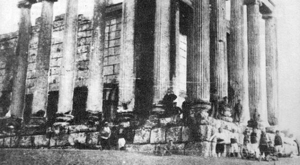
- – Petrova crkva (VIII – IX century) near Novi Pazar
- – Studenica (XI _ XII century) near Usce
- – Zica (XIII century) near Kraljevo
- – Sopocani (XIII century) near Novi Pazar
- – Djurdjevi stubovi (XII century) near Novi Pazar
- – Gradac (XIII century) near Raska
- – Pavlica (XIV century) near Raska
Kopaonik has a rich mining past. The historical sources note King of Raska Stefan Uros I who brought from Germany hired miners, know as Saxons. The miners’ settlements and towns, together with the melting plants and mints: Stari Trg, Novo Brdo, Rogozno, Plana, were situated in the surrouding district.
Mining region of Kopaonik was the most prosperous in XIV and XV century during the Despotate when it developed trade with the Dubrovnik Republic, Byzantium and Western Europe.
Mining of this region was ruined after the raids of the Turks in XV century and it revived in the XIX and XX century.
Even today, we can find the remnants and traces of the old excavations from the Roman and Medieval times on Kopaonik.
National Park Kopaonik
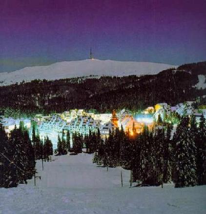
National Park Kopaonik was founded and proclaimed in 1981. It covers an area of 11.800 ha, and has a protecting belt of 19.986 ha, 689 ha of the wildlife refuge is under special protection. The park is placed on the highest parts of the mountain.
The base of the park represents mountainous, relatively levelled region of the medium height above sea – level about 1700 m. The lowest altitude is about 640 m above sea – level. The highest altitude is Pancicev vrh (2017 m).
According to the laws of the Republic of Serbia on protection of nature, a large number of objects of nature, natural and man-made objects which can be found in the National Park Kopaonik, are singled out and classified according to the different of protection.
Natural wildlife refuges of Natioanl Park
1. Kozje stene – with relict groups of juniper trees, fir trees and heather and a large nuxubel of relict kinds and vegetation of rocks.
2 . Vucak – includes unique group of fir tree and juniper tree (this combination may be seen only on Zlatibor and here), as well as two groups of juniper tree, fir tree and beech tree.
3 . Mrkonja – includes group of beech tree and fir tree of the preserved structure in the conditions of the degraded soil.
4. Jankova bara – the biggest pear-bog on Kopaonik, with a large number of peat-bog gruops as well as the specific groups of juniper tree, fir tree, Austrain / black and Scots pine.
5. Gobelja – wildlife refuge of the representatives of the mountain, climate-regional groups and distinct groups of ostenjak with habitats of extremely rare and jeopardized species.
6. Barska reka – includes forest groups of beech tree, fir tree and juniper tree of relict character, which are important for the science.
7. Samokovska reka – includes extremely interesting and various groups of juniper tree with moss, common sorrel, wood-rush and others, as well as vegetation of peat-bog.
8. Metodje – includes six phytocoenologically different groups of juniper and beech trees and the number of other rare and relict plant spacies.
9. Jelak – includes interesting ecosystem of beech and fir inside which wee meet important and rare species – yew – tree.
10. Suvo Rudiste – characteristic representative of the mountainous region at the top border of the forest vegetation with groups of climate-regional groups of blueberry, juniper bush and iub-alpine juniper tree, as well as with the groups of tipac and metlicasta vlasulja.
11. Duboka – in the municipality Brus – includes parts of relict group of beech tree with bul – rush, as well as group of beech tree with hornbeam (a unique group on Kopaonik).
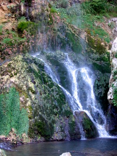
12. Jelovarnik – hydological and geomorfological monument, fall with three cascades of hight 70m, surrounded with intteresting ecosystem of beech and junipertree, rocks and waterfals.
13. Bele stene – (Withe rocks) – geologocal monument rocks massif of the limestone at the upper bonier of the vegetation in community with bluberry, juniper bush and junipertree.
Natural monuments
- – Geomorphological monuments – stone granite sculptures: Lisicja stena, Pajin grob, Suvi vrh, Jankov breg, Babin grob, Visoki deo, Karaman – Vucak
- – Geomorphological monuments – traces of Pleistocene glacialion – Circ Krcmar, Circ Siroki do, Circ V. Gobelja.
- – Geological monuments: Velika stena, Velika Siljaca, Jelica, Zljeb, Gvozdac, Ostri krs.
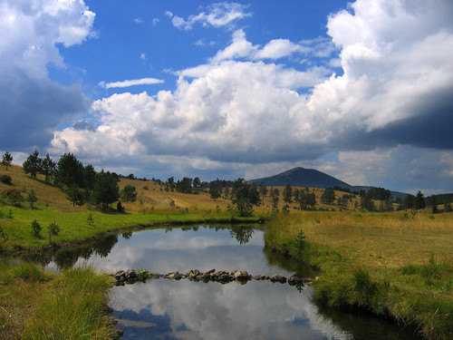
- – Hydrological monuments – springs and fountainheads: Fountainhead Duboko, “Geyser” Gvozdac, Spring Marina voda, Spring Krcmar, Waterfall Barska reka, Semetsko jezero – lake.
- – Hydrological monuments – strictly protected water – courses of the river basins: Samokovska reka, Gobeljska reka, Barska reka, Brzecka reka, Duboka reka.
Architectural achievements of the Natioanl Park area
- – Remains of the medieval road – Kukavica (about 4 km).
- – Remains of the medieval former mine site – village Zaplanina, Samokovska reka, Kadijevac, Suvo Rudiste, Brzecka reka, Bela reka.
- – Buildings of the sacral architecture – site of a former church in Metodje, church of Sv. Petar and Pavle in Kriva reka, Building from the Turkish period – turkish bath in Josanicka banja.
- – Monuments from the liberation wars: monument on Mramor, monuments Djacki grob, Raskrsnica, monument to the victims of fascism in Kriva Reka.
- – Other monuments – Pancic Mausoleum (placed in the complex of the special purpose).
- – Business buildings constructed in the past – Mijatovica jaz.
- – Housing buildings constructed in the past:village Lisina, village Djordjevici, village Crna Glava, village Kriva Reka, village Brzece.
- – Business buildings constructed in the past – water mills and saw mills: Brzece, Kriva Reka, Gobeljska reka, Josanicka Banja.