Kiribati, PIPA (Phoenix Islands Protected Area)


The small Pacific Island nation of Kiribati has become a global conservation leader by declaring the Phoenix Islands a protected area to ensure its biological diversity and sustainability. It is a California-sized ocean wilderness of pristine coral reefs and rich fish populations threatened by over-fishing and climate change. The Phoenix Islands Protected Area (PIPA) conserves one of the Earth’s last intact oceanic coral archipelago ecosystems, consisting of eight coral atolls and two submerged reef systems in a nearly uninhabited region of abundant marine and bird life. Located near the equator in the Central Pacific between Hawaii and Fiji, the Phoenix Islands form an archipelago several hundred miles long. They are part of the Republic of Kiribati, which comprises three distinct island groups (Gilbert Islands, Phoenix Islands and Line Islands) with a total of 33 islands to make it the largest atoll nation in the world. The 410,500-square-kilometer (158,453-square-mile) protected area also includes underwater mountains and other deep-sea habitat.
The Phoenix Islands and surrounding areas are home to some 120 species of coral and more than 500 species of fish. On January 28, 2008, the government of Kiribati formally declared the entire Phoenix group and surrounding waters a protected area, making its 410,500 square kilometres the world’s largest marine protected area.

The Voice of New Zealand, Broadcasting to the Pacific, Te Reo Irirangi O Aotearoa, O Te Moana-Nui-A-Kiwa, reported that Kiribati’s minister for environment, Tetapo Nakara, says the government wants to ensure a viable use of its resources. “Certain areas of the Phoenix Islands will be declared a marine protected area. In March, we’ll going to have the negotiation with the potential donors and after that we’ll determine the timeframe. The main reason for this is part of the government’s commitment to conserve the place and the biological diversity.”
Tetapo Nakara says it hopes to fully establish the area as a protected zone by the end of the year. The minister expects that the site will attract many tourists. The Phoenix Islands Protected Area (PIPA) will consist of underwater mountains, coral reefs and more than 520 species of fish. PIPA conserves one of the Earth’s last intact oceanic coral archipelago ecosystems, consisting of eight coral atolls and two submerged reef systems in a nearly uninhabited region of abundant marine and bird life.

Kiribati first declared the creation of PIPA at the 2006 Conference of the Parties to the Convention on Biological Diversity in Brazil. On Jan. 30, 2008, Kiribati adopted formal regulations for PIPA that more than doubled the original size to make it the largest marine protected area on Earth.

Kiribati and the New England Aquarium (NEAq) developed PIPA over several years of joint scientific research, with funding and technical assistance from Conservation International’s (CI) Global Conservation Fund and Pacific Islands Program. The CI support for PIPA is part of the Coral Reef Initiative in the South Pacific (CRISP).
“Kiribati has taken an inspirational step in increasing the size of PIPA well beyond the original eight atolls and globally important seabird, fish and coral reef communities,” said Greg Stone, the NEAq vice-president of global marine programs. “The new boundary includes extensive seamount and deep sea habitat, tuna spawning grounds, and as yet unsurveyed submerged reef systems.”

“The creation of this amazing marine protected area by a small island nation in the Pacific represents a commitment of historic proportions; and all of this by a country that is under serious threat from sea-level rise attributed to global warming,” said CI President Russell A. Mittermeier.

Three NEAq-led research expeditions since 2000 found great marine biodiversity, including more than 120 species of coral and 520 species of fish, some new to science. Some of the most important seabird nesting populations in the Pacific, as well as healthy fish populations and the presence of sea turtles and other species, demonstrated the pristine nature of the area and its importance as a migration route.

Protecting the Phoenix Islands means restricting commercial fishing in the area, resulting in a loss of revenue that the Kiribati government would normally receive from issuing foreign commercial fishing licenses. NEAq and CI are helping Kiribati design an endowment system that will cover the core recurring management costs of PIPA and compensate the government for the foregone commercial fishing license revenues. The plan allows for subsistence fishing by resident communities and other sustainable economic development in designated zones of the protected area.

Keeping oceans and marine ecosystems intact and healthy allows them to better resist the impacts of climate change and continue their natural role of sequestering atmospheric carbon that causes global warming.

http://pagead2.googlesyndication.com/pagead/show_ads.js

Suqatra Island, Yemen


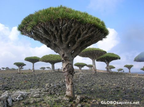
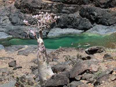
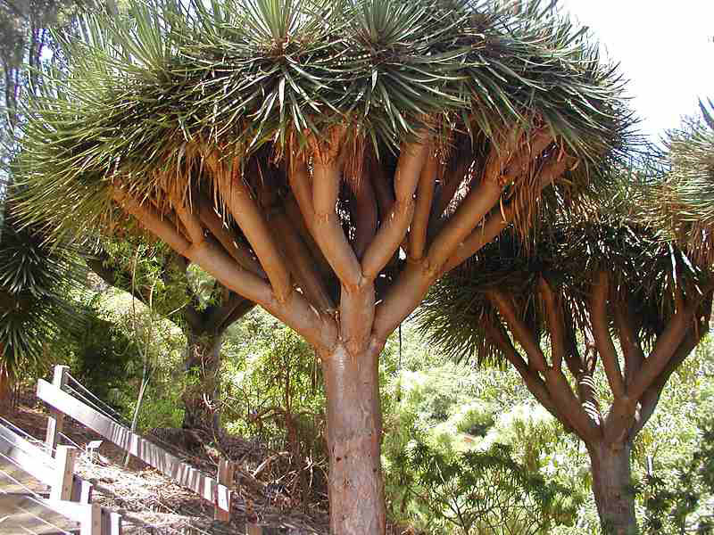
This enchanting and little known island also known as Socotra is located off the coast of Yemen in the Middle East. Isolated from the rest of the world its plants have evolved into many bizarre shapes and forms that are unknown in other parts of the world. One of the most famous of these is the Dragon’s Blood Tree the sap of which is used to make crystals that can be used as a dye or as an alleged aphrodisiac. The plant depicted on the right is the strange Desert Rose (Adenium obesium) but sometimes more popularly called the Elephants Leg Tree. The Island is slowly becoming known to the world and has great potential for eco-tourism as long as the visitors don’t do more damage than good. Other species include the Cucumber Tree and the Socotran Fig. Suqatra was listed as a World Heritage Site in 2008.

Location

The Archipelago of Socotra lies at the entrance to the Gulf of Aden between the Latitudes (12.18-12.24) north of the equator and the longitudes (53.19-54.33) east of Greenwich. It is about 380 km a way from Ras Fartak in the Yemeni eastern province of Maharah and about 553 miles away from Aden province.

Socotra stretches as a piece of land with an area of about 3650 square Km; up to a length 125 kilometer and width of 33 Km in the Indian Ocean, with an archipelago of small islands like AL-Akhawain island, Darsah island, Samh island and Abdul Kori island which is the most densely populated and is always known for its affluence of Diamonds collection. It is the second largest an archipelago after Socotra.

Population

According to the census held in 1994, the Socotra archipelago is inhabited by about 65,514 people.

Relief

The surface of the island varies into four kinds of relief as the follows:

The Central Plateau:
It occupies most of the island area and is parted by Tatrat Valley into two main parts: the eastern and the western Plateau, overlooking gradually the coastal plains.

The coastal plains:
The coastal Plains are situated in the north and south of the island and are non-existent in the east or west of the island due to the extension of drifts to the coast.

The coastal plains are divided into two parts:
The northern coastal plain named Hadibo plain, the southern plain which is called by the island inhabitants as Nawjad.
The Hadibo plain is divided into different areas as the following:
Ras Mdhin plain and the plains of Dirya’h valley and Taua’an valley

The Southern coastal plains:
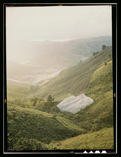
The Nawjad plain that divides into the plains of Difarho valley and Diezarhu valley. Those plains extend from the south of Moma Ras area east of the island until Shoab Ras in west. Agriculture- suitable soil covers those plains while soft sand dunes are near the coasts.

Mountains
The most important of which are the mountainous 24 km range of Hajhar mountains which are located at the eastern part of the island along Arida Bay, overlooking Hadibo and extending north easterly to south westerly at a distance of 25 Km of which the highest peak is Dawkam whose altitude 1630 m above sea level. There are also a number of other mountains, including Valege mountains east of the island whose altitude 640 m above sea level, the 978 m Qulahl mountains which lay at southwest of the island, the 699 m Kadah mountains in south and Qaten mountain whose altitude 800 m above sea level.

Valleys

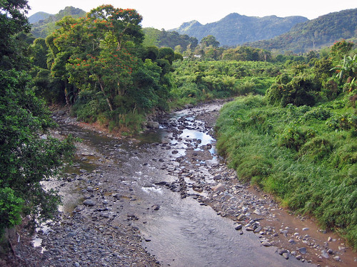
The plains are interspersed by many valleys. Some of which pour at the northern part of the island and some of which pour at its southern part and the most important of which is azroo Valley which intersects the island from north to south in addition to the valleys springing out from the Hajhar Mountainous Rang which are characterized for their running water all along the year. Those valleys are the valleys of Danjhn, Hasharah, Danayah, Draba’ah and Toa’aq.

Climate

The island is prevailed generally with a sea relatively hot weather of which the average daily temperature in Hajhar Mountains ranges between 26-28 Celsius while in June and July the temperature reaches its extreme and falls during January and February.

The island is subjected to sharp southern westerly winds during the summer months (June, July, August) with an average speed between 13-18 Km /h, whose speed decreases gradually during September till end at the beginning of October. In June, July and August, the speed of south-western winds hits 40-50 knots, accompanied by severe sea turmoil.

The average humidity ratio ranges between 55% as the maximum in August and 70% as the minimum in January. Average annual rainfall of the island is 150-170 mm but this quantity fluctuates to a great extent from one year to another.

Administrative regions

The island is divided administratively into two regions as the following:

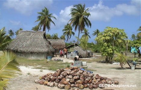
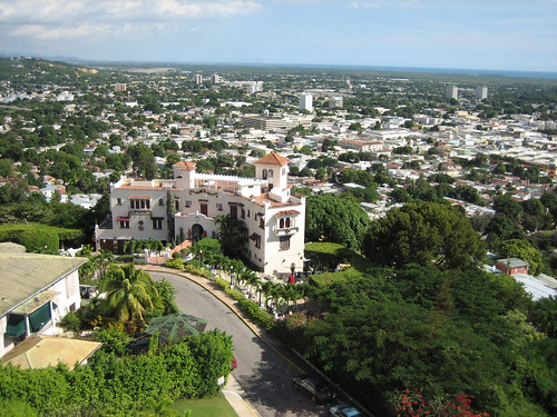
Hadibo: it is the capital of the island and located in the north-east of the island, and it has the largest urban center. The inhabitants of the city raise goats and cattle. It is also surrounded by thick forests of palm trees along the valleys, where water flow endlessly. The city provides the minimum basics of health services.

Qalanseya and Abdul Koree region: it is situated in the western part of the island, and equips many residential-populated quarters. Its main city is Qalanseya located at the western coastal strip of the island. it is the second urban habitation after Hadibo. Its houses consisted of one floor only, colored predominantly in white, which gives the city a beautiful character.

In 1967, the island it was administratively related to Aden province, but later it became a part of Hadramout province under the Republican decree No. (23) for 1999.

Historical Introduction

The name of the Socotra island originated from one old forgotten language-dialect spoken at one time by the pre-historic passers to the island. This ancient term of a name given for the island was “Eipheba Sakhotora” which used to mean “The island of Happiness.

The fame and historic important of Socotra dates back to the beginning of holy commodities trade prosperity and the activity of the old trade route which is much better known as Frankincense, Myrrh and Laudanum route for the island was one of the main producers of such essential commodities in addition to its being the back reserve for the support of Yemeni ancient Hadramawt Civilization along the first millenium BC when the kingdom of Hadramawt was named ( kingdom of Frankincense, Myrrh and Laudanum).

Based on its important role in the production of the sacred goods and valuables from various spices and pearl, it has had a presence in books of ancient voyagers. In the geographic exploration ear, it was coveted by invaders, where the Portuguese colonized it (1507-1557). They stayed till the end of the fifteenth century. Then, the British colonized the island, considering it an important strategic point so that they occupy Aden Aden on January 1839.

On 30th November 1967 the island became part of what was known as South Yemen. But now after the reunification on 22nd May 1990, It is a part of Republic of Yemen.

The Socotra archipelago

The archipelago consists of the main island of SUQATRA, ABDU ALKURI, SAMHAH, ARSAH, SIYAL ABDU ALKURI and SIYAL SUQATRA.

Abdul Kori island is the most densely populated and is always known for its affluence of Diamonds collection. It is the second largest an archipelago after Socotra. It is away 200 miles from northwest of the island of Socotra. There is a small berth at the southern shore of the island of ABDU ALKURI.

The archipelago also includes a number of rock outcrops like SIRAH, ADLAH, SAYHAR, JALIS, RADAD, KARSHAH and DHA’IN DHATIL.
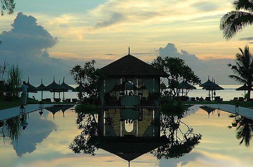
Tourist sector

This important marine location can make it a distinctive center for tourism and investment attraction, due to the island’s supporting elements of attractive features that were created through the nature existing there.

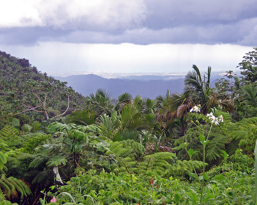
These are represented by its green forests that cover extensive areas of land suitable to be transformed to several Tourism scenes. Besides, certain tourist activities such as fish canning and diving places can be implemented in such a rare and naturally protected area.

Socotra is considered a natural jewel of rare biodiversity. The long geological isolation of the Socotra archipelago and its fierce heat and drought have combined to create a unique and spectacular endemic flora. The archipelago is a site of global importance for biodiversity conservation and a possible center for ecotourism.

Yemen is greatly interesting Socotra to take advantage of its diversified stocks and diverse natural and economic characteristics. The tourist attractions describe generally the island as a museum of natural history, including a rare biodiversity receives an attention by the UNESCO and several international bodies which make further efforts to preserve the island’s environment.

Socotra, the colony settlement for rare natural birds and plants and enjoy an important strategic location, is now prepared to become the pearl of the Arabian Sea and relatively shining diamond. It is a new era.

The UNESCO and international bodies’ interests of Socotra included firstly etting up a number of development programs devoted to preserve the island’s rare biodiversity, including the nomination of Socotra as a natural reserve in order to serve humanity.

Setting up a project of the protection of biodiversity in the island and the archipelago, the government issued in April 1996 the decree No. (96) to avoid causing any deterioration in the natural environment of the island with the increased pace of economic and population growth on the island during the current and future periods. It is to implement projects of protecting environmentally sensitive species and sites to ensure the sustainability of development in the naturally protected areas.

Socotra island can be regarded a kingdom of medical shrubs and plants. Some of theme are rare, the others unique. It occupies the tenth rank amongst the richest island in the world in respect of unique plantation kind and the rare ones.

It boasts having 750 kinds of plants of which 600 kinds are rare and 150 kind are uniquely owned by the island where noequivalents are available all over the world, the most important of which is two Brothers Blood tree. the seven different Ladanum tree. This concentration of the kinds of Ladanum is not available anywhere except on this island, in addition to other natural plants which are commonly used on the island on which the Socotra depended as a sort of cure for the different diseases.

Birds

The island also abounds with many species of birds which form with the plantation environment and Marine environment one of the Tourism parameters. It is considered one of the most important locations in the Middle east in which birds live due to the spread of natural woodland 105 kinds of birds of which thirty kinds procreate on the island, 4 kinds indigenous, 14 kinds are subject to extinction worldwide …they are The Socotran Starling, Socotran Alhazijah , and the Socotran Learner.

A Yemeni association for protecting birds seeks to expedite the conduct of studies and surveys of the island to map of the distribution of birds and breeding places for protecting them.
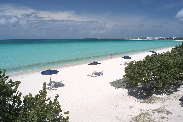
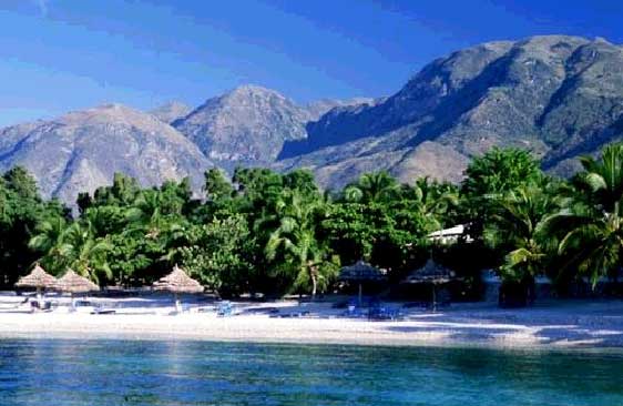
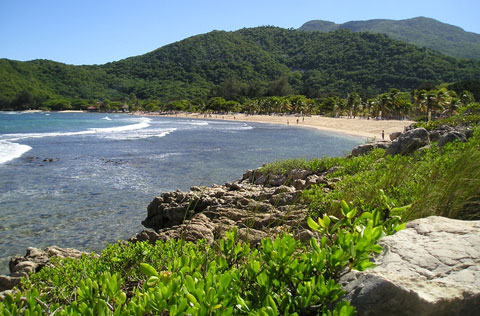
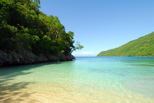
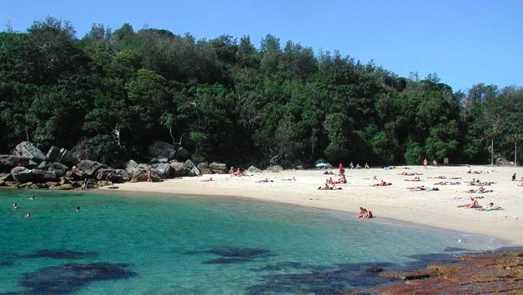
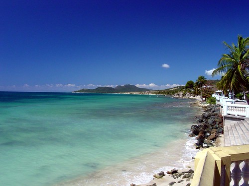
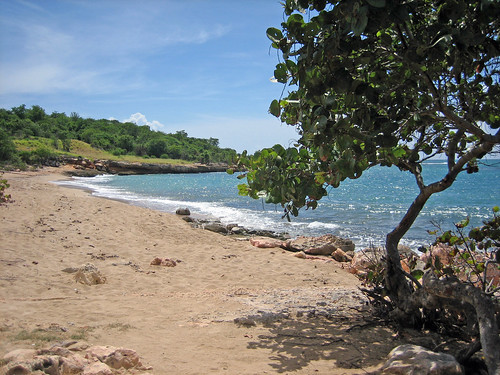
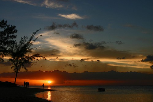
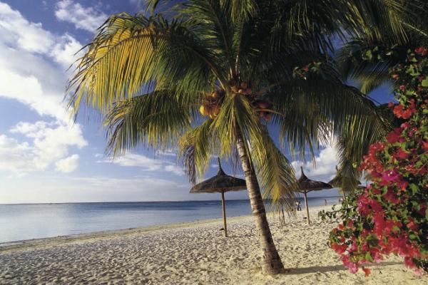
The beach
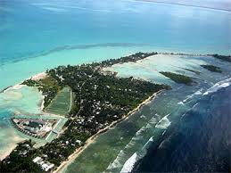
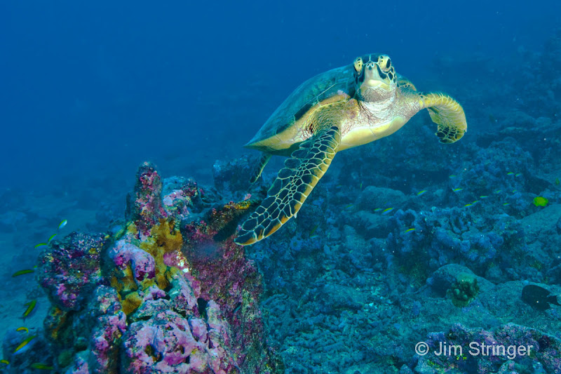
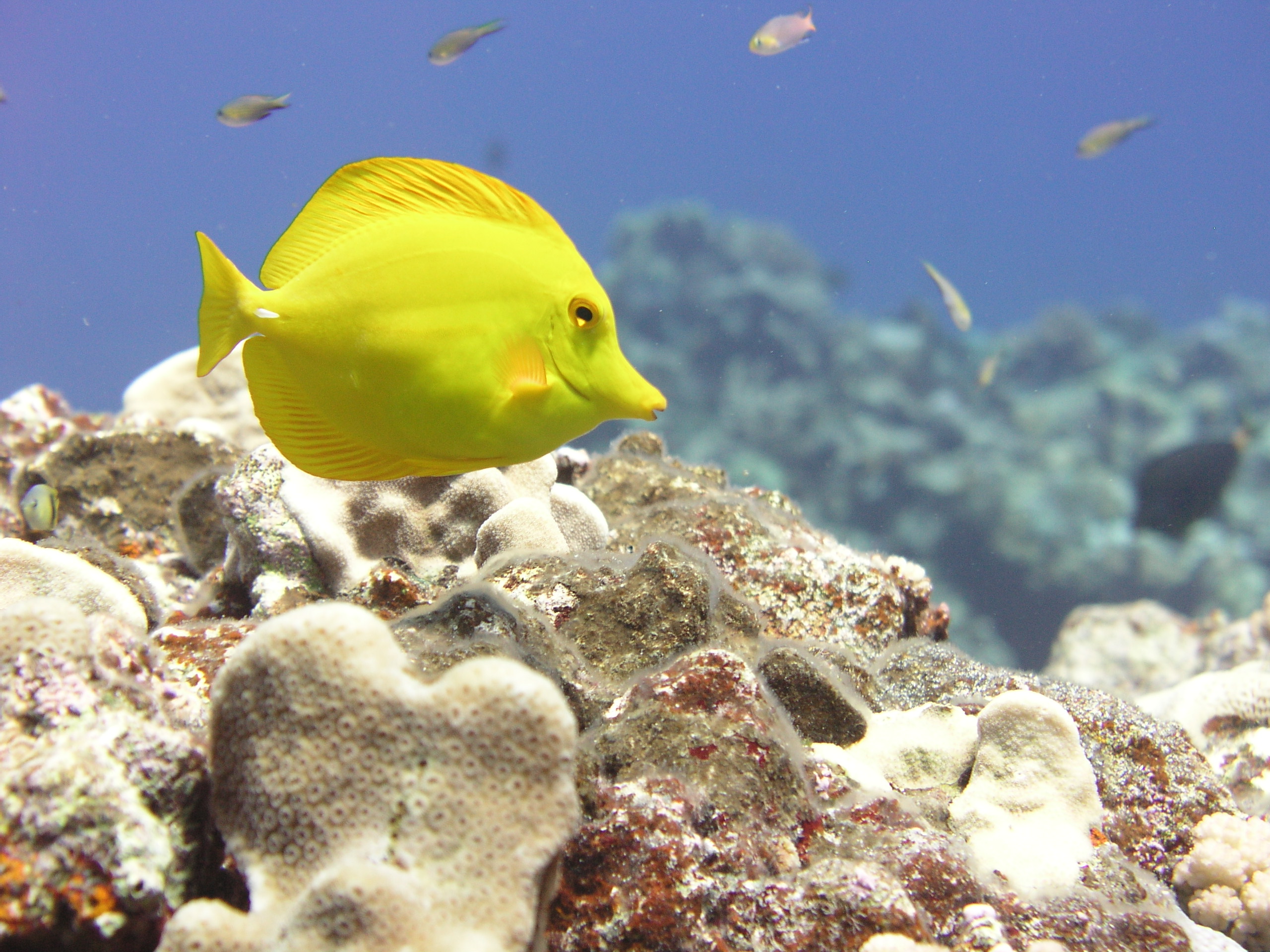
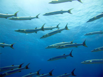
There are a number of beautiful beaches on the island, the most important of which is Nawjed beach.and also many species of marine animals and fish, especially shrimps.

The shores of the island reach 300 miles and have unique characteristics in terms of pure white sand dunes and palm trees.

They are good locations for recreation and diving, particularly after providing tourist infrastructure services in the island. The beaches of Socotra contain many rare diverse water creations like green turtles in addition to coral reefs and pearl, which the island of Socotra famous since ancient historical times.

source 1 2

Haiti


Haiti achieved notoriety during the brutal dictatorships of the voodoo physician, Francois “Papa Doc” Duvalier, and his son, Jean-Claude, or “Baby Doc”. Tens of thousands of people were killed under their 29-year rule.
Hopes that the election in 1990 of Jean-Bertrand Aristide, a former priest, would herald a brighter future were dashed when he was overthrown by the military a short time later.
Although economic sanctions and US-led military intervention forced a return to constitutional government in 1994, Haiti’s fortunes did not pick up, with allegations of electoral irregularities, ongoing extra-judicial killings, torture and brutality.
A bloody rebellion, and pressure from the US and France, forced Mr Aristide out of the country in 2004. Since then, an elected leadership has taken over from an interim government and a UN stabilisation force has been deployed. But Haiti is still plagued by violent confrontations between rival gangs and political groups and the UN has described the human rights situation as “catastrophic”.
Meanwhile, Haiti’s most serious underlying social problem, the huge wealth gap between the impoverished Creole-speaking black majority and the French-speaking minority, 1% of whom own nearly half the country’s wealth, remains unaddressed. Many Haitians seek work and a better life in the US or other Caribbean nations, including the neighbouring Dominican Republic, which is home to hundreds of thousands of Haitian migrants. Furthermore, the infrastructure has all but collapsed and drug trafficking has corrupted the judicial system and the police. Haiti is ill-equipped to deal with the aftermath of tropical storms. Severe deforestation has left it vulnerable to flooding.
With its mountainous scenery and tropical climate, Haiti, which shares the island of Hispaniola with the Dominican Republic, has the basic ingredients of a holiday destination. However, decades of poverty, instability and violence, especially since the 1980s, have all but killed off this prospect and left it as the poorest nation in the Americas.
Under the brutal dictatorships of the voodoo physician, Francois ‘Papa Doc’ Duvalier, and his son, Jean-Claude, known as ‘Baby Doc’, political dissent was systematically eradicated and opponents jailed or murdered. When Jean-Bertrand Aristide was elected in 1990, the country’s future looked brighter until he was overthrown by the armed forces a short time later.
Although economic sanctions and US-led military intervention forced a return to constitutional government in 1994, Haiti’s fortune did not improve, with allegations of electoral irregularities, ongoing torture and brutality. In 2003, a wave of protests against Aristide quickly spread throughout the country plunging Haiti into chaos. By 2004, armed rebels had seized control of many towns and violence spread across the island. In February 2004, Aristide fled the country.
Former president René Préval won presidential elections in 2006. But Haiti remains plagued by violent confrontations between rival gangs and political groups. The UN has described the human rights situation as ‘catastrophic’.
source 1 2

Sightseeing and interesting attractions around Puerto Rico


If you are looking for attractions and places to visit in Puerto Rico, then read on and I will present you some of the most interesting places to see on the island.
The island of Puerto Rico was blessed with many natural attractions and great spots for sightseeing. We invite you to go beyond the shore and explore it all. When you visit Puerto Rico you will find that in order for you to see all the attractions there are it will literally take you months to explore and visit them all. Whatever you are looking for in a vacation Puerto Rico has it; romance, adventure, relaxation, history, beauty, magical places and friendly locals that will make you feel right at home.
Puerto Rico is the favorite destination on the Caribbean simply because it is the most diverse island with a range of attractions and sightseeing spots in every corner of the island. Many places to visit on the coast, and the central hillside of the island. No other Caribbean island has such a variety of attractions and places to visit like Puerto Rico.
You won’t run out of things to do while you visit the island of Puerto Rico; the star of the Caribbean. There are attractions and places to visit for every type of traveler. From adventurous places, to the most alluring and relaxing spots that are free of crowds. Puerto Rico is very family friendly, attractions where time seems to stand still so you can build memories to last a lifetime.
Let’s go to some of the my favorite places to visit and attractions in Puerto Rico. Puerto Rico may seem small on a map, and it is when compared to many other destinations. But you will find that you will be wishing you had more time to explore the island of Puerto Rico. There are too many places to see, too many attractions and beautiful beaches to explore in a week or two. So get ready to have fun, and be ready to start blocking some time in your calendar for your next vacation to Puerto Rico. I guarantee you that once you visit this beautiful land of Puerto Rico, you will want to come again and again, and like many you may even find yourself looking for real estate so you can have a place to come and stay with friends, family and possibly retire.
If you really want to get to know Puerto Rico, transportation is a must. Get a rental car because the best of Puerto Rico is off the beaten path. Let’s explore the island in more detail.
Drive off to Porta del Sol (west Puerto Rico) and you will find pristine, un-crowded beaches with breathtaking sunsets. If you enjoy surfing visit the town of Rincòn, where you will experience the best surfing on the island.
Don’t leave Puerto Rico without going to the town ofCabo Rojo where you will find some of the best seafood restaurants in Puerto Rico at very affordable prices. In Cabo Rojo, you will also find some of the most scenic un-crowded beaches and the beautiful lighthouse where you can enjoy stunning vistas, and the best sunsets in Puerto Rico. Visit La Parguera in the town of Lajas where you can experience the natural wonder of bioluminescence.
Explore the Dry Forest of Guanica, where you will find the greatest population of birds on the island and more great beaches.
Visit the historic town of San German, where you will drive through narrow brick roads lined with old-world style Spanish homes. San German also houses the first church that was ever built in the New World. Take the scenic drive, and you will be mesmerized by the majestic mountains running through the center of the island and the breathtaking turquoise waters framed by lush, tall, green palm trees.
Another great destination in Puerto Rico is the island of Vieques, the new capital of weddings and honeymoons of Puerto Rico, where you will find pristine, virgin, and secluded beaches. Vieques will be the cherry on your perfect Puerto Rico vacation.
Before you leave Puerto Rico please take at least a couple of days to visit this beautiful island, it is like going back 60 years and seeing the Caribbean the way it was intended to be.
There is so much to see in Puerto Rico, you could spend years of your life exploring the beauty and diversity of the island.

Puerto Rican natives are very friendly and they will make you feel welcomed. Puerto Rico has the charm of an island and the conveniences and roads that you would find in the United States. It is very easy to get around the island. If you get lost, the helpful residents will be happy to lead you in the right direction. Helpful hint: Be ready to use landmarks as directions instead of road names.

Ready to get on the road and begin exploring? Start smiling you are on your way to Puerto Rico.

Puerto Rico

A bustling island whose shiny consumerism rubs up against an unspoiled interior.


Puerto Rico is where four centuries of Spanish Caribbean culture comes face to face with the American convenience store. This leads to some strange juxtapositions – parking lots and plazas, freeways and fountains, skyscrapers and shanties – but it’s all apiece with the Caribbean’s hybrid history.

Travellers who venture into the island’s mountainous interior or explore its undeveloped coasts come across stately hill towns where the locals in the plaza seem to have been feeding the same pigeons for decades, and reefs where divers can see 30 species of fish in as many seconds.

Puerto Rico is a Caribbean Vacation Spot worth visiting, because it has such huge variety. As well as being able to take a top class luxury vacation in Puerto Rico. There will be the perfect Puerto Rico vacation spot for you, whether it is a Puerto Rico beach vacation or you want to go hiking in a forest, or eating top class Caribbean cuisine. You will be able to take romantic walks on beautiful beaches. Whatever you want to do you can probably do it in Puerto Rico.

Puerto Rico is easily accessible by air from North, South, and Central America so it is an excellent choice for a business reward trip, a wedding, a honeymoon or a business conference, never mind a straightforward luxury vacation.

It is just over three hours from Washington DC, over five hours from Mexico City, and twelve hours from London.
Puerto Rico has things to do and see which will please just about everybody………

History of Mauritius

After a brief Dutch settlement, French immigrants who came in 1715 named the island Île de France and established the first road and harbor infrastructure, as well as the sugar industry, under the leadership of Gov. Mahe de Labourdonnais. Blacks from Africa and Madagascar came as slaves to work in the sugarcane fields. In 1810, the British captured the island and in 1814, by the Treaty of Paris, it was ceded to Great Britain along with its dependencies.

Indian immigration, which followed the abolition of slavery in 1835, rapidly changed the fabric of Mauritian society, and the country flourished with the increased cultivation of sugarcane. The opening of the Suez Canal in 1869 heralded the decline of Mauritius as a port of call for ships rounding the southern tip of Africa, bound for South and East Asia. The economic instability of the price of sugar, the main crop, in the first half of the 20th century brought civil unrest, then economic, administrative, and political reforms. Mauritius became independent on March 12, 1968.

The effects of Cyclone Claudette in 1979 and of falling world sugar prices in the early 1980s led the government to initiate a vigorous program of agricultural diversification and develop the processing of imported goods for the export market. The country formally broke ties with the British Crown in March 1992, becoming a republic within the Commonwealth.

In addition to sugarcane, textile production and tourism are the leading industries. Primary education is free, and Mauritius boasts one of the highest literacy rates in sub-Saharan Africa.

With a complicated ethnic mix—about 30% of the population is of African descent and the remainder is mostly of Indian descent, both Hindu and Muslim—political allegiances are organized according to class and ethnicity.

In Feb. 2002, Mauritius went through four presidents in succession. Two resigned within days of each other, each after refusing to sign a controversial anti-terrorism law that severely curtailed the rights of suspects. The law, supported by the prime minister, was ultimately signed by a third, interim president. At the end of February, a fourth president, Karl Offman, was elected by parliament.

In Oct. 2003, Paul Berenger, a white Mauritian of French ancestry, became the first non-Hindu prime minister in the history of Mauritius. Berenger and the previous prime minister, Anerood Jugnauth, formed a coalition during Sept. 2000 elections. Under their agreement, Jugnauth served as prime minister for three years and Berenger assumed the prime ministership for the remaining two years of the term. Jugnauth then became president in 2003, and in July 2005, Navin Ramgoolam, prime minister from 1995 to 2000, again assumed that office.

Republic of Mauritius

President: Anerood Jugnauth (2003)

Prime Minister: Navin Ramgoolam (2005)

Land area: 714 sq mi (1,849 sq km);
total area: 788 sq mi (2,040 sq km)

Population (2007 est.): 1,250,882 (growth rate: 0.8%); birth rate: 15.3/1000; infant mortality rate: 14.1/1000; life expectancy: 72.9; density per sq mi: 1,752

Capital and largest city (2003 est.): Port Louis, 577,200 (metro. area), 143,800 (city proper)

Monetary unit: Mauritian rupee

Languages: English less than 1% (official), Creole 81%, Bojpoori 12%, French 3% (2000)

Ethnicity/race: Indo-Mauritian 68%, Creole 27%, Sino-Mauritian 3%, Franco-Mauritian 2%

Religions: Hindu 48%, Roman Catholic 24%, other Christian 8%, Islam 17% (2000)

Literacy rate: 86% (2003 est.)

Economic summary: GDP/PPP (2007 est.): $14.9 billion; per capita $ $11,900 . Real growth rate: 5.6%. Inflation: 8.8%. Unemployment: 8.8%. Arable land: 49%. Agriculture: sugarcane, tea, corn, potatoes, bananas, pulses; cattle, goats; fish. Labor force: 552,700; construction and industry 30%, services 25%, agriculture and fishing 9%, trade, restaurants, hotels 22%, transportation and communication 7%, finance 6% (2007). Industries: food processing (largely sugar milling), textiles, clothing, chemicals, metal products, transport equipment, nonelectrical machinery, tourism. Natural resources: arable land, fish. Exports: $2.475 billion f.o.b. (2007 est.): clothing and textiles, sugar, cut flowers, molasses. Imports: $3.627 billion f.o.b. (2007 est.): manufactured goods, capital equipment, foodstuffs, petroleum products, chemicals. Major trading partners: UK, UAE, France, U.S., Madagascar, South Africa, China, India (2006).
Member of Commonwealth of Nations

Communications: Telephones: main lines in use: 357,300 (2006); mobile cellular: 772,400 (2006). Radio broadcast stations: AM 4, FM 9, shortwave 0 (2002). Radios: 420,000 (1997). Television broadcast stations: 2 (plus several repeaters) (1997). Televisions: 258,000 (1997). Internet Service Providers (ISPs): 9,792 (2007). Internet users: 182,000 (2006).

Transportation: Railways: 0 km. Highways: total: 2,020 km; paved: 2,020 km (including 75 km of expressways) (2005). Ports and harbors: Port Louis. Airports: 5 (2007).

International disputes: Mauritius claims the Chagos Archipelago (UK-administered British Indian Ocean Territory), and its former inhabitants, who reside chiefly in Mauritius, but were granted UK citizenship and the right to repatriation in 2001; claims French-administered Tromelin Island.

text taken from infoplease