Napalm cave in Russia, Icicles of red brick


These are the consequences of the use of an alternative to napalm by Russsian army back then. It was done as a test inside of the brick houses. The temperature was so high that it made bricks to melt and form such icicles.
This abandoned Russian fortress is one of the creepiest places we’ve seen. The reason it looks this way is that the Russian army used the abandoned fortress to test the influence of Russian alternative to napalm inside of the brick houses. Due to very high temperature of napalm the bricks started melting just like ice melts in the spring forming the icicles, however these icicles are made of red brick.


The Kingdom of Dwarves


In China, it’s a small world after all…

KUNMING, China — The casting call went out across China earlier this year, in newspapers and online: Entertainers needed for a new theme park, no special skills required.

Applicants should be 18-40 years old, from any part of the country. The only stipulation? To work at the Kingdom of Dwarves performers must be shorter than 4′ 3″.

Since the park opened this summer in the mountains outside of Kunming, about 80 little people have signed on. Twice a day, they take to the stage to entertain smatterings of Chinese tourists by singing, dancing and performing slapstick comedy in the model of ubiquitous Chinese television variety shows. The dwarve are not, for the most part, accomplished singers, comedians or Qi Gong masters. The “king” is a 40-year-old dwarf and the shortest performer on the payroll, a tough-looking, silent character dressed in gold silk pajamas, who cruises away on his three-wheeled motorcycle after the show.

They are on stage because they are different, and in China, being different often means being a spectacle.

“I think this is a very unusual place, and quite funny,” said Li Ximing, a visitor from Kunming.

To many around the world, the very idea of putting people on stage to perform simply because they don’t look like everyone else is cringe-inducing. But even though they must dress up in frilly princess and caped warrior costumes befitting small children and dance for tourists, performers at the bizarre theme park see this place as a haven from the overwhelming discrimination they face in China at large.

“Back home, strangers will stare at and they look down on us,” said Yang Lichun of Beijing, who moved across the country to work at the park this summer with her fiance. “If we can even find jobs at home, we have to work harder than everyone else to prove ourselves.”

This is not a protective commune founded by dwarves, as some media reports have insisted. The performers do not live in the tiny concrete mushroom houses that serve as a backdrop for their shows, but in nearby dormitories. It is a for-profit theme park run by a Yunnan province-based venture capital company. The workers simply see this as dagong — the modern Chinese notion of migrant work, leaving your hometown for a job elsewhere. Tens of millions do it for factory and construction work; these workers came here to put on a show for tourists who want to see little people.

Disabled and different people are often shunned in China, and hiring discrimination based on physical appearance is widely accepted. Still, parks where the amusement is people are a dicey topic, especially given a shady past rife with stories of China’s ethnic minorities being rounded up and displayed in the mode of circus freak shows.

But to hear the workers tell it, there’s no better place to be right now — the underlying social attitude actually made the workers want to come to the remote park, and want to stay.

Yi Shaobo, 28, used to work in an auto parts factory in his native Wuhan, 1,200 miles east of here. He doesn’t earn a lot more at the Kingdom of Dwarves, but he prefers it.

“I didn’t come here for the money. I came because it made me happy,” said Yi. “People at the factory had to help me with my job, and I wanted to be independent.”

Performers earn between $120 and $175 per month, depending on their role. It’s about as much as a factory worker earns, and more than most could make back home. More importantly, the little people here say they have found camaraderie and respect they don’t often get in the outside world. Inside the Kingdom of Dwarves (the park’s own translation), because the performers are all small, nobody is judged on height. They joke and tease about dating and about falling in love. The gossip has it that eight little people already have met mates here.

The park, which sits about an hour away from central Kunming, is tucked away in the mountains, inside a larger venue devoted to butterflies. The performers live there, isolated from city life — both a good and a bad thing for most. It’s clear the honeymoon phase won’t last forever, especially as tourist numbers are low so far. Still, the performers hope for the best.

“I’ll work here as long as this park is open,” said Yang.

Potala Palace, Lhasa


The Potala Palace (Tibetan: Po-trang Po-ta-la; Chinese: Bùdála Gong) in Lhasa was the primary residence of the Dalai Lama until 1959, when the 14th Dalai Lama fled to Dharamsala after a failed uprising.

Today the Potala Palace is a state museum, a popular tourist attraction, and a UNESCO World Heritage Site. It was also recently named one of the “New Seven Wonders of the World” by the television show Good Morning America and the newspaper USA Today.

History

This hilltop site above the city of Lhasa originally hosted the meditation retreat of King Songtsen Gampo, who built the first palace there in 637 in order to greet his bride Princess Wencheng of China.

Construction of the present palace began in 1645 under the fifth Dalai Lama, Lobsang Gyatso, an important figure in Tibetan history. Known as the “Great Fifth,” he unified Tibet and made the Yellow Hat sect the state religion. The White Palace was completed in 1648, after which it was used as winter quarters by the Dalai Lama.

Construction on the Red Palace was still underway when the Great Fifth died in 1682. Fearing the project would be abandoned, the monks kept his death a secret for 10 years until the Red Palace was completed. In the meantime, the Dalai Lama was impersonated by a monk who looked most like him.

In 1959, the current Dalai Lama fled to India amid riots against the Chinese military occupation of Tibet; he remains in exile today. During the Cultural Revolution (1966-77), the remaining monks were expelled and the abandoned palace was looted and damaged by Chinese soldiers.

Today, only a few monks are allowed to occupy the Potala Palace under strict supervision and Tibetan pilgrims are not generally admitted to the shrines. The Chinese government operates the palace as a state museum and has recently renovated the building to attract foreign tourists.

What to See

Built on a rocky hill overlooking the city of Lhasa, the Potala Palace has a sturdy fortress-like appearance. It contains more than a thousand rooms spreading over an area of 1,300 feet by 1,000 feet. The stone walls are 16 feet thick at the base, but more finely constructed (without the use of nails) in the upper stories.

The palace is fronted by a great plaza at the south base of the rock, enclosed by walls and gates. A series of fairly easy staircases, broken by intervals of gentle ascent, leads to the summit of the rock. It is important to become acclimated to the high altitude of Lhasa before making the climb.

The Potala Palace is made of two main parts, easily distinguished by their color: the Red Palace and White Palace. The two are joined by a smaller, yellow-painted structure that houses the sacred banners hung on the exterior for the New Year festivals. The rooms inside the palace are identified by numbers as well as names.

Red Palace

The heart of the complex is the Red Palace (Potrang Marpo), painted a deep red and used primarily for religious purposes. Richly decorated with painting, jewelled work, carving and other ornament, it contains several shrines and the tombs of eight past Dalai Lamas. Before the tombs are precious votive offerings, including a pagoda made of 200,000 pearls.

Especially celebrated throughout the Red Palace is the fifth Dalai Lama, whose life story is depicted in murals. His mummified body rests inside a 50-foot stupa covered with four tons of gold and encrusted with semi-precious stones. In another chapel he is shown enthroned as an equal to the Buddha. Also impressive is the golden tomb-stupa of the last Dalai Lama (d. 1933), who made Tibet an independent country.

The Red Palace also houses the monks’ assembly hall, numerous chapels and shrines (dedicated to the full extent of Tibet’s pantheon of Buddhas, bodhisattvas, saints and demons) and libraries of important Tibetan Buddhist scriptures (the Kangyur in 108 volumes and the Tengyur in 225, all hand-painted from carved wooden blocks).

White Palace

Surrounding the Red Palace is the secular White Palace (Potrang Karpo), the former home of the Dalai Lama and his monks. Originally built in the 1650s, it was extended to its present size by the 13th Dalai Lama in the early 1900s. In addition to monastic living quarters, the White Palace contained offices, the seminary for training Tibetan government officials and the printing house.

The most important shrine in the Potala is the Saint’s Chapel in the White Palace, which contains a revered statue of Chenrezi, bodhisattva of compassion. Below the Saint’s Chapel is the Dharma Cave, where King Songtsen Gampo studied the Buddhist scriptures after his conversion in the 7th century. These rooms are the oldest part of the Potala Palace.

Quick Facts

Site Information

  • Names: Potala Palace; Bùdála Gong
  • Location: Lhasa, Tibet
  • Faith: Buddhism
  • Denomination: Tibetan
  • Order: Yellow Hat
  • Categories: Castles and Palaces; Buddhist Monasteries; World Heritage Sites
  • Date: Founded 637; present building mostly 17th cent.
  • Status: museum

Visitor Information

  • Coordinates: 29.657715° N, 91.117233° E (view on Google Maps)
  • Lodging: View hotels near this location
  • Phone: 0891/683-4362
  • Opening hours: 9am-3pm daily. Admission is limited to 2,500 visitors per day. Reservations must be made a few hours to one day in advance. Entry time is assigned when the ticket is purchased.
  • Cost: General admission ¥100; admission to relics museum and roof additional ¥10 each

Waitomo Glowworm Caves, North Island


  • Location: Southern Waikato region of the North Island, New Zealand
  • Best Time to Visit: Throughout the year
  • Getting there: Waitomo Glowworm Caves, situated 8 kilometers along Waitomo Caves Road, are within proximity to the North Island. It is about 2 hours south of Auckland, 2 hours west of Rotorua and only 1 hour south of Hamilton. Depending upon your personal preferences, you will get the option of traveling by private car, self-drive hire car, motorhome or coach.
  • Entry fee: 22.57 USD for the adult and 9.76 USD for the child
  • Nearest airport: Hamilton International Airport
  • Nearest rail station: Otorohanga
  • Time required for sightseeing: Approximately 9 hours

This is a site like no other! Imagine thousands of glow-worms displaying their surreal iridescence within the dark recesses of a massive limestone cave, which goes up in tiers, matching in grandeur the most sublime Gothic cathedrals. The Waitomo Glowworm Caves, North Island, a part of the Waitomo Caves system that incorporates the Ruakuri Cave and the Aranui Cave, is famous for its population of glowworms, Arachnocampa luminosa. For more than 100 years, the trip to Glowworm Cave of Waitomo has attracted millions of travelers from all over the world.

History

The name Waitomo comes from the Maori word ‘wai’ meaning ‘water’ and ‘tomo’ meaning ‘hole’. Waitomo Glowworm Caves, Waikato had been known to the Maori for quite some time before the wide-ranging exploration of 1887 by Tane Tinorau, the local Maori Chief and Fred Mace, an English surveyor.

Flora and fauna

The most distinguished animal found in the cave is the glowworm named Arachnocampa luminosa. Apart from it, other insects seen here include albino cave ants, giant crickets, and other species of glowworms.

The walls of the caves are covered with various fungi including the cave flower which is a mushroom-like fungus. There are several underwater lakes, made by freshwater creeks or brooks.

Visit to Waitomo Glowworm Caves

The tour to the Glowworm Cave brings the visitors through 3 different levels, joined by the Tomo which is a 16 meter vertical shaft made of limestone. You will start visiting the cave from the top level of the cave and the Catacombs. The second level, known as the Banquet Chamber, is the place where the tourists stopped to eat. The final level descends into the Cathedral, the demonstration platform and the jetty.

The Aranui Cave, located 3 kilometers from the Glowworm Cave is an additional benefit for the visitors. The wonderfully delicate formations create a majestic place for quiet contemplation and a time to reflect on the surprises of Nature.

Things to do

The climax of the captivating tour is the fascinating boat ride through the Glowworm Grotto. The journey takes you into the underground Waitomo River where the only light comes from the tiny glowworms generating a sky of living lights. For the adventure-lovers, black-water rafting is an absolute must and if that is not also enough, go for rock climbing and abseiling.

Where to stay

Waitomo offers a wide range of accommodation options for the visitors. Starting from the arresting splendor of the turn-of-the-century Waitomo Caves Hotel to the pure comforts of the Kiwipaka YHA for backpackers, there is something to suit all tastes, moods and budgets. Some of the popular places to reside near Waitomo Glowworm Caves of North Island are Abseil Inn, Juno Hall Backpackers, Kamahi Cottage, Waitomo Caves Guest Lodge, Woodlyn Park – Unique Accommodation.

Discover the ancient underground labyrinth of limestone caves and grottos and experience natural history during your memorable trip to Waitomo Glowworm Caves.v

Mount Roraima, Venezuela


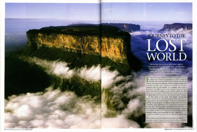
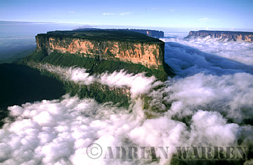
Deep within the heart of Venezuela’s dark and mysterious jungle lie islands; not islands that have coconut laden palm trees swaying in the warm summer breeze or crystaline blue water lapping backwards and forwards onto white sandy beaches, but isolated islands of sandstone forgotten by time.

To the Pemon, the indigenous people of the region known as the Gran Sabana, these flat-topped mountains or mesas are called tepuis. Most of these tepuis are remote and are almost permanently shrouded in mist and clouds, even during the dry season. Thunderstorms are frequent and torrential downpours are a way of life. Some of the tepuis have swamp-like surfaces while others have been washed by rainfall to almost sheer sandstone.

Geologists have conducted chronological-dating tests on molten rock that has thrust its way up between layers of sandstone after these ancient plateaus were formed. The dates they came up with were astounding: The sandstone is estimated to be at least 1.8 billion years old. It is because of the tepuis isolation and old age that have made them special. Each tepuis flora and fauna has been found to be unique. Many species of lichen, moss, orchids and insects are found nowhere else and have adapted themselves to their harsh environments on the mountaintops.

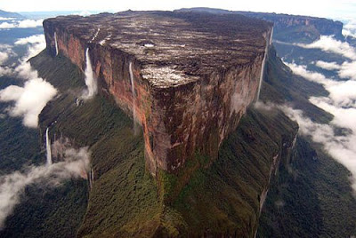
Although Mount Roraima (2,772m) is the most famous Tepui, there are several others that are of special interest. Salto Angel, or Angel Falls, the highest waterfall in the world, exits from the summit of Auyan-tepui (2,460m) a 435 square mile heart shaped table mountain in the southeastern Gran Sabana. In October 1937 an American bush pilot, Jimmie Angel, landed his plane, the El Rio Caroni, on the summit while in search of the lost river of gold. Angel had flow over the Tepui in 1933 and into Devil’s Canyon and discovered what he called “a mile high waterfall,” later to be named after him. At first, Angel’s Auyan-tepui landing appeared to be perfect, but the wheels broke through the sod and sank into the mud bringing the airplane to an abrupt halt with a broken fuel line and the airplane’s nose buried in the mud. With the plane hopelessly mired in her muddy landing spot the landing party started the long march from the mountain to the village of Kamarata in the valley below.

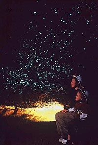
To the south of Puerto Ayacucho, a city on the outskirts of the Orinoco jungle near Colombia, is Cerro Autana. This is a sacred mountain of the Piaroa Indians who believe it is the trunk of the tree bearing the fruits and seeds of the land. This Tepui is only 1220m high but has a labyrinth of caves near the summit which at certain times of the year, the sun’s rays shine in on one side of the mountain and out the other. Nearby is Cerro Pintado or the Painted Mountain, which has the largest petroglyphs in Venezuela, including a fifty metre snake that is said to represent the Orinoco River.

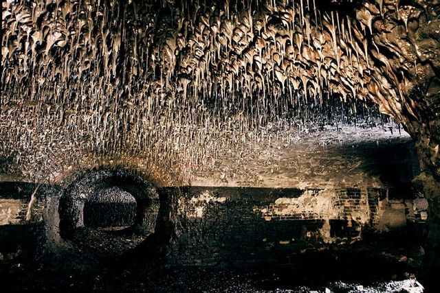
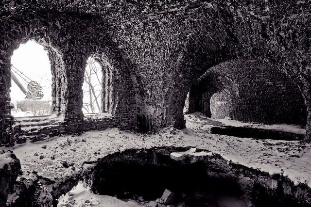
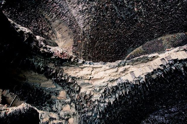
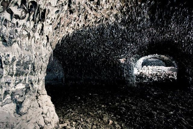
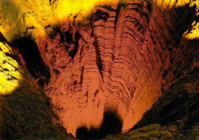
Even further to the south in the remote Amazonas region is the Sierra de la Neblina (Mountains of the Mists). This range is so remote that the highest mountain, Pico da Neblina (3014m), was not discovered until 1953 and then it was another twelve years (1965) before it received its first ascent. Another fascinating tepui is Cerro Sarisarinama with huge sink-holes on its forested summit. These perfectly circular sinkholes or “simas” vary in size with the largest being 350 metres deep by 350 metres in diameter. To the Ye’kuana Indians who live nearby the name of this tepui comes from the sound (Sari….Sari….) made by the Evil Spirit who lives atop the mountain when he eats human beings.

Mount Roraima was made famous in 1912 when Sir Arthur Conan-Doyle wrote his fictional novel entitled The Lost World. It describes the ascent of a Roraima-like mountain by an exploratory party in search of prehistoric plants and dinosaurs that were believed to live isolated and unchanged for millions of years on the mountains summit. Conan-Doyle was inspired by the British botanist Everard Im Thurn who on December 18, 1884 with Harry Perkins, was the first to reach the summit of Mount Roraima. Im Thurn and Perkins were not the first Europeans to see Mount Roraima, that goes to Robert Schomburgk, a German born explorer and scientist who explored the region for Britains’s Royal Geographical Society in 1838. When Im Thurn returned to Europe to present lectures on his expedition, Conan-Doyle attended one of his shows and was fascinated by the account, allowing his fervent imagination to wander.

Im Thurn climbed Mount Roraima from the southeast by what is now called the Im Thurn route, the only easy way to the summit. His expedition had to fight their way through hundreds of miles of wild rivers and jungles, confronting dangerous animals and savage Indians. Eventually he was within striking distance of the summit:

Up to this part of the slope our ascent had been fairly easy. We have now reached a spot where one long climb will take us to the level summit, and we shall behold that which has never been observed since the beginning of the world. Although we can’t say that the entire world has been waiting to see what our eyes will now behold, at least quite a few people have been anxious to know. We shall see that which the few white or copper-coloured people who have viewed the mountain declared would remain unknown as long as the world existed. We shall know what is Roraima.

After Im Thurn and Perkins, other British scientific expeditions arrived to collect and classify the strange flora and fauna found on the mountain: F.V. McConnell and J.J. Quelch in 1894 and 1898, three expeditions of the Boundary Commission in 1900, 1905 and 1910, Koch Grumberg in 1911, C. Clementi in 1916 and G.H. Tate of the New York Museum of Natural History in 1917. Four more expeditions visited the mountain in the next sixty years and then the noted Venezuelan naturalist/explorer Charles Brewer-Carias became interested in the tepuis. Brewer-Carias made repeated scientific journeys into the tepuis discovering and collecting many new species.

Mount Roraima has been studied by botanists, zoologists, geologists, herpetologists, orchidologists, ecologists, limnologists, entomologists, edaphologists and many more whose names don’t mean much to mountaineers but are important to science. It is their information that sparks others interests in these bizzare formations.

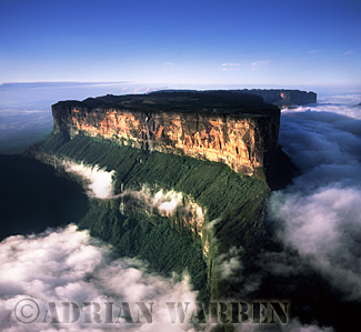
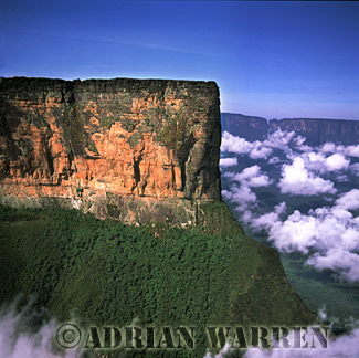
Mount Roraima is the most popular of all of the tepuis mountains located in South America. The tepuis mountains sit on the border of Guyana, Brazil, and Venezuela and are a popular destination for explorers, mountain climbers, and adventure seekers. Mount Roraima is located wholly inside the Canaima National Park in south eastern Venezuela. The mountain has attracted visitors for decades because of its beauty, remoteness, and climbability.

As with most of the tepuis mountains, Mount Roraima is not part of a chain of mountains and just rises on its own from the jungle floor. The mountain itself is made mostly of sandstone and is recognizable as a tepuis mountain because of the trademark table-top plateau at the top. This make-up allows for the diverseness of environment between what you would find at the base and what you would find on the plateau at the top. The rocky slopes keep the two areas separate and over the course of thousands of years (or more) two entirely different ecosystems have developed. In fact, to this day new species of plants and animals are occasional discovered on Mount Roraima and the other tepuis mountains. Though it is large, Mount Roraima is not the largest of the tepuis mountains, that distinction belongs to Auyantepui which is also home to the world famous Angel Falls. It is however the tallest of Venezuela’s tepuis mountains with the peak reaching a height of over 9,200 feet.

There are few roads in the vicinity of Mount Roraima and most traveling is done by small plane, hiking through the jungle, or canoe. This remoteness is also one of the reasons that the area is sought after by explorers and adventuresome people, the land is virtually unspoiled because of a lack of general tourist visitation. Most activity in the area requires the hiring of a local guide from a nearby Pemon Indian village. There is road access from the outside world to the local Indian village of Paraitepui, but the vast majority of the time this road requires four wheel drive to be successfully traveled.

Mount Roraima is one of the easier to climb of all the tepuis mountains with some gentle slopes and ramps up to the plateau. Though the trails are popular with hikers and well marked, use of a guide is still recommended because it is very easy to get lost up top when the plateau is reached. The topside of Mount Roraima has very few well marked trails, as the flatness of the terrain has led hikers over the years to hike off in many directions instead of along established trails. Another factor in making the plateau hard to navigate is the almost constant cloud cover that hangs across the top. Though it sits on the border of Guyana and Brazil, most of the climbing of Mount Roraima is done from the Venezuela side on a stair stepped trail referred to as “La Rampa”. This trail to the top is the only trail that does not require rock climbing equipment and technical experience. The standard trip is a 5 day excursion that includes one day at the beginning to get from the In dian village of Paraitepui and one day at the end to return to the Indian village. Longer trips can explore the more northern and remote areas of Mount Roraima’s plateau.

With its unique vistas and relative ease when it comes to climbing difficulty, Mount Roraima remains a popular destination for hikers and mountain climbers alike. A trip to Mount Roraima is unlike any hiking or climbing trip anywhere else in the world.

The Marble Caves of Puerto Rio Tranquilo


The Marble Caves of Puerto Rio Tranquilo are some of the most remarkable attractions of Patagonia. This magnificent nature place is located in the Region of Aisen in Chile. Las Cavernas de Marmol, as the Spanish call them were created by the clear waters of Rio Tranquilo that dug into a giant limestone peninsula, creating an impressive labyrinth of caves. The peninsula is known as the Marble Cathedral and can be reached by boat, during a guided tour. In describing the beauty of the place, while texts always do injustice, photos are worth a thousand words. Hope you enjoy the beauty that God created.

How to get to Rio Tranquilo?

Scheduled buses between Coyhaique and Cochrane drop and pick up passengers are available at Coyhaigue, near tourist information centre. Transporte Bellavista (Los Arrayanes 380, tel. 067/411904) goes to Puerto Guadal and Chile Chico (US$13, 3.5 hours) every Wednesday at 6 a.m.

Kamchatka Showplaces


The Kamchatka peninsula bristles with places of dizzying beauty, but unfortunately there is just one place – and it is the Valley of Geysers – known for those people who haven’t been to the peninsula that can be considered as one of the most beautiful lands in the whole Russia. There is one unique place that is being as good as the other nature sights of Kamchatka region and located not far from the before-mentioned Valley of Geysers, and this place is caldera of Uzon volcano. Today we will tell you about it.

Uzon caldera is the thing that was left from a huge volcano destroyed by the series of volcanic explosions that took place approximately 40,000 years ago. The height of the former volcano was about 3000 meters (10,000 feet), that’s what volcanologists say. At present, the caldera looks like a flat-bottomed punchbowl, 10 kilometers (6,5 miles) in diameter. These steep edges 200-900 meters high (650-3000 feet) are half-destroyed walls of the ancient volcano.


But what’s really tempts tourists from all over the world to come there are hydrothermal activity developments: hot pools, boiling mud pools, hot wells and mud volcanoes. Moreover, all these things are found side by side with opulent vegetation and seaweeds of extraordinary colors.


This lake has a weird name – Chloride lake. It is forbidden to swim in there.

Hot wells have such a remarkable coloring because of bacteria colonies and peculiar seaweeds that are able to live in hot water.


This is a pulsating hot spring. And again it has such a coloring because of mineral deposits and different bacteria.


These are so-called mud pools. Mud boils in there and sometimes bubbles crop up there because of gas contained.


One of the thermal fields with steam outlets. By the way, soil at the thermal fields is always snowless and well-heated so that it is covered with a thick layer of greenery year-round.


Water in some lakes is harmless for man so you can swim in there and enjoy hot water with plenty of minerals.


Due to its shape such a discharge of hot water is often called as kettle.

All the routes at the caldera are fitted out with timber flooring. One wrong step – and you are already burnt out.

Roopkund The Mysterious Skeleton Lake

Roopkund is one of the most enticing and fascinating places of the world. Situated in the isolated corners of the greatest mountains of Himalayas at a height of about 5029 meters equalizing at about 16500 feet, it is a creation that nature has brought about in quite an interesting manner. People tend to locate it in the Indian state of Uttarakhand. Roopkund has an inscrutability and vagueness that has decepted multiple generations of fortune tellers.

Roopkund is better off known as “The skeleton lake” due to the presence of an enormous grave that holds about 300 to 600 skeletons. This discovery has revolutionized the world of ancient history ever since 1942, when a park ranger came across this mass deposition of bones. It probably is an in-accessible frozen lake that requires about four day travel to reach from the nearest locality. Recently, it has become an important spot for the visitors as they learn and conjecture this advent of science.

Through carbon dating tests, it has been experimentally estimated that these skeletons belong to anytime between 12th and 15th century. It is primarily believed that the deaths were caused by some kind of natural disaster like a blizzard, landslide or any bacterial disease. However, this topic still remains controversial among the residents, anthropologists and paleontologists of modern times.

Some went ahead to mystify the deaths with fictional possibilities and creating folklores out of it. Others suggested multiple causalities of the skeletons being those of wandering Tibetan traders who had lost their way, royal pilgrims, people committing ritualistic suicides, vanquished army etc.

More recently in 2004, a team of European and Indian scientists sent by The National Geographic Channel visited Roopkund to carry on with the probe. Their research has unearthed interesting hints and information. Part of their findings includes anthropological treasures like well-preserved corpses, jewelry, bones and skulls belonging to the dead.

By conducting DNA tests on these bodies the experts have found that the dead belonged to two different teams. One team is marked by the shorter stature of the skeletons while the other is significantly taller. The first group is thought to be of local artisans while those belonging to the second group were possibly members of the same clan, like porters.

A fresh set of radio carbon dating was carried out on the bodies to reveal that the previous dating had come up with incorrect chronological data. The dead are ascribed a new 9th century date. The scientists of London and Hyderabad examined the skulls closely to find out fractures, which they deem to be the result of an abrupt hailstorm. The hails were unusually large in volume – about the size of a tennis ball each!

No wonder that anyone exposed to such a calamity in a mercilessly open Garhwal Himalayan plain were doomed to be perished. The raw air and icy hail blasts contributed to their holocaust. It is speculated that more than one landslide has struck Roopkund ever since the massacre. This has served in burying some of the bodies inside the lake – the ones that are still found intact, preserved under ice.

Even if the dating and possible causes behind such tragic death have been hinted at, the mystery continues about a different aspect of the Skeleton Lake. It still puzzles experts to think about where these people were going. Roopkund was never a historically significant region and no traces of any trade routes have been found to Tibet nor could it possibly be a site for pilgrimage to attract large groups of people.

However, the documentary ‘Skeleton Lake’ made by the National Geographic Channel has countered this assumption. The film claimed that Roopkund was the venue for the Garhwali religious festival called ‘Nanda Jaat yatra’ held in every 12 years. A procession consisting of a newborn four-horned ram considered the familiar of a Goddess starts from the nearest village and heads towards Roopkund.

Coming back to the Skeleton Lake riddle, probably the skeletons were those of the devotees participating in such a mass procession centuries ago. The folklores say that a certain king had participated in this religious ‘yatra’ with his company of female dancers. This had offended the Goddess Nanda and she vented her rage by bringing down the snowstorm at the hapless revelers.

Such accounts might sound mere fairytales, but it is quite possible that at least the taller bodies were of royalty and the short statured bodies scattered everywhere along Roopkund were of local porters – all killed by a destructive hailstorm. Whatever may be the reason of their death – no one still knows what lead so many people to take such an arduous journey so many years ago.

source