Spassky Cave Church in Russia

http://pagead2.googlesyndication.com/pagead/show_ads.js

On the banks of the Don River, in the picturesque Voronezh region of Russia lies one of the most fascinating tourist attractions this country has to offer – the Spassky Cave Church. It’s believed the first caves were dug into the cretaceous mounts of Kostomarovo before the adoption of Christianity in Russia. Hermit monks would use these austere cell-like spaces to hide from persecution, and it wasn’t until the 12th century that the first rock monastery was carved in the region. Because there is no any historical note, it is difficult to pinpoint the exact date the Spassky Cave Church appeared near the small Russian village of Kostomarovo, but it is now considered one of the most incredible monuments of ancient architecture in Russia.

The Svyato-Spassky Convent in Kostomarovo is an ancient cave monastery located about 150 kilometers south of the town of Voronezh, just 3-hours drive away. There are two churches in these caves: a big Spassky temple with columns and a small St. Seraphim Sarovsky church. The Spassky temple burrows deep into the chalky cliff to form a spacious interior that can house up to 2,000 people.
This church is unique, made by carving a rocky mountain. The style is influenced by Byzantine architecture, but the interior is much more Orthodox style.

This unique and amazing building has a sad story. In the past, the Spassky Cave Church is used as torture chambers the communists against the monks. During communist power they were expelled from church, even one from them was shot.

Those who have visited Spassky Church speak of a fantastic sense of easiness and divine bliss, and it also has a reputation for healing diseases and wounds, helping people make the right decisions and cleansing sins. In fact, there is even a Cave of Repentance inside the chalk church where condemned sinners were once confined to repent for their sins. The sense of easiness may also be influenced by the beautiful natural surroundings that the locals believe look so much like the Holy Land that they named them after it. There is a hill of Golgotha, a Mount Tabor and even a Gethsemane Garden. Local residents believe that place around Spassky Cave Church is a sacred place.

Although famous among Russia’s religious folk, Spassky Church and the cretaceous caves of Kostomorovo remain almost unknown to the rest of the world.

http://pagead2.googlesyndication.com/pagead/show_ads.js


Spooky cemetery in Peru

http://pagead2.googlesyndication.com/pagead/show_ads.js

The oldest cemetery in Peru has become a hit with tourists and locals.

The Presbitero Maestro Cemetery was built between 1805 and 1808 on the former outskirts of Lima and was the first municipal cemetery in Latin America. This impressive and beautiful historical Sanctuary houses the final resting places of many historical important personalities, but is still in use. The neoclassical complex contains the largest collection of 19th century European marble sculptures in Latin America. It’s absolutely worth seeing!

It was cold and dark, and people clutching lanterns in the moonlight gave a spooky cast to Peru’s oldest cemetery, now Lima’s oddball hit with locals and tourists. “It is scary. But we’re into it,” said a teenage girl clinging to her boyfriend as they walked through darkness and silence interrupted only by visitors’ footsteps.
Each group has a guide who entertain visitors with tales about those buried at the Presbitero Matias Maestro Museum-Cemetery, a Peruvian national historical monument.

The cemetery covers an area of 25,000 m². It has 6 magnificent main gates and over 220,000 people found their final resting place at this outstanding burial ground. Although the Presbitero Maestro Cemetery was declared a National Historic Monument in 1972 the sculptures and the impressive mausoleums are threatened by natural aging, air pollution, pressure of the growing population and unfortunately by vandalism. At least the Public Beneficence Society of Lima tries to preserve this jewel of peace with a very tight budget.

Night tours are scheduled with different themes for different crowds: one focuses on love; another on patriotic fervor; still others on presidents; and inevitably one focuses on death itself. “What really brings in the most people is the tour focused on death, in November, and another on love, in February,” says historian Jose Bocanegra, who has the historical details at the ready.

Some visitors are so apprehensive about being in a cemetery that they tiptoe around expecting something worthy of a horror movie. 

When tours started a decade ago they were limited to no more than 40 people; but they have become so popular that groups are now as large as 350 people, mainly young people and tourists, Bocanegra said.

One of the most popular tombs for local visitors is Peruvian poet Jose Santos Chocano, who asked to be buried standing, in a one square meter space. “So his coffin was placed in the niche vertically. And on his tombstone, there are lines from his poem ‘Shipwrecked Life,'” Bocanegra said. “This square meter that I have looked for on Earth will be mine, if a bit late. Dead, in the end, I shall have it. … I only expect now a square meter, where one day they’ll have to bury me, standing,” the poem reads.

It is a cemetery, and it is dark, to be sure. But there is enough light for visitors to stop and get a look at Carrara marble sculptures like the “La Dama de la Mantilla” (Lady in a mantilla) and “El bastón de Hermes” (Hermes’ staff). Bronze works such as “A mother weeping at her son’s tomb” and “A cry of pain” also are on display, steeped in the mood of the location, adorning mausoleums that are often caked in mud and apparently forgotten.

The cemetery, tucked into a corner of Lima’s Barrios Altos district, was named for its designer, the priest Matias Maestro, who also was buried there. Opened in 1808 by Viceroy Fernando Abascal during Spanish colonial rule, the facility is a sort of history of Peru in tombs and crypts. Decorated with a staggering 940 sculptures — some of them from as far away as Italy, by sculptors like Santo Varni, Pietro Costa, Ulderico Tenderini, and Rinaldo Rinaldi, or France’s Jean Louis Barrias and Antonin Marcie.

The success of the tours is a blessing for the facility, providing a source of funding to care for tombs and sculptures that have themselves often seemed on their last legs.

http://pagead2.googlesyndication.com/pagead/show_ads.js

Naica Mine, The Cave of Giant Crystals, Mexico

http://pagead2.googlesyndication.com/pagead/show_ads.js

The Naica Mine of Chihuahua, Mexico, is a working mine that is known for its extraordinary crystals.
With air temperature of 50C(122F) plus relative humidity of over 90% we get humidex value of 105C (228F) !!! This is one of the most extreme places on the planet.
Naica is a working mine and the only times you can get in is on Sundays and even then only if you know someone working at, or conected to the mines. The days of just suiting up and going in or long gone.

Naica is a lead, zinc and silver mine in which large voids have been found, containing crystals of selenite (gypsum) as large as 4 feet in diameter and 50 feet long. The chamber holding these crystals is known as the Crystal Cave of Giants, and is approximately 1000 feet down in the limestone host rock of the mine.

The crystals were formed by hydrothermal fluids emanating from the magma chambers below. The cavern was discovered while the miners were drilling through the Naica fault, which they were worried would flood the mine. The Cave of Swords is another chamber in the Naica Mine, containing similar large crystals.

The Naica mine was first discovered by early prospectors in 1794 south of Chihuahua City. They struck a vein of silver at the base of a range of hills called Naica by the Tarahumara Indians. From that discovery, until around 1900, the primary interest was silver and gold. Around 1900 large-scale mining began as zinc and lead became more valuable.

The huge mines at Naica have been excavated for years, but in 1975 a massive area was drained so mining operations could take place. When the water disappeared the crystals stopped growing, however, it was more than 25 years before two miners stumbled across the vast Crystal Caves and the incredible collection of gypsum was discovered. The formation of the beams 290 metres below the surface, occurred when super-heated water began cooling and became saturated with gypsum. Over time, crystals formed in the water. One of the major problems still facing scientists wishing to study below the ground at Naica is the heat. A hot spring located close to the Crystal Caves means the temperature is too hot for people to remain in the crystal chamber for longer than ten minutes at a time.

Just before the mine was closed, the famous Cave of Swords was discovered at a depth of 400 feet. Due to the incredible crystals, it was decided to try to preserve this cave. While many of the crystals have been collected, this is still a fascinating cave to visit. In one part there are so many crystals on one of the walls, they appear to be like an underwater reef moving in a gentle undulating motion in an ocean current.

In April 2000, brothers Juan and Pedro Sanchez were drilling a new tunnel when they made a truly spectacular discovery. While Naica miners are accustomed to finding crystals, Juan and Pedro were absolutely amazed by the cavern that they found. The brothers immediately informed the engineer in charge, Roberto Gonzalez. Ing. Gonzalez realized that they had discovered a natural treasure and quickly rerouted the tunnel. During this phase some damage was done as several miners tried to remove pieces of the mega-crystals, so the mining company soon installed an iron door to protect the find. Later, one of the workers, with the intention of stealing crystals, managed to get in through a narrow hole. He tried to take some plastic bags filled with fresh air inside, but the strategy didn’t work. He lost consciousness and later was found thoroughly baked.

Momentarily, the penetrating heat is forgotten as the crystals pop into view on the other side of the “Eye of the Queen”. The entire panorama is now lighted and the cavern has a depth and impressive cathedral-like appearance that was not visible on earlier trips with just our headlamps.
When inside the great cathedral of crystals, the pressure of intense heat create a gamut of emotions and perhaps hallucinations. One can only remain for a short period of time.

Ten years after the amazing discovery, scientists are petitioning the Mexican government to claim for Unesco World Heritage status to protect the unique formations for future generations.

It takes 20 minutes to get to the cave entrance by van through a winding mine shaft. A screen drops from the van’s ceiling and Michael Jackson videos play, a feature designed to entertain visitors as they descend into darkness and heat. In many caves and mines the temperature remains constant and cool, but the Naica mine gets hotter with depth because it lies above an intrusion of magma about a mile below the surface.
It is still incredibly hot in the cave due its proximity to a magma chamber, deep underground. The air temperature is 50C with a relative humidity of over 90%, making the air feel like an unbearable 105C (228F) Entering the cave without special protective suits can be fatal in 15 minutes. I will be entering the cave wearing a special cooling suit with chilling packs inside and a specialized backpack respirator which will allow me to breath chilled air. Even with all this equipment, I will still only be able to stay in the cave for no more than 45 minutes at a time.
In extreme heat, the body begins to lose higher brain functions which made the expedition much more difficult with the risk of falling into deep pits, or being impaled on a sharp crystal. All the camera gear needs to be slowly brought up to temperature beforehand by pre-heating it and most cameras with moving parts and tape mechanisms simply will not work at all.
It is as dangerous as it is beautiful.

Geologists report that these natural crystal formations are incredibly complex, yet so simple. They have a magical or metaphysical personality independent of their chemical structures. There is a magma chamber two to three miles below the mountain and that heat from this compressed lava travels through the faults up into the area of the mine. Super heated fluids carry the minerals the miners are seeking as well as form the crystals. The mine is ventilated; otherwise, it could not be worked. Some parts, however, are not air-conditioned, such as the Cave of the Crystals, and there you feel the heat from the magma deep below. The fluids travel along the Naica fault, enter voids in the bedrock, and then form entirely natural structures that are not easily explained scientifically.

In April 2000, the mining company became confident that the water table on the other side of the fault had been lowered sufficiently to drill. When they did this, it is almost as if a magical veil of reality was breached and an entirely new world was discovered. Two caverns filled with the Earth’s largest crystals were immediately revealed. More discoveries are expected to be made in this magical kingdom of intense natural beauty.

Selenite, the gypsum crystal, named after the Greek goddess of the moon, Selene, due to its soft white light, is said to have many metaphysical and healing benefits. Selenite powder has been used cosmetically for thousands of years to enhance one’s natural beauty. It is believed that this crystal assists with mental focus, growth, luck, immunity, and soothes the emotions.

http://pagead2.googlesyndication.com/pagead/show_ads.js

Check In, Swim Out: The Boggsville Boatel

http://pagead2.googlesyndication.com/pagead/show_ads.js

Artist and boat-builder Constance Hockaday has constructed a series of floating hotel rooms and a theater at Marina 59 at Far Rockaway in New York City. Boggsville is a floating hotel and theater built in the Neutrino tradition, that is, fashioned out of abandoned and re-claimed boats from the marina. Five of the vessels are leisure fishing crafts from the 70’s and early 80’s, ranging from 28 to 35 feet long. Another is a 70’s drifter houseboat remodeled into a rustic penthouse. The boats are all moored around a floating platform in the middle of a small bay.

Named for Ms. Nancy Boggs, who would move her floating brothel to either side of the Willamette River of Portland to evade the law – depending on where the authorities were bringing trouble to her business – the Boatel explores the boundaries of the hospitality experience.

The Neutrino drifted into Port Isabel, Texas where a 19 year-old college dropout named Constance Hockaday was living with her parents. Hockaday, a rather alienated young woman, immediately became enthralled with the idea of living on a boat and not paying rent. Before long, she was on the boat, so to speak. Her life hasn’t been the same since.

“It’s kind of a post-apocalyptic adventure,” said Katie McKay, 34, a designer from Brooklyn who was staying aboard the houseboat with four friends. “It doesn’t feel like you’re in New York at all.” 

The Boatel is the work of an artist, Constance Hockaday, who said she hopes to attract the romantic and the adventurous — and amid them, the marina’s neighbors — to this unlikely getaway. Under the auspices of Flux Factory, a Queens gallery, it will be open for reservations Thursday through Saturday all summer long, an experiment in urban vacationing and D.I.Y. ingenuity.

“When you think about it, the water is the last remaining open public space,” said Jean Barberis, the artistic director of Flux Factory. “As artists and creative people venture more and more into the outer boroughs, there’s less and less unclaimed territory on land. But the water is still completely open.”

Boggsville Boatel is a floating hotel and theater fashioned out of abandoned and re-claimed boats, all of which sleep 2-5 people. Five of the vessels are leisure fishing crafts from the 60’s, 70’s and early 80’s, ranging from 28 to 40 feet long. Another is a 70’s drifter houseboat remodeled into a rustic penthouse. Rooms include dinner and access to the Swimming Cities GOING AWAY PARTY on Sept 10, from 8pm-late. Kick it on your poop deck four blocks from the beach with cold beer, all of your friends and swim trunks—plus Cocktail Cruises in Jamaica Bay, Jerk Burgers & Pineapple Hot Dogs by Carnival Queen Lamar Iposa and Sea Shanty Karaoke.

July 7 – September 4
Marina 59, 5914 Beach Channel Drive, Far Rockaway
-THE BOATS-

Americano is a Guido vessel with a long sloping bow. This boat is very private. The windows are tinted and the inside is very Slick Rick. $50 a night.

CRUMB is a quaint and comfortable boat and was probably previously owned by an elderly couple. There is a private sleeping area; it’s spacious and perfect for rolling around in. She sleeps 4 people. This boat also has a shaded top deck with reclining furniture. $50 a night.

New York, NY is Euro. This boat has been remodeled to be more open than she was originally designed to be. She sleeps 3-4 people, and she has a breakfast nook, a great space for preparing lunches, and a desk for the writer-ly types. $50 a night.

Queen Zenobia is a classy little 30-foot yacht. She can sleep 3-4 people, if they are willing to snuggle up. On this boat there is a comfortable little breakfast nook and plenty of deck space for lounging around. $50 a night.

Ms. Nancy Boggs is a rustic floating cabin. This 1967 Drift-R houseboat has been remodeled into down-home love nest. This boat can sleep up to 5 people. There are two beds, one of which can fit 3.5 people. It is the perfect place to roll around with more than one or two. It has a spacious breakfast nook and several decks for sun bathing, fishing, or picnicking. $100 a night.

http://pagead2.googlesyndication.com/pagead/show_ads.js

Ningwu Ice Cave, China

This is a sight that will really send a shiver down your spine. Not because it’s scary – but because of its sheer beauty. The caves are so cold it sends a shiver down the spine of people standing outside.
The caves are, like many interesting corners of China, not yet on any tourist trail, but are spectacular to visit. Situated in the middle of the Yellow River valley, in the heart of one of China’s most scenic regions, these incredible ice caves are more than three million years old. Identified by the Chinese Academy of Sciences Institute of Geology, cave expert on-site inspection: this hole is formed in the Cenozoic Quaternary Ice Age, hence the name of years the ice cave.
The experts said that only the first of nine ice cave in the ice cave ranked the country more than 10,000 caves. Divided into upper and lower five-story drill ice cave, under the ice stairs, over ice stack, available layers sightseeing. Each floor can accommodate dozens of people. Over 20 meters in diameter, the hole at its widest point, the narrowest of over 10 meters. Formed by the ice, icicles, ice curtain, frozen waterfalls, ice, ice Buddha, ice sheets, ice bell, Iceman, ice Buddha, etc., strange, to name a few. Carved inside the cave, large and small views or exquisite, dazzling crystal, or graceful, magnificent, all amazing.
Photos shows an ancient ice cave in Ningwu County of Xinzhou City, north China’s Shanxi Province, 50 km west of the Wa township Ma Tei Village Office next to the travel lanes, 2300 meters above sea level. The cave, lit up by coloured lights, is more than 100 meters long. Inside it is covered with thick ice that freezes in the winter and remains all year.
Huge icicles are formed which hang from the ceiling, in sharp contrast with the green summer foliage outside.
They’re so chilly that even standing outside you can feel the cold – even on a hot summer’s day.

http://pagead2.googlesyndication.com/pagead/show_ads.js

Animals Inside Out Exhibition

The exhibit is currently touring large zoological gardens, museums of natural history, and popular science centers around the world.

Naked animals may not cause even a blush, but a look under the covers of our four-legged friends (and finned ones) is a revelation. London’s Natural History Museum presents a new exhibition of preserved animals from the team behind the plastinated Body Worlds shows. With more than 100 exhibits – including a giant 56-year-old elephant, a giraffe balanced on one hoof, a blood-red shark and a hairless gorilla – it is the most recent creation of the 21st-century Frankenstein, Gunther von Hagens.
While zoos present animals in environments that resemble their natural habitat, Animals Inside Out give onlookers a peek inside, “into a 3rd dimension of experience.”
He treats the animals with a process called plastination which removes all the blood from the muscles, veins and arteries and replaces them with a latex material. He suffered through a lot of controversy in the past when some people had suggested that Chinese prison inmates had been the source of his bodies.

With a body so heavy that it would collapse under its own weight, Von Hagens came up with the idea of creating an internal scaffolding for the creature – a series of blood red steel pipes designed to precisely represent its vascular system. This is a new method that preserves only the blood vessels, while removing all other tissue. You’ll be startled at the number and density of blood vessels in an ostrich or a shark.

After embalming stops the bodies’ decay, body tissues that won’t be on display are removed, and the specimen is placed in an acetone bath to remove water and fat. Then, the animal is immersed in a liquid plastic and placed in a vacuum chamber, which forces out the acetone and causes the plastic to replace it. The specimen is then put into position and then hardened with gas, heat or light.

The lack of human specimens does make it feel slightly less macabre than previous von Hagens shows, but we still wouldn’t recommend this display to the squeamish. It’s unsettling to see, under their skins, that these animals are remarkably similar to us, with the same organs and muscle groups in slightly different arrangements.
“We really want visitors to learn more about the anatomy and physiology of the animals that are on display. It’s a really unique chance for visitors to sort of see under the skin of animals and see them in a way that they’ve never seen them before,” said Georgina Bishop, curator at the Natural History Museum.

Animal Inside Out
6 April – 16 September 2012
10.00 – 17.50
Waterhouse Gallery
Ticket prices:
Adult £9
Child and concessions £6
Family £27
School groups £3 per pupil
Free to Members, Patrons and children aged 3 and under.

Mysterious Toyama Bay

For the past 10,000 years, the sea forest has stood just as it is today. This mysterious world is a large bay on the east side of the Noto Peninsula, which projects into the Sea of Japan in west-central Japan. 3,000-meter-high mountains suddenly drop to 1,000 meters below the surface of the ocean creating wondrous natural phenomena and extreme habitat for exotic sea creatures. Known for its wide variety of fish, Toyama Bay has been dubbed “a natural fish tank,” because throughout the year many kinds of fish (meaning “very fresh” in Toyama’s local dialect) are caught and then unloaded from ships at bustling fishing ports along the coast of the bay, such as Uozu, Shinminato, and Himi. Nutrient-rich springs overflow from deep beneath the sea-bed, causing several hundred species of sea life to inhabit the area.

The coastal shelf in Toyama Bay is small, and the sea floor drops sharply a short distance from the land, with the deepest parts of the bay being more than 1,200 meters deep. Into the surface seawater of the bay, warm-water fish species are carried by the warm Tsushima current, while in the deep seawater at a depth of over 300 meters coldwater fish species live in the much cooler waters of the Japan Sea (deep seawater) at a temperature of around two degrees Celsius. Thus, Toyama Bay has an environment where both warm- and cold-water marine life can exist, and thus it is a treasure trove of marine resources.
Seventy percent of the total fish catch is comprised of migratory warm-water fish such as tuna and yellowtail, while the rest includes many kinds of deep-water fish and shellfish such as sweet shrimp, benizuwai crab, Japanese ivory shell, firefly squid, and white shrimp. Rare firefly squid and white shrimp are particularly valuable marine resources that are rarely found in areas other than Toyama Bay. Every spring, a large number of the tiny squids come to the coast from waters more than 200 meters deep for spawning. The mysterious pale blue light emitted by the squids in the night sea when they are caught is a common spring sight in Toyama Bay.
Watasenia scintillans, or the Firefly Squid, is only 3 inches long, but packs a stunning feature in that small package. At the end of their tentacles are special organs called photophores that light up like glow sticks at a rave. In the Toyama Bay, in the central Japan Sea, the squid are found in fantastic abundance. Normally living at 1200 feet underwater, a v shaped canyon in Toyama bay pushes the current, and the squid, to the surface in massive numbers where, forced up, the millions of squids turn the bay into a writhing, gleaming blue froth.
Fished by the ton from March to June, when the fishing boats dump the nets onto the boat floor the squirming squids light up and turn the boats themselves into blue beacons. Thankfully, for the curious visitors, one need not sign up to work on a Japanese fishing-boat tour to see the phenomenon.
The habitat of the world-famous glowing firefly squid limits itself to the Western Pacific ocean. The firefly squid is a middle-deep sea squid that can live on depths of 600 to 1200 (365m) feet. The body of these little squids are covered with photophores that give a blue light. The main goal of these photophores is to lure little fishes, so that it can catch them easier. Just as the vampire squid, the firefly squid has its photophores totally under control. He can make different light show patterns with these photophores to communicate with others, to distract a predator or even lure their pray.
The reproduction of the firefly squid, once a year (March to June) millions of squids come together to fertilize and to drop their eggs in the Toyama Bay in Japan. The big reunion of these squids is one big light show that you can admire and it attracts thousands of tourists. Once the firefly squids have done their job, they die. The firefly squid has a one year life-cycle and once that year is over they die and wash up on the shore. This event is very important for other sea creatures and sea birds who enjoy eating the dead bodies of the firefly squid.
Firefly squids are just as many other sea creature a delicacy in Japan and they’re mainly caught when the firefly squids come together to mate.
Sightseeing
Early in the morning, after 3 AM, sightseeing boats depart the Namerikawa fishing port (Namerikawa is also home to the world’s only museum dedicated to the firefly squid) in Toyama prefecture, making a short journey to fixed nets located about 1 to 2 km offshore. As the fishermen haul in their nets, the light emitted by the firefly squid causes the sea surface to glow a cobalt blue, evoking squeals of delight from the tourists.
Toyama Bay’s firefly squid fishing season opened on March 1 and is expected to continue until the end of June. Sightseeing boats are scheduled to run until May 7.


http://pagead2.googlesyndication.com/pagead/show_ads.js

The Diavik Diamond Mine, Canada


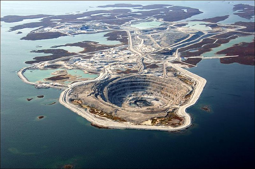
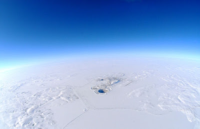
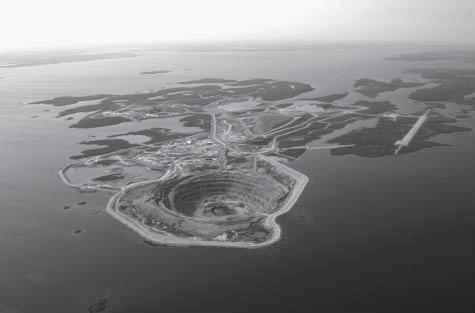
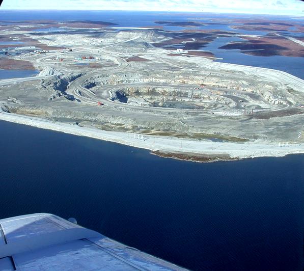
Many of the Canadian Diamonds which we offer are manufactured using diamond rough which was sourced from the Diavik Diamond Mine which is located on a 20 kilometer square island, informally called East Island, which is in Lac de Gras located within the Northwest Territory of Canada approximately 300 kilometers as the crow flies Northeast of Yellowknife which is the Capital of Canada’s Northwest Territories. The Artic Circle is located about 220 kilometers North of the mine. The key to operating a mine in Canada’s remote wilderness is a private ice road which is shared by various mining companies that are operating in the area. The road has been in operation for about twenty years and must be rebuilt annually to maintain service. Approximately 75% of the road is ice and is built over frozen lakes.

Geology: The Diavik Diamond Mine was discovered in Precambrian rocks of the Slave Geological Province. Known to host deposits of gold, copper, zinc, nickel, and now diamonds, this ancient rock is among the world’s oldest and was formed about 2.7 to 2.5 billion years ago. The Slave Geological Province has produced much of the North’s mineral wealth.

Granitic rocks predominantly underlie the area, and have been intruded into slightly older meta-sedimentary rocks, originally deposited as sandstone and shale. The geology of the project area is typical of ancient, 2.5-2.7 billion-year-old Precambrian rocks, with a mixture of metamorphosed sedimentary (metaturbidites) and granitic (e.g. granite, tonalite) rocks. The kimberlite pipes at the Diavik Diamond Mine are volcanic cores injected into the much older, granitic and meta-sedimentary rocks a mere 55 million years ago. Relatively fresh, often charred – but not petrified – wood found only in China today, has been encountered in drill core at depths up to 400 metres. Reflecting a much warmer climate at that time, the coniferous trees were uprooted and incorporated into the pipes.

What are Kimberlite Pipes?

Kimberlite is a rare rock type commonly found in carrot-shaped pipes which represent the roots of ancient, small volcanoes. A drawing of a carrot shaped kimberlite pipe appears above. Originating from over 150 km below the earth’s surface where diamonds are commonly formed, the kimberlite may bring diamonds to surface. Globally, kimberlite pipes average 12 hectares in surface area, and may reach depths of several hundred metres. The kimber pipes used by the Diavik Diamond Mine range in surface area from 0.9 to 1.6 hectares, and extend below 400 metres.

The Exploration for Diamonds

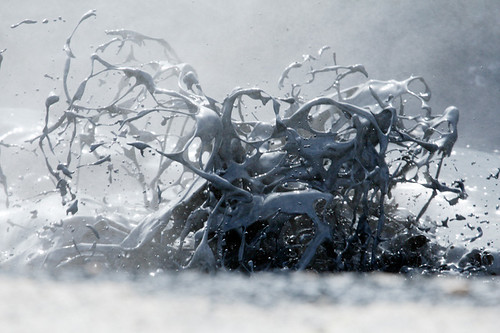
Finding diamond deposits is difficult and costly. Rather than look for the elusive and rare diamonds, geologists seek other clues. Working from tent camps, geologists conduct several types of surveys. Using geochemical surveys, soil samples are taken and panned for indicator minerals like garnets found in more abundance in kimberlite pipes. A trail of indicator minerals can lead to potential pipes. In addition, geophysical surveys are used to differentiate hidden kimberlite pipes from surrounding host rock. Computer-generated geophysical data is mapped as pictured above. If a potential kimberlite target is identified, portable diamond drills are used to remove core samples to determine if the target is in fact kimberlite. Further drilling helps define pipe size and shape, and provides additional rock for diamond testing. Not all kimberlite pipes have diamonds. In fact, of the worlds estimated 5,000 kimberlites only 23 contain enough diamonds to warrant the expense of operating a mining operation. When diamonds are found in sufficient quantities to suggest an ore body, a small mining operation is conducted to remove a larger, several thousand tonne bulk sample. This sample is processed to remove the diamonds, which are then evaluated for quantity, quality, and size.
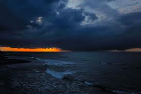
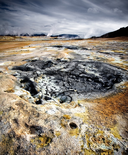
Lac de Gras

Aboriginal people named the Lake Ekati for quartz veins found in local bedrock outcrops resembling caribou fat. Lac de Gras is 60 kilometers long and averages 16 kilometers wide with a shoreline length of 740 kilometers. The lake averages 12 meters in depth and has a maximum depth of 56 meters. The water temperature ranges from 0°C to 18°C in the summer. Aquatic productivity is low due to low nutrients, low light during the winter, eight months of ice and low water temperatures. The water quality resembles distilled water. The lake is habitated by lake trout, cisco, whitefish, artic grayling, burbot, longnose sucker and slimy sculpin. The lake has a drainage area of about 4,000 square kilometers and together with Lac du Sauvage located to the Northeast form the headwaters of the Coppermine River which flows 520 kilometers from Western Lac de Gras to the Artic Ocean.

The Region

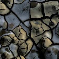
Rolling tundra surrounds the Diavik Diamond Mine. The region was originally named the “Barren Lands” by early explorers due to its lack of trees. The area includes numerous lakes, bedrock outcrops and glacial deposits of boulders, till, and eskers. What little soil is found is of cryosolic order – formed where permafrost occurs within 1-2 metres of the surface – and is characterized by layers that are disrupted, mixed, or broken, by freeze-thaw activity.

Vegetation

Vegetation includes dwarf birch, northern Labrador tea, blueberry, mountain cranberry, and bearberry, with willow, sphagnum moss, and sedge tussocks dominating wet lowlands.

Wildlife

Mammal species that inhabit the region include, grizzly bears, wolves, foxes, arctic hare, ground squirrels, and wolverines. In spring and fall, portions of the Bathurst caribou herd migrate through the region. 84 bird species and 16 mammal species are summer visitors or permanent residents.

Chronological History of the Diavik Mine

*1991- 1992 Aber stakes mineral claims
*March 1992 Exploration begins
*June 1992 Aber Resources, Kennecott Canada Exploration form Diavik joint venture
*1994-1995 Pipes A-21, A154-South, A154-North and A418 discovered
*February 1996 75-person exploration camp erected for underground bulk sampling
*July 1996 5,900 tonne bulk sampling of A418 and A154 South pipes completed
*December 1996 Diavik Diamond Mines Inc. created with head office in Yellowknife
*March 1997 Bulk sample transported over winter road to Yellowknife for processing. Approximately 21,000 carats of diamonds recovered
*June 1997 Environmental baseline studies completed
*September 1997 Pre-feasibility study completed
*March 1998 Project description submitted to Federal Government triggering formal environmental assessment review under the Canadian Environmental Assessment Act
*September 1998 Environmental Assessment Report submitted and Comprehensive Public Involvement Plan initiated
*November 1999 Federal Government approves project for permitting and licensing
*September 2000 Diavik Diamond Mines Inc. receives all necessary permits and licenses to bring mine into production
*December 2000 Investors of Rio Tinto plc and Aber Diamond Corporation approve $1.3 billion expenditure to build mine
*January 2001 Mine construction begins October 2001 A154 dike earthworks completed
*July 2002 A154 dike completed, dewatering commences
*December 2002 Mine virtually complete
*January 2003 Diamond production begins
*May 2003 First million carats
*May 2003 1.9 million accident-free hours
*April 2003 Aber’s first sale of rough diamonds
*July 2003 Rio Tinto Diamonds’ first sale of rough diamonds

Perseid meteor shower: Best places and times to see the spectacle


The Perseid meteor shower that will peak Thursday night and Friday morning is expected to be unusually bright and visible in the night sky this year because moonlight won’t be hampering the celestial show. The best time to watch will be from midnight to dawn, and the best place to watch will be any dark-sky spot you can find.

Some places to check out:

Lake Tahoe: For the fourth year, the Squaw Valley USA resort will open its High Camp area for a Perseid Meteor Shower Mountaintop Campout to watch meteors streaking through the sky. Campers will arrive between 5 and 6:30 p.m. Thursday and take the cable car up to stake a spot at the 8,200-foot perch that overlooks Lake Tahoe.
The night’s activities will include a sunset hike around nearby peaks, a briefing on telescopes and a campfire. Meteor watching will begin at 10 p.m. and continue throughout the night. Campers can also grab a continental breakfast before taking the cable car back down between 8 a.m. and 9:20 a.m. Friday.
Southern California: If you don’t have time to drive up to Lake Tahoe, consider going to Joshua Tree National Park east of Palm Springs or Mt. Pinos on the border of Ventura and Kern counties. For other optimal viewing spots, go to “See the Perseid Meteor Shower in Southern California.”

Red Rock Canyon State Park: Yes, it’s another desert location, but like Joshua Tree the nighttime views are well worth the daytime heat. The park, at the southernmost tip of where the Sierra Nevada mountain range converges with the El Paso Range, has only one campground, Ricardo Campground, which is tucked up against the base of White House Cliffs. The sandstone cliffs make the night sky spectacle that much more dramatic.

Mount Pinos: This 8,831-foot peak on the border of Ventura and Kern counties is far enough from any major light sources to offer a great dark-sky view of the meteor shower. But you don’t have to make the steep hike to the summit. Most amateur astronomers go to the tree-bordered parking lot about two miles east of the peak.

Kennedy Meadows: This campground sits at 6,100 feet above sea level along the South Fork of the Kern River in the Southern Sierra Nevada. It’s a favorite among trout-hunting anglers but star gazers also rank it as one of the best places in the country for getting an undiluted view of the night skies. Although getting to his campground is quite a trek, visitors will be rewarded with a spectacular view. Directions: From U.S. 395, just north of the Inyo County line, take Ninemile Canyon Road west for about 25 miles and follow the signs to Kennedy Meadows. The campground has 38 sites, bathrooms and running water. Overnight fees: $5. A small general store operates on the road just outside the campground.

Anza Borrego Desert State Park: California’s largest state park on the eastern end of San Diego County is another great dark-sky desert park far from the glare of city lights. Local astronomy buffs congregate at the campgrounds in Culp Valley, about 10 miles southwest of the park’s visitor center along County Road 22.

What to expect:

How spectacular will the show be? When you look and where you stand will determine what you see. And if there’s a cloud cover, all bets are off, so hope for clear skies.
Check out the Fluxtimator, a Java application on NASA’s website that claims to allow you to calculate the expected shower rate for a given date and a location. Using that application, I found that the the most meteors per hour are expected to occur at 5:08 a.m. Friday. If you’re in downtown Los Angeles, it indicated that you can expect to see fewer than seven meteors per hour. if you’re on a mountaintop somewhere near L.A., you could see as many as 96 per hour.
If you want to hear what meteor showers sound like, Spaceweather Radio broadcasts the radar echoes of meteors passing — ping! — in the skies above Texas.
Online chat: Got questions? NASA astronomer Bill Cooke at the Marshall Space Flight Center in Huntsville, Ala., will conduct an hourlong online chat starting at noon Thursday. Sign up for the chat here.

http://pagead2.googlesyndication.com/pagead/show_ads.js

Namaskar pass, Iceland – "the gateway to hell"


Iceland is a beautiful place that is surrounded with a number of geographical wonders that are believed to be immensely distributed in the wide diversity. The indigenous land is also surrounded by a number of wide and open horizons that has all the power to just attract any visitor towards itself with a sense of gravity and independent freedom.

When visiting Iceland you just may feel an ever living quest so that you can always explore the beautiful topographical diversity the very moment you step on the soils of Iceland. The famous Namaskar pass which is located near the North of beautiful Lake Myvatn is also considered as one of the wonders of the world, and is one such place that you must surely visit when in Iceland.

Situated at a height of 410 m in the famous Mount. Namafjall, this pass has managed to derive its name based on the 19th century due to sulfur recovery from this mountain. One of the best ways to reach to the famous pass certainly is to try and take route No. 1 of the Ring road that is located between the Mynav and the Egilssta. There is also another route which is called as the Serpentine routes which you can take from the Reykjahli, that is situated at least 5 Kms away. Lake Myvatn is one place that is also looked up as most famous resort area of Iceland and can be reached just within 45 minutes from the nearest town. So, once you have managed to reach Hinauffahrt, you may immediately get a nice view of the Muckensee and the Jar-ba-sholar, which is also a famous volcanic crater and covers the Jar-bo-in lagoon right behind it.

A stretch of hot water springs called as Hverarond is certainly located just at the foot of this famous mountain and these are better known for the wide variety that they keep on changing. There are also a number of mud holes, mud pots or fumaroles that can always be seen boiling with extra amount of energy.

The famous Namaskar pass is just situated at a little distance to Krafla volcano and there are also a number of other geological spots that are located nearby to it including desert Myvatsorafi and Burfellshraun. Whenever visiting Namaskar pass you have to keep in mind to visit Heibquellengebiet, Pseudo craters of Skutusta, Dimmuborgir’s lava formations and also the historic waterfalls of Go-afoss which is just located nearby to the road.
At the foothills of this spectacular volcanic mountain is an expanse of hot springs called Hverarönd or Hverir that are known for their changing variety. You may also find a number of fumaroles, mud pools and mud pots that all seem to be boiling with relentless energy. The pass Námaskarð is strategically located at a short distance from the Krafla volcano system as well as other interesting geological spots like Búrfellshraun and the desert Mývatsöræfi. While visiting Námaskarð, you must not miss the Heißquellengebiet, lava formations of Dimmuborgir, pseudo craters of Skútustaðir and the historic waterfall Goðafoss by the road.
However, Námaskarð earns its notoriety chiefly because of its sulphurous mud springs called solfataras and steam springs called fumaroles. Though you will scarcely find any pure water spring in this wonderful geothermal site of Iceland, the beauty of the colorful minerals defies all comparisons. The gigantic size of the mud craters is what makes you go ‘wow’ at the sight of them. You get parking, accommodation and dining facilities at Grýtubakki.
The other thing that is sure to strike you about Námaskarð is the sheer lack of vegetation. However, if you give a thought to the high temperature range, it does not appear an impossibility altogether. The constant emission of the fumes has made the ground utterly sterile and acidic, unfit to sustain any floras and faunas. You must bear in mind that the fumes can be harmful for humans as well.
Hence, better not forget to cover your nose or wear a mask while enjoying the hues of mineral deposits. You also must be careful about where you walk. Do not try to get over adventurous and cross the ropes that surround the pools. The ground beyond might crumble any moment and accidents do occur every now and then due to the erosive nature of the mud springs. There are no guards or guides to keep you off from the impending danger and so you must look after yourself.
It needs a visit to Námaskarð and Lake Mývatn to dispel the myth of icy coldness that people tend to associate with Iceland. In fact, Mývatn ranks fourth among the largest lakes of Iceland and remains the favorite haunt of various species of birds. The efflorescence of the sulphuric gases and hydrogen sulphide lets loose a riot of colors to flood the neighboring rhyolite rocks of this region. The view of the magnificent Lake Mývatn coupled with the turbulent bubbling and overhanging fog gives you a feeling that you have arrived at some extraterrestrial land or is it…the gateway to hell!