Spassky Cave Church in Russia

http://pagead2.googlesyndication.com/pagead/show_ads.js

On the banks of the Don River, in the picturesque Voronezh region of Russia lies one of the most fascinating tourist attractions this country has to offer – the Spassky Cave Church. It’s believed the first caves were dug into the cretaceous mounts of Kostomarovo before the adoption of Christianity in Russia. Hermit monks would use these austere cell-like spaces to hide from persecution, and it wasn’t until the 12th century that the first rock monastery was carved in the region. Because there is no any historical note, it is difficult to pinpoint the exact date the Spassky Cave Church appeared near the small Russian village of Kostomarovo, but it is now considered one of the most incredible monuments of ancient architecture in Russia.

The Svyato-Spassky Convent in Kostomarovo is an ancient cave monastery located about 150 kilometers south of the town of Voronezh, just 3-hours drive away. There are two churches in these caves: a big Spassky temple with columns and a small St. Seraphim Sarovsky church. The Spassky temple burrows deep into the chalky cliff to form a spacious interior that can house up to 2,000 people.
This church is unique, made by carving a rocky mountain. The style is influenced by Byzantine architecture, but the interior is much more Orthodox style.

This unique and amazing building has a sad story. In the past, the Spassky Cave Church is used as torture chambers the communists against the monks. During communist power they were expelled from church, even one from them was shot.

Those who have visited Spassky Church speak of a fantastic sense of easiness and divine bliss, and it also has a reputation for healing diseases and wounds, helping people make the right decisions and cleansing sins. In fact, there is even a Cave of Repentance inside the chalk church where condemned sinners were once confined to repent for their sins. The sense of easiness may also be influenced by the beautiful natural surroundings that the locals believe look so much like the Holy Land that they named them after it. There is a hill of Golgotha, a Mount Tabor and even a Gethsemane Garden. Local residents believe that place around Spassky Cave Church is a sacred place.

Although famous among Russia’s religious folk, Spassky Church and the cretaceous caves of Kostomorovo remain almost unknown to the rest of the world.

http://pagead2.googlesyndication.com/pagead/show_ads.js


Top 8 Private-Island Homes

http://pagead2.googlesyndication.com/pagead/show_ads.js

1.E Sister Rock Island, Marathon Florida
For sale: US $12,000,000
Many homes in the Florida Keys boast private beachfront and spectacular water views. Few, however, can lay claim to having a 360-degree beachfront, but this special private island home does.
Located a quarter-mile off the Atlantic shore of Marathon, FL, this small and private oasis on East Sister Rock Island is surrounded by white sand and coral reef.
The islands have a home, it’s a little house. This house is 5,000 square feet.
The Marathon home for sale is completely off-the-grid, relying on solar panels on the roof and side of the house for power, and cisterns collect rainwater.
Built in 1980 as a family getaway spot, the home holds all the vacation essentials: a wrap-around porch measuring 2,700 square feet, private dock and 21-foot-long boat, which is included in the sale. The island also has a helipad for ease of transportation to the Marathon and Miami airports.
The Bahamas-style residence was updated in 2001 and features enormous windows and 19 sliding glass doors that open out to veranda. In addition to the three bedrooms and two bathrooms in the main home, there is a smaller, detached 1-bedroom, 1-bathroom guest house. 

2. Architectural Island Gem, Lake Mahopac, New York

You don’t have to be a Frank Lloyd Wright fan to recognize his signature style in this private island home. Its 28-foot cantilever is nearly twice the length of the one at Fallingwater in Mill Run, Pennsylvania. Celebrating the island’s natural surroundings, the home, which is in Lake Mahopac, New York, features an enormous boulder in its entry hall and rocky surfaces discovered along the shores.


3. Pine Cay Private Island Community, Providenciales, Turks And Caicos Islands

Situated on Pine Cay, an 800-acre private island, this 10,000 square foot home is nestled in a lush landscape framed by an intimate pond. The villa-style residence is one of only a few exclusive residences on the tiny Caribbean island. Each of the home’s four bedrooms is housed in a separate pavilion. Located at Amanyara Villas, it has its own private black-volcanic-rock, infinity-edged pool.

4. Wallis Island, Australia
 With exceptional views over Wallis Lake and the surrounding area, and just 50 metres from its own jetty, 
the chateau offers fantastic opportunities for water skiing, windsurfing and swimming.
For sale: AUD $20,000,000
Built in an area of outstanding natural beauty, Le Marais faces a 1.5km beach and is in a region that is considered to have one of the best climates in the world.

Despite the property’s classic feel, it also has impeccable eco credentials, as it will have its own electricity generation system and solar panels, meaning it will be entirely self-sufficient.

This is where stunning architecture, nature, cutting edge technology and self-sufficient green energy come together to create the perfect, private oasis.

5. Cabbage Tree Island Estate, Australia
Cabbage Tree Island Estate is an exotic mid-North Coast paradise overlooking the Manning River and Pacific Ocean.
For sale: AUD $4,200,000
Situated on the waterfront, the main residence is set in park-like established gardens including magnificent 100-year old Port Jackson and Moreton Bay figs, Orange Guava, Cherry Guava, Pineapple Guava, Persimmon, Lychee, Custard Apple, Mango, Sapote, Orange, Lemon and Lime Trees.
With 3 residences and 5 Lots spanning approx. 130 acres, the Estate is situated on Cabbage Tree Island, around 5 kms to the township of Old Bar and about 25 mins driving time to Forster, and approx. 3 1/2 hrs driving distance from Sydney. The property is everything you would imagine island-living to be, and so much more. Spectacular views and scenery, glorious peace and solitude, vast rolling lawns and magnificent 100-year old trees.
 

6. North Coco Plum Island, Belize

This 3 year old Private Green Island Resort feels like you’ve entered a Tropical Nature Park with a mile of Sand Paths, surrounded by Crystal Clear Waters, spectacular Star Filled Nights and Some of the Friendliest People in the western hemisphere.

For sale: US $2,750,000
North Coco Plum Caye is located a short 15 minute flight from the International Airport and 30 minutes by boat from the mainland in the Southwater Marine Reserve off Dangriga Town on the Central Coast of Belize.
This handcrafted Eco-Island with 5 concrete Casitas ,5 Over Water Cabanas, and a 3 Unit Family Villa accommodates 31 in privacy and comfort.
World Class Scuba, Snorkeling, Sailing, Fly Fishing and Sea Kayaking are featured in this accessible part of Belize. Banks, pharmacies, markets, and essentials are only 30 minutes away.
This turnkey, fully titled, private Green Island feels like you’ve entered a Tropical Nature Park with a mile of Sand Paths and two Beaches surrounded by Crystal Clear Waters and spectacular Star Filled Nights.

7. Sandy Cay Bahamas, Bahamas
Sandy Cay is an private island nestled in the turquoise waters of The Sea of Abaco and is currently enjoyed as a private family retreat.

For sale: US $14,000,000

The potential is enormous for the use of the island as a an upscale private boutique resort. There are four residences on the island, a private Harbour that houses the five vessels included with the island, a fitness center comparable to commercial facilities, two beaches, and much more.
Located just off Man O War Cay, Sandy Cay offers an ideal location in the protected Sea of Abaco. Unnoticed by most that pass, the island has been developed very carefully, leaving much of the natural vegetation that provides the utmost privacy.
The island offers four homes strategically placed on the island to capture the views and to offer seclusion to its guests. Leading from the main house, beautiful white sand paths manicured and lined with conch shells lead to the various buildings, beaches and private harbour.
There are two beaches on the island, one facing west and the other facing the south east, with a total of over 800 feet of white powder soft sand. The island also lends itself to the potential of development. Sandy Cay provides an ideal opportunity for an exclusive private boutique resort as there is ample room on the island for further development.
Being centrally located in The Sea of Abaco, just 5 minutes from Marsh Harbour and Hope Town, day trips are a breeze for both owners and guests.


8. Cave Cay, Bahamas
Rarely does an island with the attributes of Cave Cay become available. Stunning natural beauty, a protected and private, deep-water harbour and marina with floating cement dock system and 35 dock slips, plus a 2,800 ft. private airstrip make this the perfect private island.

For sale: US $110,000,000

Located in the heart of the Exumas and near to famed Musha Cay, Cave Cay is one of the most beautiful spots in the world and is totally self sufficient with water and power supplied by diesel generators, while solar energy can easily be made available. The island is available “as is”, and features unspoiled beaches, lush vegetation, elevations of up to 40 ft. capturing breathtaking views, and a vast excess of compacted sand that can be sold to nearby islands if desired.
Perched atop one of the highest points on the island, the luxurious main house is move-in ready and enjoys 360-degree views and top-of-the-line appointments. Plans for 38 buildings totaling 70,000 sq. ft. include a 3-story houseboat with a marina shop on the first level and a 2-story residence overhead, plus staff and maintenance buildings. A large clubhouse and restaurant, shower and bathroom facilities, and three guest houses with hotel rooms and suites are still under construction.
Approved as a full-fledged commercial operation with approvals for a marina, hotel with an unlimited number of rooms, and clubhouse, this island paradise can be fully completed and operational in 6 months with a full construction crew, or converted for private use as a club or family compound. The owners have thought of everything – all building materials and heavy equipment are included such as tractors, rollers, graders, trucks, golf carts, boats, full and back-up generating systems, machine shops, back-up supplies of all working parts for easy repairs, along with a great team of 6 employees that are intimately familiar with the island. A 118 ft. landing craft and a dredger round off this sales offering.
A once in a lifetime opportunity to purchase a private island that has it all endless possibilities to enhance it to you personal taste.

Giethoorn, “the Venice of Holland”

For anyone dreaming of a simple life, you may want to consider moving to a rural village in the northwest corner of the province of Overijssel, Giethoorn, Netherlands.
Giethoorn, also known as “the Venice of Holland” or the “Venice of the North”, is a beautiful village is and wonderful place to spend a couple of hours. It’s a lot smaller, less crowded and doesn’t have the rich history of the real Venice, but if you enjoy long, peaceful boat rides while admiring classic Dutch sceneries, Giethoorn will make a great impression on you.
This idyllic village has no roads, and the only access is by water over the many beautiful canals or on foot over its wooden arch bridges. The locals use punters to get around and cars have to remain outside the village.
Giethoorn is located at the edge of a national park (Weerribben-Wieden), a beautiful area.
The village Giethoorn is home to less than 3000 people, most of them live on their private islands. The around 180 bridges are the only way to reach many houses, other than by boat that is.
It’s no surprise Giethoorn is a popular tourist attraction and has been given the nickname the Venice of the Netherlands. Cycling and sailing as well as a guided canal tour are some of the many ways to discover its rustic charm.

Located in the center of the Netherlands, right in the middle of the De Wieden nature reserve, the small village of Giethoorn was in 1230, by a group of fugitives from the Mediterranean region around AD 1230. When they arrived in the area the first thing they noticed was a large mass of goat horns, left over after a flood ravaged the area a few years earlier. They initially named their settlement Geytenoorn (geit = goat), but the dialect suffered some changes over the years and it is now known as Giethoorn.

It became well known in 1958 when it was featured in the film Fanfare, made by Dutch filmmaker Bert Haanstra.

In winter Giethoorn is a very popular destination for ice skaters. During my last years in Holland I lived close to Giethoorn and in cold enough winters I was among the thousands who would go to Giethoorn to ice skate on a sunny Sunday afternoon.

Informations (brochures) about Giethoorn and surroundings you can inform at the Tourist Information office VVV at 0031-521-362124. Unfortunately the tourist office has no information brochures available in English. Pleas contact the above mentioned telephone number for informations about hotel addresses. For RESERVATIONS guided canaltours or rent a boat info@zwaantje.nl

For more information visit:
http://www.zwaantje.nl/uk.giethoorn.html 

http://pagead2.googlesyndication.com/pagead/show_ads.js

Danxia , China


Bordering on Hunan Province to the further north and Jiangxi Province to the east, Shaoguan is a hub of communications connecting Central China with South China. It lies in the north of Guangdong Province, thus having been called the northern Gate of Guangdong. Covering an area of 18,579 square kilometers (7,173 square miles), Shaoguan has a population of 3,148,500 (2003) and consists of three urban districts, six counties and two cities. With a long history, an important geographic location, aged cultural tradition and rich natural resources, Shaoguan is an excellent tourist city in China, a national advanced clean city and a civilized city in Guangdong as well.

History
Shaoguan is one of the earliest birthplaces of Lingnan’s ancient culture, the native place of Maba People and the rising place of Shixia’s culture. As early as 100 thousand years ago, the ancestors of North Guangdong labored and lived here. Shaoguan was called Shaozhou in Sui Dynasty (581 – 618) and set up the customhouse in Ming Dynasty (1368 – 1644) and Qing Dynasty (1644 – 1911) and thus began to be called the present name.

Landform
At Shaoguan, the Wu River from the northwest and the Zhen River from the northeast join up to create the Beijiang River which flows south to Guangzhou. Shaoguan’s downtown area lies on a peninsula shaped by the Zhen River and the Wu River. There are seven bridges crossing the three rivers. Located in a comparatively high mountainous region, Shaoguan City is popular for its beautiful natural scenery with a few hot springs.

Climate
Shaoguan is in the middle subtropical monsoon area of humid type. The four seasons are very distinct with a lot rain in summer and occasionally snowfall in winter. The annual rainfall is 1,910 millimeters (6.3 feet) and the average annual temperature is 20.7 degrees Celsius (69.3 degrees Fahrenheit). The rainy season and hot season are basically of the same time, favorable to plant growth and agricultural production.

Tourist Resources
Shaoguan has peculiar landscapes and rich tourist resources. It has 11 scenic spots, conservation areas, forest parks, key temples and cultural relics at national level and 19 scenic spots, temples and cultural relics at provincial level, such as Fengcailou Mansion, Mausoleum of Zhang Jiuling, Mt. Furongshan and Maozifeng Peak. The most well known natural view is Danxia Mountain, one of the four famous mountains of Guangdong Province, distinctive for its steep stone walls, peaks and pillars. Besides, there is a modern communication network of railways, highways and waterways organically connected. Shaoguan has become a modern city with convenient transport facilities and it was rated as China’s Excellent Tourist City in 2001.

– Mount Danxia

Located in the northeast of Shaoguan city in Guangdong Province, Mount Danxia is called ‘Red Stone Park of China’, 45 kilometers (28 miles) away from downtown Shaoguan. Danxia means the ‘red rays of the sun’ in Chinese words. It is the peculiar landform characterized by red steep cliffs, flat valleys and sheer body. Geologist classifies the same sort of such formations into ‘Danxia Landform’. Mount Danxia is the most beautiful and typical among the other 700 landforms which are to be found elsewhere in China.

The recognition of Mount Danxia can be traced back to 1,500 years ago, when our ancestors approached it and put their admiration into beautiful poems. The numberless sized red stone peaks, stone walls, stone bridges and the like are scattered randomly over the mountain.

What impress us most are the peaks. The top is flat, one or more sides are almost upright cliffs, while the opposite side is the gently sloping hill. More often the gentle places are covered by lush vegetation, and the place that the red stones expose are usually the craggy cliffs. The unique body endows the peaks with the beauty of majesty as well as the charm of softness. Standing in front of the cliffs, the stone wall of hundreds of meters high is like the magnificent pillar that holds up the sky. Overlooking the mountain from afar, the line of the summit and mountain slopes brings you a feeling of softness and intimacy.

The peculiar red stone in Mount Danxia came into being 100 million years ago. It was an inland basin here at that time in which the surrounding rocks broke and accumulated. It was pretty hot and dry then, thus the rock was oxidized and turned rusty. Undergoing a period of 30,000,000 years, the deposits in the basin gradually transformed into red sandstone and conglomerate. Later, as a result of the crustal movement, the land rose and turned into the mountainous area. The long-time erosion made it present Danxia Landform constituted by red sandstone.

Mount Danxia is not only bright in color, but peculiar in outlook. Yangyuan Stone, Yinyuan Stone and Longlin Stone are the most distinctive among the others. Yangyuan Stone is a colossal stone rising sharply into the sky with the height of 28 meters (92 feet) and the diameter of 7 meters(7.7 yards). Yinyuan Stone is a crack that was eroded by the running water on the mountain, and it is considered as the ‘Mother Stone’ and ‘Source of Life’. The two special stones face each other across the mountain, one is masculine and the other is feminine, one is firm and the other is tender. The perfect match of the two stones is far enough to stir up your astonishment and exclamation. The surface of Longlin Stone has some similarity to the scale of the dragon, connected to be the lines by thousands of honeycomb-like holes. The color of the epiphytic moss varies as the climate changes, resembling a huge dragon on the stone wall, undoubtedly a wonder in nature.

http://pagead2.googlesyndication.com/pagead/show_ads.js

Cesky Krumlov


Cesky Krumlov nowdays belongs to the most attractive cities amongst the visitors – mainly due to its unique character and its preserved hisotry. It is famous for its Old Town, with 300 protected medieval buildings, and its castle complex, the second largest in the Czech Republic.
This small picturesque city is situated on the banks of the Vltava River (Moldau in German) in Southern Bohemia and is about a 2 hour drive from Prague. The town was built around a 13th century castle with gothic, renaissance and baroque elements. Despite the passage of time, the town together with chateau complex has retained its exemplary mediaeval character for more than five centuries.
The town Cesky Krumlov is dominated by two grate landmarks: the chateau complex, which was included to the list of UNESCO World Cultural Heritage Monuments in 1992, and the gothic Church of St.Vitus. Cesky Krumlov chateau complex is one of the largest in Central Europe. Complex is composed of more than forty historical buildings, a cylindrical tower reconstructed in its preset form in the 16th century, unique Baroque theatre with original equipment and fittings. Under the Castle Complex lies the old town with its winding alleys and venerable Gothic and Renaissance houses, many galleries, little shops and inns.
The International Music Festival in Český Krumlov has an extensive tradition starting from 1992. Václav Klaus, President of the Czech Republic said about this festival: “This Festival has been for a long time a well established event, which far exceeds the borders of Český Krumlov. Today, it is considered an event of national importance. I have had the chance to visit many of the concerts and I must say that that last year´s opening concert was the most impressive – thanks to its repertoire and excellent performances.

I have a soft spot for the International Music Festival Český Krumlov and if I didn’t visit, many people would be disappointed. And I wouldn´t like to do that.”

One of the three Prizes in Category Conservation has been awarded to the conservation of the Southern facade of Horní Hrad (Upper Castle) of the Český Krumlov State Castle and Chateau in the Czech Republic, European Union Prize for Cultural Heritage / Europa Nostra Awards 2008. This project estabilishes new standards of Czech monument care and is appreciated as an excellent example of a respectful approarch to conservation in Europe.


World’s Most Romantic Islands

Romantic island getaways from the Caribbean to the South Pacific to help start—or stoke—the flame.
Whether you’re after all-out luxury or sand-between-the-toes casual, there’s a romantic island for you. And while many of these dream destinations have “remote” and “secluded” as their principle selling points, others are surprisingly close to home. (One you can practically see from the Hollywood sign.)
No matter whether you’re a new couple just getting to know each other or you’re celebrating your golden anniversary, these romantic islands will help you holiday happily ever after.

Rangali Island, The Maldives

Of the 1,192 islets that make up this island nation in the Indian Ocean, roughly 1,000 are uninhabited. Suffice to say, your chances of finding romantic seclusion are pretty high. Like most of the resorts here, the Conrad Maldives Hotel occupies its own private atoll, called Rangali Island. The romance factor kicks in before you even arrive, thanks to a seaplane ride over the shallow, impossibly clear lagoon. Soon enough, you’re dining in the underwater restaurant and kicking back in the over-water spa.

Molokai, Hawaii

A conspicuous absence of international hotel chains is just one reason this idyll—situated east of Oahu in the Hawaiian archipelago—draws romantics from all over. Hike to remote waterfalls, kayak secluded rocky coastlines, and ride donkeys into the lush valleys, or just laze beachside. (Head for the golden sands of secluded three-mile-long Papohaku Beach, at the far-west end of the island.) With just one traffic light on the island, the only gridlock you’ll encounter is caused by colonies of curious sea turtles frolicking in the outrageously clear waters.

Capri, Italy

Sure, noon in Capri Town can be a tourist swarm, but the bulk of visitors depart on the last ferry back to Naples or Sorrento—leaving the island blissfully free for lovers. And this dramatically craggy outcrop, a Mediterranean Garden of Eden splashed with floral color and perfumed by lemon trees and herb gardens, has remained a magnet for the A-list since antiquity, when Emperor Tiberius set up camp here.

St. Lucia, Caribbean

If the Caribbean Sea were a catwalk, St. Lucia would be its most bankable supermodel. This 27-mile-long island is lush, mountainous, and blessed with gorgeous beaches and verdant cocoa plantations. The jade-green twin peaks of the Pitons, jungle-swathed volcanic plugs that rise from a silvery ocean on the southwest coast, are the Caribbean’s most striking backdrop.

Bocas del Toro, Panama

Located in the Caribbean Sea near the border with Costa Rica, this group of islands is all about low-key relaxation with a Latin American flavor, pitch-perfect for sybarites who don’t want to pack a designer bikini. The main island of Colon has a buzzy downtown full of waterfront bars and laid-back nightclubs, while the smaller islands offer deserted beaches, rainforests, mangroves, and coral reefs.

Catalina Island, California

Just 22 miles southwest of Los Angeles, Santa Catalina has a certain Mediterranean flavor. Yachts jostle in a glinting harbor, sorbet-colored homes cascade down the hillside, and the secluded coves are ready-made for romance—including the aptly named Lover’s Cove, east of Avalon.

Santorini, Greece

Sweeping views over a picture-perfect caldera—the result of a volcanic eruption around 1600 B.C.—is just one factor in Santorini’s romantic charm. Gorgeous, striated cliffs and black-sand beaches don’t hurt, either. Head to the famously picturesque village of Oia (book a room at the 18-suite Mystique) with its classic whitewashed, cliff-edge architecture, blue-domed churches, and stone houses overhung with bougainvillea canopies.

Barbuda, Caribbean

If your idea of Eden is unpaved roads, truly deserted beaches, and nary a nightclub, this 68-square-mile island in the Eastern Caribbean is for you. Barbuda features just a handful of high-end hotels, including Coco Point Lodge, on its own 164-acre peninsula fronting glorious pink-sand beaches. Take a boat trip to the Frigate Bird Sanctuary on a lagoon in the island’s northwest and ogle the 5,000 namesake birds that call it home.

Laucala Island, Fiji

The South Pacific fantasy of swaying palm trees and extravagantly lush scenery reaches its fullest expression here. There are just 25 cottages on this privately owned resort, which occupies the entire island, each with a private pool, dining pavilion, and outdoor hot tub and shower. While the resort attracts deep-pocketed travelers, don’t expect glitzy lobbies. The emphasis is on rustic, pared-back luxury; every detail seems crafted to appeal to couples, including the lagoon pool with its man-made “islands” big enough for two.

Pamalican Island, The Philippines

You’ll find only one resort here—Amanpulo, set on its own private island southwest of Manila with just 40 secluded pitched-roof traditional villas, strung along a pristine beach with sand so white it’s blinding. Beachcombers can navigate the entire island on foot in less than two hours, keeping their eyes out for baby sharks, kingfishers, and sea turtles, which lay their eggs here between March and October.

Jellyfish Lake, Palau

Located on an uninhabited rock island off the coast of Koror in Palau, Jellyfish Lake is one of 70 saltwater lakes on this South Pacific archipelago that were once connected to the ocean, but are now cut off. It is notable for the millions of golden jellyfish which migrate horizontally across the lake daily.
An attraction most can only dream of, this daring and unusual phenomena, Jellyfish Lake, departs radically from convention; for it is an enclosed body of water wherein – over the course of a millennia – resident jellyfish have completely lost their sting because they have not had to fight off predators. Instead, they spend their days in privileged leisure, pulsating gently from one side of the lake to the other while catching the sun’s rays and farming their own food supply of algae.
Jellyfish Lake is connected to the ocean through fissures and tunnels in the limestone of ancient Miocene reef. However the lake is sufficiently isolated and the conditions are different enough that the diversity of species in the lake is greatly reduced from the nearby lagoon. The golden jellyfish, Mastigias cf. papua etpisoni, and possibly other species in the lake have evolved to be substantially different from their close relatives living in the nearby lagoons.

The millions of golden jellyfish that pack Palau’s Jellyfish Lake spend much of their lives on the move during a daily migration that follows the sun’s arc across the sky. Before sunrise, the jellies cluster along the saltwater lake’s western shore. Each morning around 6, when dawn brightens the eastern sky, they begin to swim toward the light. Pumping water through their bells, these jellyfish use a type of jet propulsion to follow the sunlight until they nearly reach the eastern shore—stopping just short of the shadows caused by lakeside trees.
Two species of scyphozoan jellyfish live in Jellyfish Lake, moon jellyfish and the golden jellyfish.

  1. The golden jellyfish are most closely related to the spotted jellyfish that inhabit the nearby lagoons. They are similar to the spotted jellyfish in that they derive part of their nutrition from symbiotic algae (Zooxanthella) that live in their tissues and part of their nutrition from captured zooplankton.
  2. The moon jellyfish were identified as Aurelia aurita by Hamner. Addition to the three species of Aurelia there are at least six other cryptic species in the Aurelia genus. Three of the cryptic species identified were from Palau. One of these cryptic species is common to four of Palau’s marine lakes with jellyfish populations including Jellyfish Lake.
Swimming in the lake is safe and permitted, but scuba diving is not as it may disturb the ecosystem. Also, you will want to stay away from the dangerous layer of hydrogen sulfide that hovers between 15 and 20 meters deep.
Here is some interesting sightseeing offers:

Jellyfish Lake is one of the truly unique and amazing wonders of the world. No visit to Palau is complete without a trip to Jellyfish Lake! Neco Marine is a 5 Star PADI award-winning National Geographic dive training facility. We offer daily dive tours, boat charters, fishing, kayaking, and snorkeling tours, as well as PADI courses and specialties. Come and experience Palau with our professional and experienced staff. All dive tours include lunch and water, and all trips are guided by one of our multilingual PADI instructors. Neco Marine features a large retail store, a specially designed dive training pool with showers and restrooms where you can relax after diving, and the popular Drop-off Bar and Grill where you can enjoy great burgers and fresh local fish. Free hotel transfers!
Website: http://www.necomarine.com

We offer an exciting full day of sightseeing, scenic cruises through the Rock islands, snorkeling, and exploring hidden marine lakes filled with fascinating natural wonders. A minimum of 4 passengers is required to ensure our Rock Island tour departures. We are happy to combine bookings to meet our required number of passengers. We also offer customized tours and departures for private charters and group bookings upon request.
Website: http://www.samstours.com
Contact: Sam Scott, Founder & President


http://pagead2.googlesyndication.com/pagead/show_ads.js

Leverkusen, Germany

Leverkusen, city, North Rhine–Westphalia Land (state), west-central Germany. It lies on the Rhine River at the mouth of the Wupper River, in the Dhünn valley, just north of Cologne.
Formed on 1.4.1930 by the union of the town of Wiesdorf, the communities of Schlebusch, Steinbüchel and Rheindorf, it is well served by highway and rail and is the headquarters of the pharmaceutical firm Bayer. In 1975 the regional reorganisation took place and by union with the district town of Opladen (with Lützenkirchen, Quettingen, Rheindorf, Alkenrath, Bürrig, Küppersteg, Manfort), the town of Bergisch Neukirchen and Hitdorf, a former part of Monheim. Other economic activities include metal plating and the manufacture of machinery and textiles. Morsbroich Castle houses a museum of modern art and is used for plays and concerts. There are numerous parks and open spaces. Pop. (2003 est.) 161,543.
Leverkusen is well connected with the airports of Desseldorf and Cologne. Thus it is very easy top reach the city and the good networks or railway and roads make it even easier.
By its twin towns it is connected with Oulu, Finnland (since 1968), Bracknell, England (since 1973/74), Ljubljana, Slowenien (since 1979), Nazareth Illit, Israel (since 1980), Chi-nandega, Nicaragua (since 1986), Schwedt, Federal Republic of Germany (since 1989), Villeneuve d’Ascq, Frankreich (since 2001), Ratibor/Racibórz, Polen (since 2002) and it is in loose contact with Wuxi, China. 
 If you are interested in art, history, architecture, botany, environmental questions or in the carnival, there are some interesting places:
The baroque Morsbroich Museum in Alkenrath, buiilt the 18th century on the ruins of a moted castle of the 13th century, where you find an international collection of modern art. Here numerous worthy exhibitions held on literature and art that attract considerable visitors.
The Colony Museum or the Museum of Industry is excellent places to get a taste of the culture and lifestyle of Leverkusen, Germany. 
Near by the Chapel St. Gezelin is situated with its healing water, as people believe.
The fabulous Water Tower allows tourists to enjoy the breathtaking view of the entire city from its heights. 
Once a year an European day is celebrated and all the different clubs of foreigners, living in town, present themselves, here concerts take place and here you find a nice restaurant.
The other must-see places in Leverkusen are Recovery House, a Museum of Industry in the Kuhlmannsche Sensenfabrik in Schlebusch, or the Villa Wuppermann, built in the 19th century in the style of an Swiss country house, a citizens meetingplace. The history of town is presented in the Villa Römer, former residential building of a factory owner, in Opladen.
The Stadium BayArena is a place that throbs with life and gets filled with football lovers from various parts of the world. 


http://pagead2.googlesyndication.com/pagead/show_ads.js

Plitvice lakes, Croatia


Discover why million people every year visit this pearl of world’s natural heritage that is on the UNESCO World Heritage List since 1979. Experience a unique blend of continental and maritime Croatia on remarkable cascade lakes. Timeless beauty of waterfalls thrills in every season in a different way. The perfect picture nature has been creating for several millenniums, leaving everyone breathless.
Though it’s a trek from either Zagreb or Zadar, Some 300 sq. km of forested hills, dappled with 16 lakes and hundreds of waterfalls, Croatia’s oldest and largest national park is one of the country’s most spectacular sights. Experience the birth of a vivid rainbow while getting refreshed with the scattered drops of 78 meters high waterfall.
Take a walk on one of 18 kilometres marked trails in unspoiled countryside or relax while driving on electric boat or small train. Only 2 hours from Zagreb, do not miss the opportunity for unique experience that attract visitors from all over the globe.
On the way to Plitvice there is a small Millers village Rastoke usually called “Little Plitvice”. Rastoke is situated at the Slunjcica River estuary which over travertine barriers “dissolves” into the river Korana creating a series of small lakes and picturesque waterfalls. Experience this natural monument compared with famous Fontana di Trevi in 1860 by well known philologist and travel writer Adolf Veber Tkalcevic. Discover the rare symbiosis of fantastic natural creations and centuries old human technical achievements such as old mills from the 17th century.

Free shuttles drive around the lakes (3 per hr.), and a boat crosses Jezero Kozjak, the largest lake (2-3 per hr., 9:30am-6:30pm). At the main entrance, local women sell delicious strudels, bread-cakes stuffed with cheese, spinach, nuts, apples, peaches, or cherries (15kn). If you want to enjoy the peace of the lakes by yourself, go in the early morning or the late afternoon and avoid the shortest trails. Most tourists circulate around the four lower lakes (Donja Jezera) to get a shot of Plitvice’s famous 78m waterfall, Veliki Slap.
Buses run to: Rijeka (3hr., 1 per day, 120kn); Split (3hr., 7 per day, 150kn); Zadar (2hr., 6 per day, 72kn); Zagreb (2hr., 9 per day, 70kn). Most bus drivers let passengers off at the park’s main entrance. Tourist offices offer maps and exchange currency for a 1.5% commission at each of the three entrances. (☎023 751 026; http://www.np-plitvicka-jezera.hr. Open daily 7am-10pm. Park open daily July-Aug. 7am-8pm; May-June 7am-7pm; Apr.-Oct. 110kn, students 55kn; Nov.-Mar. 70kn/40kn. Tour guide 700kn, min. 4hr. for groups only. MC/V.) To get to the main info center from the bus stop, walk toward the pedestrian overpass; crossing the road can be dangerous.

Caution! The takeover of Plitvice Lakes National Park by the Serbs in 1991 marked the beginning of Croatia’s bloody war for independence. Throughout the 1991-95 conflict, the Serbs holding the area planted landmines in the ground. Both the park’s premises and surrounding area have been officially cleared of mines, and the last mine-related accident dates back to 2002. However, do not stray from the trail for any reason.

source 1 2


<!– google_ad_client = "ca-pub-0118091800242678"; /* incredi unutar posta velika kocka */ google_ad_slot = "8056163329"; google_ad_width = 336; google_ad_height = 280; //–> http://pagead2.googlesyndication.com/pagead/show_ads.js

Crater Lake National Park, Orego


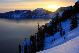
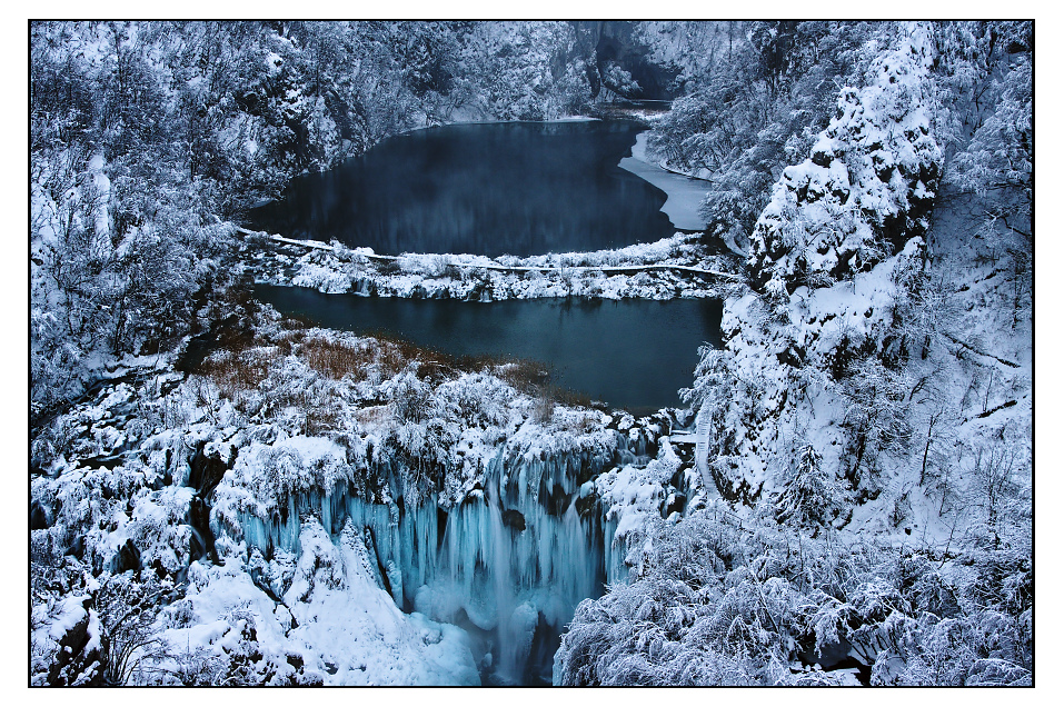
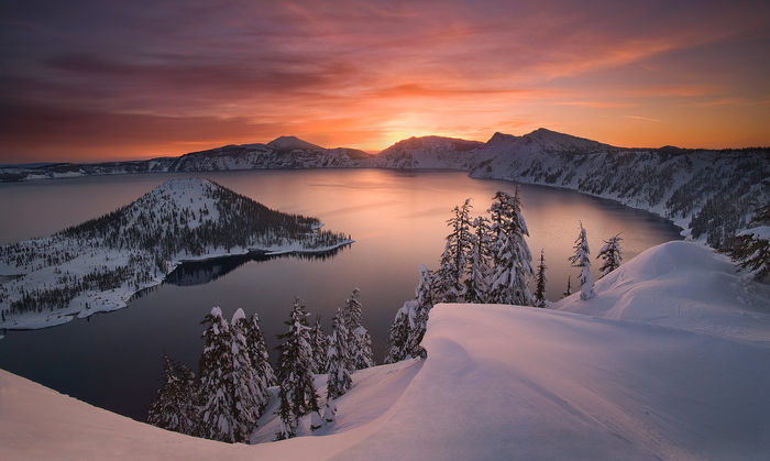
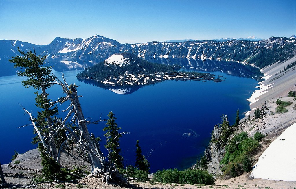
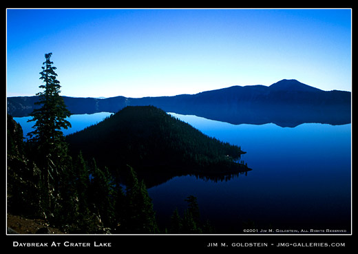
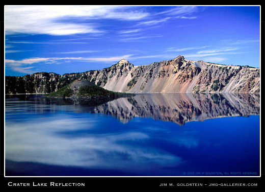
Overwhelmingly yet sublimely beautiful. Moody.
At times brilliantly blue, ominously somber; at other times buried in a mass of brooding clouds.
The lake is magical, enchanting – a remnant of fiery times, a reflector of its adjacent forested slopes, a product of Nature’s grand design.
Provided by the National Park Service
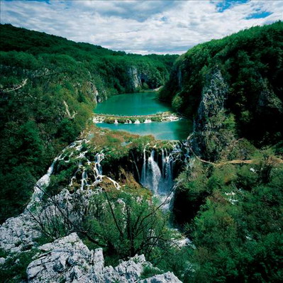
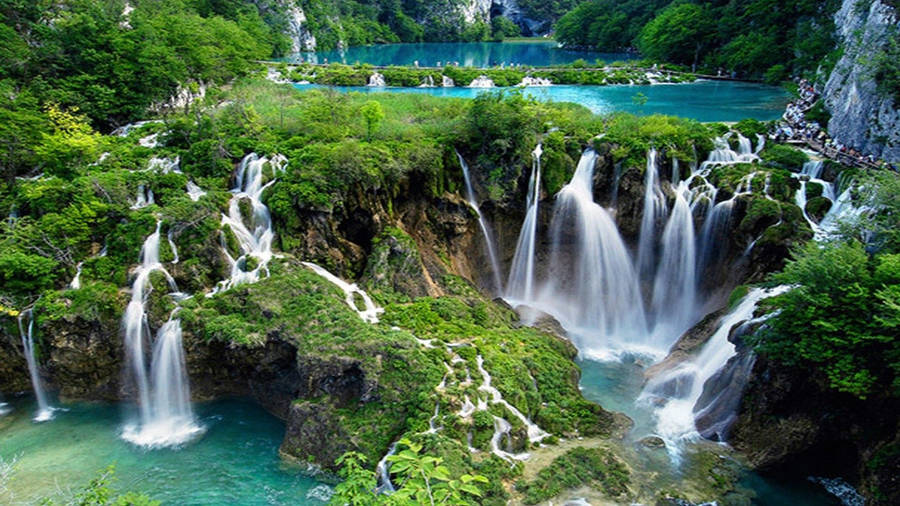
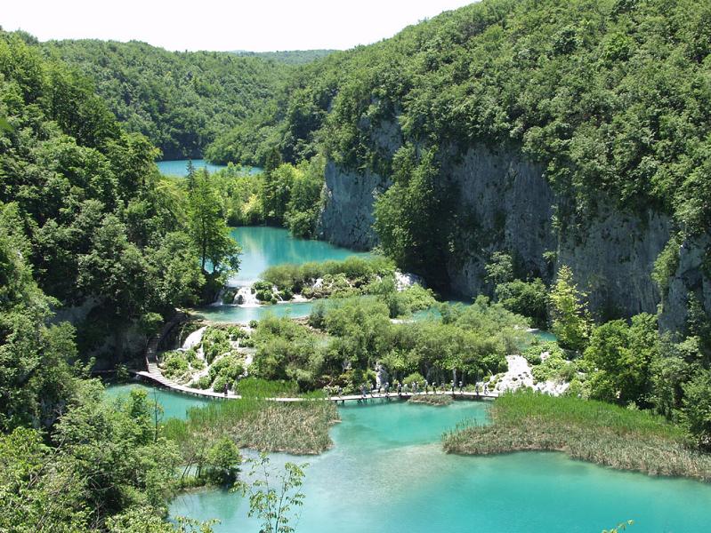
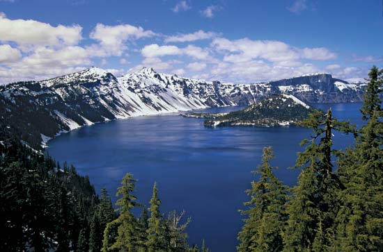
Few places on earth command overwhelming awe from observers, but Crater Lake, in south central Oregon, certainly does. Even in a region of volcanic wonders, Crater Lake can only be described in superlatives. Stories of the deep blue lake can never prepare visitors for their first breathtaking look from the brink of this 6 mile wide caldera which was created by the eruption and collapse of Mt. Mazama almost 7,000 years ago. Even seasoned travelers gasp at the twenty-mile circle of cliffs, tinted in subtle shades and fringed with hemlock, fir, and pine: all this in a lake of indescribable blue.
Crater Lake National Park is host to a diverse array of activities. While enjoying the natural scenic wonders, park visitors may hike in old growth forests, participate in a variety of interpretive activites, camp out or stay in an historic hotel, or even cross- country ski during the eight month long winters which are experienced here in the high Cascades.
Preserving this environment for the continued use and enjoyment of the public is also a major goal of the National Park Service. Resource managers are invloved in studies on lake ecology, forest ecosystems, geologic processes, even the role of fire in maintaining healthy relationships between the forests and the land. Their work yields valuable data on the natural systems which have created and maintained that which we fondly call Crater Lake National Park.
Crater Lake National Park has been recommended as a wilderness preserve, a place where we may forget ourselves for a time and enjoy a surge of healthy outdoor exploration. Here, we may rediscover ourselves and learn that material things do not necessarily constitute our richest possessions. This blue gem of the Cascades certainly moves us deeply when we imagine the awesome power which created this wonderful place.
Visitors to the park enjoy multiple opportunities to explore the caldera and enjoy all the spectacular view points on the 33 mile long rim drive. A peaceful guided boat tour, hiking trails and interpretive programs are offered in the summer and Ranger lead snowshoe walks and many trails for cross-country skiing in the winter.
Crater Lake is widely known for its intense blue color and spectacular views. During summer, visitors may navigate the Rim Drive around the lake, enjoy boat tours on the lake surface, stay in the historic Crater Lake Lodge, camp at Mazama Village, or hike some of the park’s various trails including Mt. Scott at 8,929 ft. Diverse interpretive programs enhance visitors’ knowledge and appreciation of this national park, 90% of which is managed as wilderness. The winter brings some of the heaviest snowfall in the country, averaging 533 inches per year. Although park facilities mostly close for this snowy season, visitors may view the lake during fair weather, enjoy cross-country skiing, and participate in weekend snowshoe hikes.
Park History
Local Native Americans witnessed the collapse of Mount Mazama and kept the event alive in their legends. One ancient legend of the Klamath people closely parallels the geologic story which emerges from today’s scientific research. The legend tells of two Chiefs, Llao of the Below World and Skell of the Above World, pitted in a battle which ended up in the destruction of Llao’s home, Mt. Mazama. The battle was witnessed in the eruption of Mt. Mazama and the creation of Crater Lake.
The Klamaths revered the lake and the surrounding area, keeping it undiscovered by white explorers until 1853. That year, on June 12, three gold prospectors, John Wesley Hillman, Henry Klippel, and Isaac Skeeters, came upon a long, sloping mountain. Upon reaching its highest point, a huge, awe-inspiring lake was visible. “This is the bluest lake we’ve ever seen,” they reported, and named it Deep Blue Lake. But gold was more on the minds of settlers at the time and the discovery was soon forgotten.
Captain Clarence Dutton was the next man to make a discovery at Crater Lake. Dutton commanded a U.S. Geological Survey party which carried the Cleetwood, a half-ton survey boat, up the steep slopes of the mountain then lowered it to the lake. From the stern of the Cleetwood, a piece of pipe on the end of a spool of piano wire sounded the depth of the lake at 168 differnt points. Dutton’s soundings of 1,996 feet were amazingly close to the sonar readings made in 1959 that established the lake’s deepest point at 1,932 feet.
William Gladstone Steel devoted his life and fortune to the establishment and management of Crater Lake National Park. His preoccupation with the lake began in 1870. In his efforts to bring recognition to the park, he participated in lake surveys that provided scientific support. He named many of the lake’s landmarks, including Wizard Island, Llao Rock, and Skell Head. Steel’s dream was realized on May 22, 1902 when President Theodore Roosevelt signed the bill giving Crater Lake national park status. And because of Steel’s involvement, Crater Lake Lodge was opened in 1915 and the Rim Drive was completed in 1918.
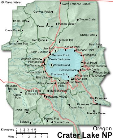
HOW TO FIND CRATER LAKE
From Roseburg – Route 138 east to the park’s north entrance.
From Bend – Route 97 south to route 138 west to the park’s north entrance.
From Medford – Route 62 north and east to the park’s west entrance.
From Klamath Falls – Route 97 north to route 62 north and west to the park’s south entrance.
*The park’s north entrance is typically closed for the winter season from mid-October to mid-June.
DRIVING DISTANCES
Bend, OR – 119 miles
Klamath Falls – 57 miles
Los Angeles – 785 miles
Medford – 77 miles
Portland – 250 miles
San Francisco – 450 miles
Seattle – 422 miles
Did You Know?
Because Crater Lake is filled almost entirely by snowfall, it is one of the clearest lakes anywhere in the world. Scientists using a reflector called a Secchi disk commonly record clarity readings of 120 feet. On June 25, 1997 scientists recorded a record clarity reading of 142 feet.
A small volcanic island, Wizard Island, rises 764 feet above the surface of the lake on its west side. A small crater, 300 feet across and 90 feet deep, rests on the summit.
Crater Lake was named for this beautiful, symmetrical crater by James Sutton, editor of the Oregon Sentinel in Jacksonville, in 1869.
Scientists have identified 157 species of phytoplankton and 12 species of zooplankton in the lake. The density and diversity of these minute life forms is restricted by low concentrations of nitrogen in the lake. Large colonies of moss circle the lake at depths of up to 400 feet. At the bottom of the lake, communities of bacteria grow around at least two areas of hydrothermal activity. Two species of fish, rainbow trout and kokanee salmon, also thrive in the lake, the result of stocking between 1888 and 1942.
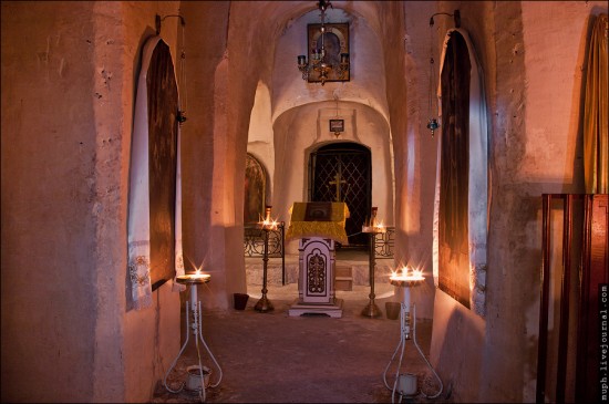
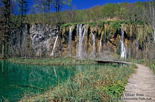
Sinnott Memorial Overlook and Museum

Built in 1930 and 1931, the Sinnott Memorial Overlook is located below the caldera rim at Rim Village. A short but steep path begins near the Rim Visitor Center. The Overlook and its accompany museum are available to visitors as staff is available. Exhibits focus on the history of research on the lake and the geologic history of historic Mt. Mazama. Ranger talks relating the formation of Crater Lake are given from the Overlook daily at 11:00 a.m., 12:30 p.m., 2:00 p.m., and 3:30 p.m from June 26 through September 5th.
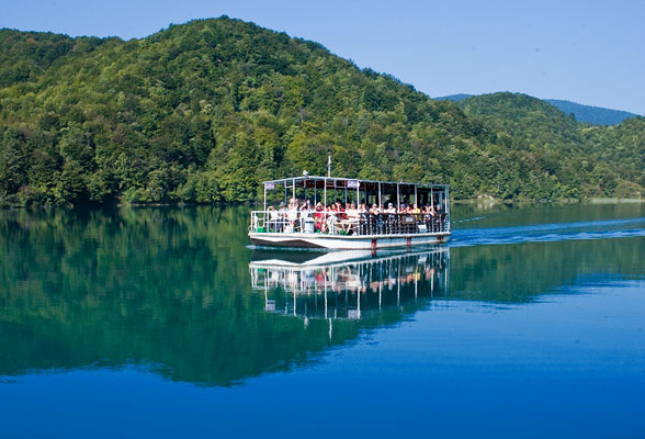
Boat Tours

The boat tours are accessible only by hiking the one mile Cleetwood Cove trail located on the north side of Crater Lake. It climbs 700 feet in elevation and is recommended only for those in good physical condition. It is not recommended if you have heart, breathing, or leg problems.

Temperatures on the lake may be much cooler than those at the trailhead so bring extra clothing and a hat. There is no water available at Cleetwood Cove. You will need to bring your own. Composting toilets are available at the boat dock. A vault toilet is available at the trailhead.

Tickets are purchased at the top of the trail. No reservations are taken. Allow at least one hour to drive from Rim Village to Cleetwood Cove parking area and to hike down the steep trail.

What can we learn from Crater Lake? Why is it important geologically and ecologically? And when’s the last time you were inside a caldera? This two hour, ranger lead tour is operated by the Xanterra Parks & Resorts in cooperation with the National Park Service to provide visitors with an expanded knowledge of the lake and its resources, whether visible, submerged, or intangible. Boat tours are scheduled to begin in early July – however, inquire at the park visitor centers to insure correct information.

Cost: $20.00 for adults $12.00 for children 11 and under and free for those 24 months and under. Prices Subject to Change.

Wizard Island Options:

Boats stop at Wizard Island. It is possible to stay on the island and take a later boat back. However, your return journey is dependent upon available space on returning boats. You are not guaranteed a ride back until the final tour of the day, possibly arriving at the Cleetwood Dock as late as 6:30 p.m. There are two hiking trails on Wizard Island. There is no camping allowed on the Island. Keep in mind that Wizard Island is a remarkable place: an infant cinder cone with all the expected hazards: extremely rough lava, loose cinder, and dry conditions. Use caution when hiking. A pit toilet is located at the dock area. There are no other facilities provided for the public on Wizard Island.

Hiking and Biking

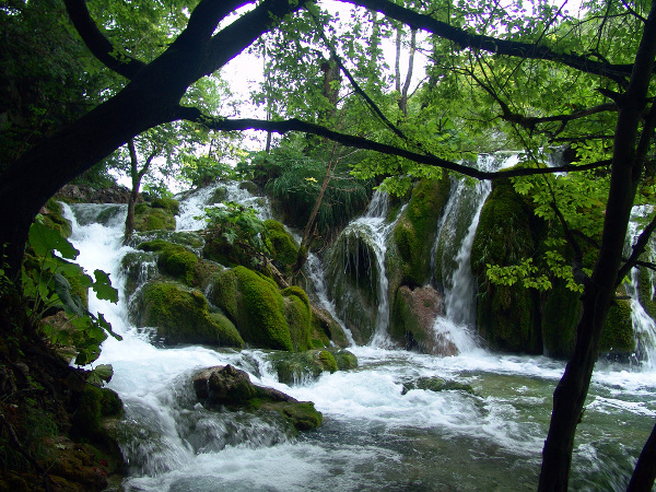
This national park has over 180,000 acres of which only 11,500 are taken up by the lake. The remaining 93% is land based, most of it backcountry. In fact, portions of the park await designation as wilderness. There are approximately 90 miles of hiking trails in the park — with each one offering the visitor a chance to take a closer look at nature or study a geological feature. You can hike for several days or wander quietly as long as you like. In addition to the many trails that start inside the park, there are several connections with paths in the surrounding National Forests. A good example is the Pacific Crest Trail, which runs all the way from the Mexico to Canada and passes through Crater Lake’s backcountry.

No bicycles are allowed on any park trails. Bicycling is allowed only on paved roads, the Grayback Motor Nature Trail, and the dirt trail entering the park on the east side near the Pinnacles.

Start your trip at the information desk located in the Steel Center in Munson Valley or the Rim Village Information Center. Park staff will also issue free backcountry permits for overnight stays and inform you of the regulations designed to protect these areas.

Bring plenty of food and water. Wear comfortable shoes or boots. If you plan on drinking stream water, you need to treat it with a reliable purification system. You should also be prepared for any extremes of weather. Temperatures can change dramatically in the course of a day. Snow has fallen in all twelve months of the year here. This information should be helpful in planning your trip to Crater Lake. Take time to enjoy the spectacular views of the lake but include time to relax and enjoy the green forests, cool mountain streams, and other magnificent features of Crater Lake’s backcountry.

The following is a partial list of day hikes at Crater Lake National Park. The list is organized according to estimated time length for completing the hike. Please note that steep terrain of Crater Lake means time, length and difficulty are not directly related. Times are given are estimates of how long it will take to complete the trail and return to the trailhead. Trails listed as strenuous should be taken only by people in good physical condition.

▪ Sun Notch View – Time: 20 minutes, Length: 0.25 miles one way, Elevation: 7000 – 7115 ft., Difficulty: moderate, Trailhead: 4 miles east of Park HQ on East Rim Drive, marked by a sign. Feature: Overlook of Crater Lake and Phantom Ship, scattered wildflowers, dry meadow. Use caution near steep edges.

▪ Godfrey Glen – Time: 30 minutes, Length: 1.00 miles, Elevation: 6000 – 6050 ft., Difficulty: easy, Trailhead: 2.4 miles south of Park HQ.

▪ Castle Crest Wildflower Garden – Time: 30-45 minutes, Length: .4 mile loop from Rim Drive, 1 mile loop from Park HQ, Elevation: 6400 – 6500 ft., Difficulty: easy but some uneven ground and rocks, Trailhead: 1) East Rim Drive, 0.5 miles from park HQ, or 2) Across road from Park HQ parking lot. Features: Small brook, lush vegetation, and spectacular blooms of wildflowers in summer months.

▪ The Watchman – Time: 1 hour, Length: 0.7 miles. one way, Elevation: 7400 to 8056 ft, Difficulty: difficult, steep, Trailhead: “The Corrals”, 3.7 miles northwest of Rim Village on West Rim Drive. Features: Panorama of surrounding area, overlook of Wizard Island, a historic fire lookout and an interpretive map of local peaks and landforms.

▪ Annie Creek Canyon – Time – 1 hour and 15 min, Length: 1.7 mile loop, Elevation: 5800 to 6000 ft., Difficulty: moderate, Trailhead: Amphitheater at Mazama Campground. Features: Deep stream cut canyon, creek habitats, wildflowers and occasional animals.

▪ Cleetwood Cove (lake shore trail) – Time – 1 hour, Length: 1.1 miles, one way, Elevation: 6850 to 6176 ft., Difficulty, strenuous, 11% grade, Trailhead: Parking area 4.5 mi. east of North Junction. Features: Access to lake shore and boat landing.

▪ Garfield Peak – Time: 2 to 3 hours, Length: 1.7 miles, one way, Elevation. 7050 to 9060 ft, Difficulty: difficult, Trailhead: Rim Village Parking Lot. Features: Panorama of surrounding area, excellent views of Crater Lake, occasional small animals, wildflowers, and an overhead view of Phantom Ship.

▪ Mt. Scott – Time: – 3 hours, Length: 2.5 miles. one way, Elevation: 7450 to 8929 ft., Difficulty: – strenuous, Trailhead: 14 miles east of Park HQ, across East Rim Drive from road to Cloudcap junction.

Wildlife Viewing Opportunities

Spring at Crater Lake National Park- is a very long season or merely a heartbeat, depending on your perspective. With the disappearance of the several feet of snow that blankets the area until early summer, wildflowers bloom, transitory birds return, trees bud, and animals play in the abundance of summer. The largest park residents are the deer and elk that roam the woods of the park from June until October. A herd of pronghorn antelope also migrate across the Pumice Desert in the northern end of the park in early summer as the snow finally leaves the ground. These ungulates, a word used to describe hoofed animals, indicate that summer is here; that the plants and trees are in the midst of their growing season.

Pine martens, mice, squirrels, and rabbits are just a sampling of winter wildlife who stay active by feeding on pine seeds, hemlock bark and other gifts left by summer’s vegetation. Deer must migrate to lower elevations, sometimes traveling up to thirty miles to the Rogue Valley where a food supply is still available. Deer and elk feed mainly on different types of grasses and lichens, as well as twigs and bark of hemlock, lodgepole pine, and Douglas fir. Carnivores, or meat eaters, don’t suffer the same food loss as deer when plants are snowed in.

Elk are the largest of the park’s animals, with females weighing as much as 700 lbs. and males weighing up to 1100 lbs. They commonly come into the south and western areas of the park as snow allows, usually around mid-June. The species native to the park, Roosevelt Elk, were hunted nearly to extinction in the park by early settlers. To help the population, 15 elk were from Wallowa County, Oregon. Oregon’s first state game warden, William L. Finley, brought in 15 elk from the National Elk Refuge in Jackson Hole, Wyoming, in 1912, to live in a protected enclosure at Billy Meadows north of Enterprise. Another 15 were brought in 1913. The Crater Lake elk are descendants of these. The effort was successful; today, more than 160 elk (approx) have been counted within the park in recent summers. Deer winter with elk and generally live in the same regions.

All of these beautiful animals travel in both daylight and during evening hours. Please obey all speed regulations and be very watchful as you travel park roadways for your safety and theirs. Henry David Thoreau wrote, “Perhaps what moves us in winter is some reminiscence of far-off summer. The cold is merely superficial – it is summer still at the core, far, far within.” It is the wakeful summer core that maintains the sleeping winter of Crater Lake. Deer and elk are a welcome indication of this transition.

Camping

There are two developed campgrounds at Crater Lake. Mazama Campground is located near the Annie Springs Entrance Station. Lost Creek Campground is accessed by taking East Rim Drive to the Pinnacles road. Campsites are all on a first come, first served basis. No reservations are taken. Camping opportunities are also available at several locations outside the park.

Mazama Campground – This 198 site campground is operated by Xanterra Parks & Resorts. Call 541-594-3704 for prices regarding sites per night. Fresh water, flush toilets, a dump station, pay showers, and laundry facilities are available. There are no utility hookups. Fires are permitted in designated fireplaces only. Firewood is available for purchase at the Mazama Store. Campers are allowed to collect only dead and downed wood. Mazama Campground is open from June 11 to October 4, 2004, weather permitting.

Lost Creek Campground – A 16 site tents-only campground is operated by the National Park Service. It normally opens in July and closes for the season in mid-September. Check at the park visitor centers at 541-594-3100 for exact opening and closing dates & rates. Sites are first come-first serve, they do Not Reserve by phone. These sites fill by early afternoon, so campers should select sites upon arriving in the park.

Visitor Services

Food and Beverages – Crater Lake National Park offers three types of dining. The Crater Lake Lodge Dining Room is located in the Crater Lake Lodge and offers fine dining featuring Northwest regional cuisine. The Lodge Dining Room is open for breakfast, lunch, and dinner from May 26 to October 17, 2004. The Café is located adjacent to the Gift Shop at Rim Village and serves breakfast, lunch, and dinner. The Café is open year-round with decreased hours in the winter. The Watchman Buffet is upstairs from the Café and offers a dinner buffet. Its hours are 5:00 p.m. to 10:00 p.m. from June 11 through September 12, 2004.

Lodging – The historic Crater Lake Lodge, perched on the rim of Crater Lake, has 71 rooms and is open from May 26 to October 17, 2004 The Mazama Village Motor Inn is located at Annie Springs, near the Route 62 junction. Two units are designed for wheelchair accessibility. The Motor Inn is open from June 4 to October 4. Check in is at the Mazama Village Store. To reserve rooms in advance, contact 541-594-2255 ext. 3705.

Automotive Needs – Gas is available Seasonally. Unleaded gasoline, oil, and some basic automotive needs are available at the Mazama Village Store. Regular and Diesel fuels are not available. There are no mechanics available in the park. Tow services come from Chemult or Prospect, Oregon.

Mazama Village Store – The store is located at the Annie Springs Entrance near the junction with Route 62. Convenience store items, a coin operated laundry, and shower facilities are available. Hours are 10:00 a.m. to 5:00 p.m. from June 4 to June 11; 7:00 a.m. to 10 p.m. from June 11 to September 7; 8:00 a.m. to 8:00 p.m. from September 7 to closing on October 4, 2004

For more information about Crater Lake please call 541-594-3100 or you can visit this website at www.craterlakelodges.com

http://pagead2.googlesyndication.com/pagead/show_ads.js