Spassky Cave Church in Russia

http://pagead2.googlesyndication.com/pagead/show_ads.js

On the banks of the Don River, in the picturesque Voronezh region of Russia lies one of the most fascinating tourist attractions this country has to offer – the Spassky Cave Church. It’s believed the first caves were dug into the cretaceous mounts of Kostomarovo before the adoption of Christianity in Russia. Hermit monks would use these austere cell-like spaces to hide from persecution, and it wasn’t until the 12th century that the first rock monastery was carved in the region. Because there is no any historical note, it is difficult to pinpoint the exact date the Spassky Cave Church appeared near the small Russian village of Kostomarovo, but it is now considered one of the most incredible monuments of ancient architecture in Russia.

The Svyato-Spassky Convent in Kostomarovo is an ancient cave monastery located about 150 kilometers south of the town of Voronezh, just 3-hours drive away. There are two churches in these caves: a big Spassky temple with columns and a small St. Seraphim Sarovsky church. The Spassky temple burrows deep into the chalky cliff to form a spacious interior that can house up to 2,000 people.
This church is unique, made by carving a rocky mountain. The style is influenced by Byzantine architecture, but the interior is much more Orthodox style.

This unique and amazing building has a sad story. In the past, the Spassky Cave Church is used as torture chambers the communists against the monks. During communist power they were expelled from church, even one from them was shot.

Those who have visited Spassky Church speak of a fantastic sense of easiness and divine bliss, and it also has a reputation for healing diseases and wounds, helping people make the right decisions and cleansing sins. In fact, there is even a Cave of Repentance inside the chalk church where condemned sinners were once confined to repent for their sins. The sense of easiness may also be influenced by the beautiful natural surroundings that the locals believe look so much like the Holy Land that they named them after it. There is a hill of Golgotha, a Mount Tabor and even a Gethsemane Garden. Local residents believe that place around Spassky Cave Church is a sacred place.

Although famous among Russia’s religious folk, Spassky Church and the cretaceous caves of Kostomorovo remain almost unknown to the rest of the world.

http://pagead2.googlesyndication.com/pagead/show_ads.js


TauTona Mine – World’s Deepest Mine

http://pagead2.googlesyndication.com/pagead/show_ads.js

The TauTona Mine or Western Deep No.3 Shaft, located in South Africa, is the deepest gold mine in the world with miners working 2.4 miles below the earth’s surface. Known as one of the most efficient mining processes, 5600 miners roam through 500 miles of tunnels removing the gold containing ore.
The TauTona mine exists within the West Witts area slightly South West of Johannesburg in the North West of South Africa. The mine is near the town of Carletonville. TauTona neighbours the Mponeng and Savuka mines, and TauTona and Savuka share processing facilities. All three are owned by AngloGold Ashanti. 
The mine was originally built by the Anglo American Corporation with its 2 km (1.2 mi) deep main shaft being sunk in 1957. The mine began operation in 1962. It is one of the most efficient mines in South Africa and remains in continuous operation even during periods when the price of gold is low. In 2006 AngloGold Ashanti commenced a project to extend its South African TauTona gold mine to 3.9km. This was completed in 2008 making it the world’s deepest mine, surpassing the 3,585m deep East Rand Mine by a good distance. The name TauTona means “great lion” in the Setswana language.

The mine is a dangerous place to work and an average of five miners die in accidents each year. The mine is so deep that temperatures in the mine can rise to life threatening levels. Air conditioning equipment is used to cool the mine from 55 °C (131 °F) down to a more tolerable 28 °C (82 °F). The rock face temperature currently reaches 60 °C (140 °F).


The journey to the rock face can take one hour from surface level. The lift cage that transports the workers from the surface to the bottom travels at 16 meters a second. The mine has also been featured on the MegaStructures programme produced by National Geographic.

Gold production declining due to increased seismic activity in the vicinity of the CLR shaft pillar which is being mined, and at several highgrade production panels, where production was halted for limited periods during the course of the year. Both face length and face advance were negatively affected by seismicity during the year. The increased geological risk from this seismic activity necessitated re-planning regarding mine layout and mining methods.

http://pagead2.googlesyndication.com/pagead/show_ads.js


World Largest Outdoor Swimming Pool – San Alfonso del Mar

If you like doing laps in the swimming pool, you might want to stock up on the energy drinks before diving in to this one. It is more than 1,000 yards long, covers 20 acres, has a 115-foot deep end, and holds 66 million gallons of water.

Chile, home to immense natural beauty from lakes to parks to beaches, can now add another appeal to its two million tourists annually with the Guinness World Record holder of the world’s largest pool, The Crystal Lagoon at the San Alfonso Del Mar Resort.
San Alfonso is located at only 90 kilometers apart from Santiago in Algarrobo’s northern sector, the closer beach spot to the eastern sector of the capital city.

Swimming a length in this, the world’s largest outdoor pool, would mean stroke after stroke for more than three fifths of a mile – that’s 20 Olympic-size swimming pools.
The enormous man-made lagoon is set halfway up the country’s Pacific coast, in the city of Algarrobo, and is filled with 66 million gallons of crystal clear seawater.
It also hold the Guinness record for the world’s deepest – so if you don’t feel like diving 115ft to the bottom, it might be best to bring some spare goggles.
The Crystal Lagoon reportedly took over five years to construct, which totaled over $1.2 billion, and opened to the public in December 2006 and costs over $3 million to maintain annually.
It uses a computer-controlled suction and filtration system to suck water in from the ocean at one end and pump it out at the other, while the sun warms it to 75 degrees – nine degrees higher than the sea.

Chilean biochemist Fernando Fischmann, whose Crystal Lagoons Corporation designed the pool, said advanced engineering meant his company could build “an impressive artificial paradise” even in inhospitable areas. It uses hardly any chemicals.
“As long as we have access to unlimited seawater, we can make it work, and it causes no damage to the ocean.”

For sport lovers, there are sport schools imparting training classes on sailing, kayak, scuba diving, swimming, ocean navigation, golf, tennis and paragliding, and they also will find at their disposal artificially-lit five-a-side soccer courts, volleyball courts and tennis courts, a real statutory soccer field, a last-generation 3D golf simulator and a gym with large windows that enjoy a stimulating overview of the lagoon.
Children have play grounds and entertainment activities organized by child monitors, whereas teenagers have an exclusive space destined for them – the Teen-Pub -, and also SubTerra discotheque, where often music recitals and live shows are featured.
The Beach Club with spa, a tempered beach under a crystal pyramid, open-air Jacuzzis, sauna, beauty parlor and gym; the Blue Spa, the first medical spa in Chile; the cybercafé; the exhibition and cultural activities room; the open-air amphitheater; the Lighthouse Café with icecream parlor and teashop; the sushi Lighthouse; the supermarket and the North Bay pub-restaurant with its own dock and a large terrace along the lagoon’s coastline – where often amusing parties and shows are held – are also part of San Alfonso’s facilities.
To all that, the South Bay development has to be added, where the SubAqua Café stands out for its inner aquarium, the largest in Chile, which holds more that 60 Chilean species that can be appreciated in full magnitude through a 25-meters-long glass surface. A giant 100-meters-long water chute is also located in this zone. This sector will be completed by the South Bay Pub that will have a multiple-level restaurant, a Jacuzzi-bar with a giant screen and a gym.

Along with views of the sea and white sandy beaches, visitors can engage in a myriad of activities from boating to snorkeling.
San Alfonso has created a private world with activities for all family members to spend days full of enjoyment without ever leaving the resort.

http://pagead2.googlesyndication.com/pagead/show_ads.js

Giethoorn, “the Venice of Holland”

For anyone dreaming of a simple life, you may want to consider moving to a rural village in the northwest corner of the province of Overijssel, Giethoorn, Netherlands.
Giethoorn, also known as “the Venice of Holland” or the “Venice of the North”, is a beautiful village is and wonderful place to spend a couple of hours. It’s a lot smaller, less crowded and doesn’t have the rich history of the real Venice, but if you enjoy long, peaceful boat rides while admiring classic Dutch sceneries, Giethoorn will make a great impression on you.
This idyllic village has no roads, and the only access is by water over the many beautiful canals or on foot over its wooden arch bridges. The locals use punters to get around and cars have to remain outside the village.
Giethoorn is located at the edge of a national park (Weerribben-Wieden), a beautiful area.
The village Giethoorn is home to less than 3000 people, most of them live on their private islands. The around 180 bridges are the only way to reach many houses, other than by boat that is.
It’s no surprise Giethoorn is a popular tourist attraction and has been given the nickname the Venice of the Netherlands. Cycling and sailing as well as a guided canal tour are some of the many ways to discover its rustic charm.

Located in the center of the Netherlands, right in the middle of the De Wieden nature reserve, the small village of Giethoorn was in 1230, by a group of fugitives from the Mediterranean region around AD 1230. When they arrived in the area the first thing they noticed was a large mass of goat horns, left over after a flood ravaged the area a few years earlier. They initially named their settlement Geytenoorn (geit = goat), but the dialect suffered some changes over the years and it is now known as Giethoorn.

It became well known in 1958 when it was featured in the film Fanfare, made by Dutch filmmaker Bert Haanstra.

In winter Giethoorn is a very popular destination for ice skaters. During my last years in Holland I lived close to Giethoorn and in cold enough winters I was among the thousands who would go to Giethoorn to ice skate on a sunny Sunday afternoon.

Informations (brochures) about Giethoorn and surroundings you can inform at the Tourist Information office VVV at 0031-521-362124. Unfortunately the tourist office has no information brochures available in English. Pleas contact the above mentioned telephone number for informations about hotel addresses. For RESERVATIONS guided canaltours or rent a boat info@zwaantje.nl

For more information visit:
http://www.zwaantje.nl/uk.giethoorn.html 

http://pagead2.googlesyndication.com/pagead/show_ads.js

Cesky Krumlov


Cesky Krumlov nowdays belongs to the most attractive cities amongst the visitors – mainly due to its unique character and its preserved hisotry. It is famous for its Old Town, with 300 protected medieval buildings, and its castle complex, the second largest in the Czech Republic.
This small picturesque city is situated on the banks of the Vltava River (Moldau in German) in Southern Bohemia and is about a 2 hour drive from Prague. The town was built around a 13th century castle with gothic, renaissance and baroque elements. Despite the passage of time, the town together with chateau complex has retained its exemplary mediaeval character for more than five centuries.
The town Cesky Krumlov is dominated by two grate landmarks: the chateau complex, which was included to the list of UNESCO World Cultural Heritage Monuments in 1992, and the gothic Church of St.Vitus. Cesky Krumlov chateau complex is one of the largest in Central Europe. Complex is composed of more than forty historical buildings, a cylindrical tower reconstructed in its preset form in the 16th century, unique Baroque theatre with original equipment and fittings. Under the Castle Complex lies the old town with its winding alleys and venerable Gothic and Renaissance houses, many galleries, little shops and inns.
The International Music Festival in Český Krumlov has an extensive tradition starting from 1992. Václav Klaus, President of the Czech Republic said about this festival: “This Festival has been for a long time a well established event, which far exceeds the borders of Český Krumlov. Today, it is considered an event of national importance. I have had the chance to visit many of the concerts and I must say that that last year´s opening concert was the most impressive – thanks to its repertoire and excellent performances.

I have a soft spot for the International Music Festival Český Krumlov and if I didn’t visit, many people would be disappointed. And I wouldn´t like to do that.”

One of the three Prizes in Category Conservation has been awarded to the conservation of the Southern facade of Horní Hrad (Upper Castle) of the Český Krumlov State Castle and Chateau in the Czech Republic, European Union Prize for Cultural Heritage / Europa Nostra Awards 2008. This project estabilishes new standards of Czech monument care and is appreciated as an excellent example of a respectful approarch to conservation in Europe.


Flying Tennis! The World’s Highest Tennis Court at Burj Al Arab, Dubai

The world’s highest tennis court stands atop the one of the highest hotel in the world – Burj al-Arab at Dubai. On February 22, 2005, the Burj al Arab hosted Andre Agassi and Roger Federer to play a match on their helipad tennis court before heading to the US$1 million Dubai Duty Free Men’s Open, which was the first round of the two-week Dubai Tennis Championships. The tennis legends couldn’t resist the temptation to have a friendly ‘hit’ on the world’s most unique tennis court. The court is circular in shape ,and also doubles as a helipad, hovering 211 meters above the Arabian gulf and covers a surface area of 415 sq m.

Would you like to play round of tennis at this height?
Here is some info about hotel so you can book your game today!

Designed by Tom Wright and completed in 1999, the hotel features a double membrane PTFE fiberglass covering that reduces solar heat gain, but lets in filtered light. Burj Al Arab is located on Dubai’s Jumeirah Beach strip, 15 km from the main city centre and 25 km from Dubai International Airport. It is Dubai’s most recognisable landmark and the fourth tallest hotel in the world at 321 m (1,053 ft) and stands 280 metres offshore on a man-made island, linked to the mainland by a slender, gently curving causeway. Resembling the sail of a ship, the iconic hotel gives itself a 7 star rating, although we’re not really sure if you can go above 5 on the luxury scale. It is well served by taxis and has its own fleet of chauffeur driven Rolls-Royces, BMWs, and a helicopter.

Contact Details:

Burj Al Arab
PO Box 74147, Dubai, UAE

Tel: +971 4 3017777
Fax: +971 4 3017000

http://pagead2.googlesyndication.com/pagead/show_ads.js

The Diavik Diamond Mine, Canada


Many of the Canadian Diamonds which we offer are manufactured using diamond rough which was sourced from the Diavik Diamond Mine which is located on a 20 kilometer square island, informally called East Island, which is in Lac de Gras located within the Northwest Territory of Canada approximately 300 kilometers as the crow flies Northeast of Yellowknife which is the Capital of Canada’s Northwest Territories. The Artic Circle is located about 220 kilometers North of the mine. The key to operating a mine in Canada’s remote wilderness is a private ice road which is shared by various mining companies that are operating in the area. The road has been in operation for about twenty years and must be rebuilt annually to maintain service. Approximately 75% of the road is ice and is built over frozen lakes.

Geology: The Diavik Diamond Mine was discovered in Precambrian rocks of the Slave Geological Province. Known to host deposits of gold, copper, zinc, nickel, and now diamonds, this ancient rock is among the world’s oldest and was formed about 2.7 to 2.5 billion years ago. The Slave Geological Province has produced much of the North’s mineral wealth.

Granitic rocks predominantly underlie the area, and have been intruded into slightly older meta-sedimentary rocks, originally deposited as sandstone and shale. The geology of the project area is typical of ancient, 2.5-2.7 billion-year-old Precambrian rocks, with a mixture of metamorphosed sedimentary (metaturbidites) and granitic (e.g. granite, tonalite) rocks. The kimberlite pipes at the Diavik Diamond Mine are volcanic cores injected into the much older, granitic and meta-sedimentary rocks a mere 55 million years ago. Relatively fresh, often charred – but not petrified – wood found only in China today, has been encountered in drill core at depths up to 400 metres. Reflecting a much warmer climate at that time, the coniferous trees were uprooted and incorporated into the pipes.

What are Kimberlite Pipes?

Kimberlite is a rare rock type commonly found in carrot-shaped pipes which represent the roots of ancient, small volcanoes. A drawing of a carrot shaped kimberlite pipe appears above. Originating from over 150 km below the earth’s surface where diamonds are commonly formed, the kimberlite may bring diamonds to surface. Globally, kimberlite pipes average 12 hectares in surface area, and may reach depths of several hundred metres. The kimber pipes used by the Diavik Diamond Mine range in surface area from 0.9 to 1.6 hectares, and extend below 400 metres.

The Exploration for Diamonds

Finding diamond deposits is difficult and costly. Rather than look for the elusive and rare diamonds, geologists seek other clues. Working from tent camps, geologists conduct several types of surveys. Using geochemical surveys, soil samples are taken and panned for indicator minerals like garnets found in more abundance in kimberlite pipes. A trail of indicator minerals can lead to potential pipes. In addition, geophysical surveys are used to differentiate hidden kimberlite pipes from surrounding host rock. Computer-generated geophysical data is mapped as pictured above. If a potential kimberlite target is identified, portable diamond drills are used to remove core samples to determine if the target is in fact kimberlite. Further drilling helps define pipe size and shape, and provides additional rock for diamond testing. Not all kimberlite pipes have diamonds. In fact, of the worlds estimated 5,000 kimberlites only 23 contain enough diamonds to warrant the expense of operating a mining operation. When diamonds are found in sufficient quantities to suggest an ore body, a small mining operation is conducted to remove a larger, several thousand tonne bulk sample. This sample is processed to remove the diamonds, which are then evaluated for quantity, quality, and size.

Lac de Gras

Aboriginal people named the Lake Ekati for quartz veins found in local bedrock outcrops resembling caribou fat. Lac de Gras is 60 kilometers long and averages 16 kilometers wide with a shoreline length of 740 kilometers. The lake averages 12 meters in depth and has a maximum depth of 56 meters. The water temperature ranges from 0°C to 18°C in the summer. Aquatic productivity is low due to low nutrients, low light during the winter, eight months of ice and low water temperatures. The water quality resembles distilled water. The lake is habitated by lake trout, cisco, whitefish, artic grayling, burbot, longnose sucker and slimy sculpin. The lake has a drainage area of about 4,000 square kilometers and together with Lac du Sauvage located to the Northeast form the headwaters of the Coppermine River which flows 520 kilometers from Western Lac de Gras to the Artic Ocean.

The Region

Rolling tundra surrounds the Diavik Diamond Mine. The region was originally named the “Barren Lands” by early explorers due to its lack of trees. The area includes numerous lakes, bedrock outcrops and glacial deposits of boulders, till, and eskers. What little soil is found is of cryosolic order – formed where permafrost occurs within 1-2 metres of the surface – and is characterized by layers that are disrupted, mixed, or broken, by freeze-thaw activity.

Vegetation

Vegetation includes dwarf birch, northern Labrador tea, blueberry, mountain cranberry, and bearberry, with willow, sphagnum moss, and sedge tussocks dominating wet lowlands.

Wildlife

Mammal species that inhabit the region include, grizzly bears, wolves, foxes, arctic hare, ground squirrels, and wolverines. In spring and fall, portions of the Bathurst caribou herd migrate through the region. 84 bird species and 16 mammal species are summer visitors or permanent residents.

Chronological History of the Diavik Mine

*1991- 1992 Aber stakes mineral claims
*March 1992 Exploration begins
*June 1992 Aber Resources, Kennecott Canada Exploration form Diavik joint venture
*1994-1995 Pipes A-21, A154-South, A154-North and A418 discovered
*February 1996 75-person exploration camp erected for underground bulk sampling
*July 1996 5,900 tonne bulk sampling of A418 and A154 South pipes completed
*December 1996 Diavik Diamond Mines Inc. created with head office in Yellowknife
*March 1997 Bulk sample transported over winter road to Yellowknife for processing. Approximately 21,000 carats of diamonds recovered
*June 1997 Environmental baseline studies completed
*September 1997 Pre-feasibility study completed
*March 1998 Project description submitted to Federal Government triggering formal environmental assessment review under the Canadian Environmental Assessment Act
*September 1998 Environmental Assessment Report submitted and Comprehensive Public Involvement Plan initiated
*November 1999 Federal Government approves project for permitting and licensing
*September 2000 Diavik Diamond Mines Inc. receives all necessary permits and licenses to bring mine into production
*December 2000 Investors of Rio Tinto plc and Aber Diamond Corporation approve $1.3 billion expenditure to build mine
*January 2001 Mine construction begins October 2001 A154 dike earthworks completed
*July 2002 A154 dike completed, dewatering commences
*December 2002 Mine virtually complete
*January 2003 Diamond production begins
*May 2003 First million carats
*May 2003 1.9 million accident-free hours
*April 2003 Aber’s first sale of rough diamonds
*July 2003 Rio Tinto Diamonds’ first sale of rough diamonds

Ellora Caves, Maharashtra – India


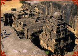
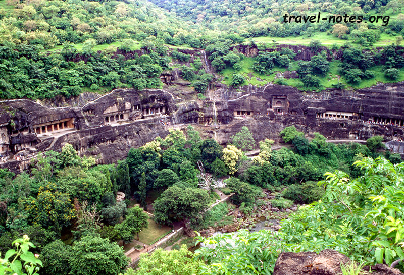
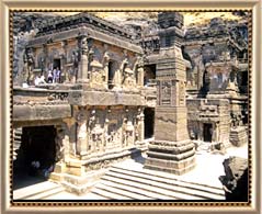
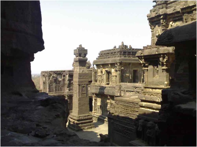
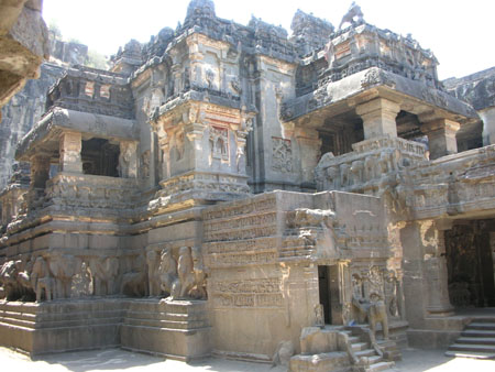
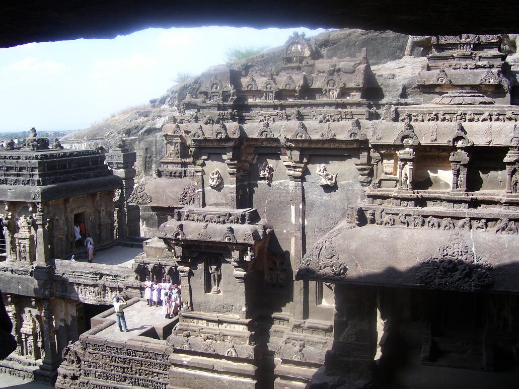
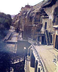
The Ellora caves, locally known as ‘Verul Leni’ is located on the Aurangabad-Chalisgaon road at a distance of 30 km north-northwest of Aurangabad, the district headquarters. The name Ellora itself inspires everyone as it represents one of the largest rock-hewn monastic-temple complexes in the entire world. Ellora is also world famous for the largest single monolithic excavation in the world, the great Kailasa (Cave 16). The visit to these caves is enjoyed maximum during monsoon, when every stream is filled with rainwater, and the entire environ is lush green. The monsoon is not only a season of rains in this part, the local visitors are attracted to visit these ideal locations to have a glimpse of the mother nature in full bloom. The caves are hewn out of the volcanic basaltic formation of Maharasthra, known as ‘Deccan Trap’, the term trap being of Scandinavian origin representing the step like formation of the volcanic deposits. The rock formation, on weathering has given rise to the appearance of terraces with flat summits. At Ellora, one can also have a glimpse of the channels (near Cave 32) through which the volcanic lava once flowed. These channels, due to overheating, have a characteristic brownish red colour. Similar rock was used in the construction of the Grishneshwar Temple nearby and also utilised for the flooring of the pathways at Bibi-ka-Maqbara.


The hills in which the caves are hewn, forms part of the Sahyadri ranges of the Deccan and dated to the Cretaceous era of the Geological time scale (about 65 million years ago). The hills rise abruptly from the surrounding plains on the south and west, the western surface being extensively utilised for hewing the cave complexes. The hill also supports several streams, the prominent among them being the Elaganga, which drains into the Shiv, a stream of the Godavari river system. The Elaganga is in its full vigour during the monsoon, when the overflowing waters of a barrage in the upstream near Mahismati allows the gushing waters to land at “Sita-ki-nahani” near Cave 29 as a crashing waterfall.

The volcanic lava flowed during different periods, gave rise to extensive horizontal flows alternating with vesicular trap beds. The vesicular traps formed the upper portion of each of the massive trap beds. The different lava flows also gave rise to vertical as well as horizontal joints in the rock formation. Depending upon the nature and mineralogical content of the lava flow, the rock formations also varied in character and texture, giving rise to various qualities like coarse grained, fine grained formations. The ancient builders at Ellora, like other places, particularly chose the fine grained formations of the Deccan trap, ideal for sculpting and rock hewing. In addition to this, the ancient builders also traced the horizontal and vertical joints in the rock formation to minimise the labour and time during excavation and rock splitting. The basaltic rock is also ideal for rock hewing, as they are soft during the initial excavation and hardens on exposure to environment. The basaltic formation of the Deccan is ideal for rock hewing, the technique widely understood during ancient times. This induced the religious followers of various creeds to establish their settlements in them. By a rough estimate, there are nearly 1200 caves of varying sizes in the entire Maharashtra, out of which nearly 900 alone belong to Buddhism.

The region is also famous for its antiquity. It has been inhabited since time immemorial, the stone tools belonging to the Upper Palaeolithic (around 10,000 to 20,000 years ago), Mesolithic (less than 10,000 years ago) bearing testimony to this fact. The Chalcolithic remains (2500-1000 BC) in the vicinity also indicates the continuity of human occupation in this region.


The importance of Ellora during the early centuries of the Christian era is also understood by the findings of coins of Satavahanas, the ruling dynasty during the period. The Satavahanas had their capital at Pratishtana (modern Paithan) and ruled the entire area between the Arabian Sea and Bay of Bengal and bordered by the Narmada River on the north. Ellora being located on the ancient trade route connecting the western ports on the Arabian sea like Sopara (Surparaka, the Supara of Greek; Subara of Arab writers; the ancient capital of northern Konkan), Kalyan a thriving port; Chemula, the Samylla of Greek geographers, Chemula of Silaharas, on the island of Trombay and the inland cities like Paithan (Pratishtana), Ter (Tagara), Bhokardan (Bhogavardhana) etc. The fact that Satavahanas traversed this region is attested by their inscriptions at Nasik caves and donor inscriptions of their times at Pital Khora caves, located at a distance of 40 km west of Ellora. Ellora is located directly on the ancient trade route which traversed from Pratishtana via Aurangabad, Ellora, Pital Khora, Patne, Nasika (modern Nasik). Nasik is at the crossroads of an ancient trade route connecting centres on the west to east and those on the north to south.

The location on the ancient trade route did not induce any activities at Ellora during the Satavahana rule. Brisk activities were already on at nearby Pital Khora, Nasik, Ajanta, etc., and this could have been a diversion of the ancient builders to support any activity here. However, as the multiplication of the religious establishments took place in every nook and corner of Maharashtra, the ideal location of Ellora was unavoidable.

Thus grew one of the largest cave excavations at Ellora, that too of three different religious creeds, viz., Buddhism, Brahmanism and Jainism. The caves are datable from circa 6th – 7th century A.D. to 11th – 12th century A.D. In total, there are nearly 100 caves in the hill range out of which 34 caves are famous and visited by many tourists, out of which Caves 1 to 12 are Buddhist; Caves 13 to 29 are Brahmanical and Caves 30 to 34 are Jaina. Two more groups of caves are noticed on the Elaganga and on an upper terrace, namely, the Ganesh Leni and Jogeshwari Leni.

These religious establishments could have received royal patronage from various dynasties, even though inscriptional evidences are lacking for most of them. The only definite inscriptional evidence is that of Rashtrakuta Dantidurga (c. 753-57 A.D.) on the back wall of the front mandapa of Cave 15. The Great Kailasa (Cave 16) is attributed to Krishna I (c. 757-83 A.D.), the successor and uncle of Dantidurga. A copper plate grant from Baroda of the period of Karka II (c. 812-13 A.D.) speaks about the greatness of this edifice. The inscription tells us that this great edifice was built on a hill by Krishnaraja at Elapura (Ellora) and even the celestial beings moving in the sky were struck by its magnificence, as though it was self-existent, not created by mortals, and, even the architect who caused it was wonder struck that he could build it. Apart from the above two inscriptions, the entire cave complexes lack inscriptions of the nature found at other cave sites like that of Ajanta, Nasik, Karle, Kanheri, etc.

In the absence of concrete inscriptional evidence, we can deduce the royal dynasties that could have extended their patronage to the religious establishments. The initiation of religious establishments at Ellora coincides with the departure of the tradition at Ajanta. It is well known that the excavations started here before the Rashtrakutas arrived on the scene and the Caves 1 to 10 and Cave 21 (Ramesvara) were definitely constructed before them. These excavations are generally attributed to the Kalachuris of Mahismati, appeared to have gained control of the region around Nasik and parts of ancient Asmaka (region around Aurangabad) including Bhogavardana (modern Bhokardan) and the Chalukyas of Badami who held their sway in this region for a brief period before their feudatories, the Rashtrakutas took over.

The majority of the Brahmanical establishments and the remaining Buddhist ones can be attributed to the Rashtrakuta times which indicate the religious tolerance of the contemporary period. The Jaina caves definitely post-date the Rashtrakutas as indicated by the style of execution and fragmentary inscriptions. This region was under the control of Kalyani Chalukyas and Yadavas of Deogiri (Daulatabad) during this period. The patronage towards Jainism under the Yadavas is also known by the findings of several sculptures of Jaina faith from Daulatabad. Thus, we have the greatest religious conglomeration at a single place, signifying the religious tolerance and solidarity of different faiths.

The Ellora caves, unlike Ajanta, have a distinction that they were never lost to oblivion, due to their close proximity to the trade route. There have been numerous written records to indicate that these caves were visited regularly by enthused travellers and royal personages as well. The earliest is that of an Arab geographer Al-Mas‘udi of the 10th century A.D. In 1352 A.D. the approach roads to the caves were repaired on the ensuing visit of Sultan Hasan Gangu Bahmani, who also camped at the site and visited the caves. The other important accounts of these caves are by Firishta, Thevenot (1633-67), Niccolao Manucci (1653-1708), Charles Warre Malet (1794), Seely (1824). During the 19th century A.D. these caves were owned by the Holkars of Indore who auctioned for the right of worship and leasing them for religious as well as a form of entrance fee. After the Holkars, these caves passed into the control of Nizams of Hyderabad, who through their Archaeology Department carried out extensive repairs and maintenance of the caves under the guidance of Archaeological Survey of India. The caves are under the maintenance of the Archaeological Survey of India after the reorganisation of states and the dominions of erstwhile Nizams merged into the state of Maharashtra.

A brief account on the architectural splendour and artistic expressions of various caves is given here for enabling one to understand the real character and importance of this wonderful place.

A tourist can plan the visit of these caves according to the time available and depending upon the interest in ancient art. If a visitor has at his disposal three to four hours, then the Cave nos. 10 (Visvakarma Cave), 16 (Kailasa), 21 (Ramesvara) and 32 & 34 (Jaina group of caves) should not be missed. Thus, by visiting these caves, one can have a glimpse of the representative art of Buddhism, Brahmanism and Jainism. If a visitor has an entire day at his disposal, the Cave nos. 2, 5, 10 & 12 of the Buddhist group; Cave nos. 14, 15, 16, 21 & 29 of the Brahmanical group and Caves 32 to 34 of the Jaina group should be visited.

The caves are excavated in the scarp of a large plateau, running in a north-south direction for nearly 2 km, the scarp being in the form of a semi-circle, the Buddhist group at the right arc on the south, while the Jaina group at the left arc on the north and the Brahmanical group at the centre.
Open from sunrise to sunset
Closed on Tuesday
Entrance Fee:
Citizens of India and visitors of SAARC (Bangladesh, Nepal, Bhutan, Sri Lanka, Pakistan, Maldives and Afghanistan) and BIMSTEC Countries (Bangladesh, Nepal, Bhutan, Sri Lanka, Thailand and Myanmar) – Rs. 10 per head.

Others: US $ 5 or Indian Rs. 250/- per head
(children up to 15 years free)

Dunhuang, China


Dunhuang City is located at the west part of Hexi Corridor, Gansu Province. It was called Shazhou (sandbank) in ancient time.

Dunhuang City is famous for its historical culture of China and an important ancient city on Silk Road in ancient time. The snow melt water of the Qilian Mountain covered with a expanse of white snow, flows into the Dang River, along which the green land has formed gradually.

When the prefecture was established here from the Han Dynasty, Dunhuang then became the hub of communication, junction of economic and cultural exchange in Gobi Desert between China and western countries and the starting point of three Silk Roads leading to Xiyu (western regions, a Han Dynasty term for the area west of Yumenguan, including what is now Xinjiang and parts of Central Asia). The silk and China invented paper of the Han Dynasty were disseminated from Dunhuang to Persia and Europe passing through desert.

The Budhism of India was spread to the Central Plains (comprising the middle and lower reaches of the Huanghe River). Being as a gate of the Central Plains, Dunhuang received monks and priests of preaching religions from the west and Chinese monks seeking Sutra to India. At that time many temples and churches were established and the cave arts were introduced from India. In Dunhuang, not only lived national minorities of China, but also foreigners from Iran and India mingled with, thus being a prosperous metropolis bustling with activities.

The caves of Mogaoku have fused Budhist arts indigenous and alien, which reflect the achievements of ancient architecture, painting and sculpture. This is the treasure-house of arts, biggest and richest in content reserved in China now. Besides, there are places of historic interest and scenic beauty like Shazhou ancient city, Great Wall built in the Han Dynasty, Yangguan ancient city and Yumen Pass etc. The traditional famous specialties are Dunhuang carpet, Ming Mountain large dates, Zhiyan peach and grape etc. The main communication of Dunhuang City is highway. It has airliner connection with Lanzhou, Xi’an and Urumqi cities.

Dubai, UAE


Dubai is located in the north east of the United Arab Emirates and is the country’s principal commercial center, chief port and the capital of the state of Dubai. The city has a population of approximately 970,000 people, a large proportion of which are expatriates and, according to the Dubai Development and Investment Authority; the population is expected to reach 1.4 million by 2010. 
Economy:
Dubai’s economy was built on the back of the oil industry, which developed rapidly after oil was first struck in the mid 1960s. Since then Dubai has developed a diverse economy and by 2000 the oil sector accounted for just 10 percent of Dubai’s GDP. The city now has thriving manufacturing, finance, information technology and tourism sectors and is home to numerous multinational companies such as AT&T, General Motors, Heinz, IBM, Shell, and Sony. Figures published by the Dubai Development and Investment Authority show that Dubai’s GDP totaled $16.4 billion US in 2000.
The manufacturing sector in Dubai is very healthy with some of the most important industries including beverages, chemicals, paper, pharmaceuticals and rubber. The financial services industry grew by a remarkable 12 percent per annum during the 1990s and this trend seems set to continue. All the major international accountancy firms have offices in Dubai and the city is also home to dozens of national and locally incorporated international banks. Furthermore, the banking sector will be completely opened up to foreign banks by 2005. In March 2000, the UAE’s first stock exchange, the Dubai Financial Market was opened.
To encourage the development of the technology sector the Dubai Internet City was established. This information technology and telecommunications centre has been set up inside a free trade zone and allows 100 percent foreign ownership and sales, while company earnings and private income are exempt from any form of taxation. The site is already home to hundreds of companies including Arabia, Cisco, Compaq, Hewlett Packard, IBM, Microsoft and Oracle.
The tourist industry is the fastest growing sector within Dubai’s economy. The number of tourists visiting Dubai has increased dramatically over the last 10 years, especially with regards to visitors from Western Europe, and the government hopes to attract 10 million tourists a year by 2010. With this in mind, huge investment is being made to develop the city’s hotel, leisure and recreational infrastructure.
Local Infrastructure:
Dubai International Airport is the busiest in the Middle East and, according to the Airports Council International (ACI), is one of the fastest growing airports in the world. It catered for approximately 16 million passengers in 2002, an increase of some 18 percent on the previous year, and is expected to cater for 30 million passengers a year by 2010. The airport has benefited from considerable investment and, in 2000, the first stage of expansion was completed with the opening of a new terminal. This brought the airports capacity up to 22 million passengers a year. The next stage of expansion work is currently underway and is due to be completed in 2006. By 2018 the airport plans to have a total passenger handling capacity of 45 million.
Dubai also benefits from extensive port facilities with terminals at Jebel Ali Port and Port Rashid. In 2001, the Dubai Ports Authority (DPA) catered for well over 11,000 ships carrying a total of 47 million tons of cargo. The ports are capable of handling a large variety of cargo and are among the best in the Middle East. The (DPA) was recently awarded the ‘Best Seaport in the Middle East’ award for the 9th consecutive year, at the Asian Freight & Supply Chain Industry Awards. 
Local Workforce:
According to figures from the Ministry of Planning, Dubai had an employed workforce of more than 522,000 people in 2000. The trade sector was the biggest employer, accounting for 25 per cent of employment, followed by manufacturing, construction and services. Government services were responsible for employing 9 percent of the workforce. 
Standard of Living:
Dubai is a truly cosmopolitan city with a lively and modern environment that offers a fantastic quality of life. The city benefits from excellent schools, modern medical facilities and great shopping and entertainment opportunities. Dubai also plays host to a fantastic horse racing track and the ATP tennis tour and there is an annual shopping festival, which is gaining an international reputation.
The city has a sub-tropical climate with mild temperate winters and very hot summers. There is very little rainfall, even in the winter months.
Business Costs:
Office occupancy costs in Dubai are extremely competitive. Figures from a report published by Richard Ellis Global Research & Consulting in 2002 put the total occupancy cost of offices in Dubai at $24.10 US per square foot per annum.